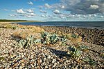
Harilaiu hiking trail (6 km or 11 km)
Saaremaa, Vilsandi National Park
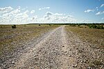
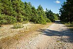
Diverse and deserted coastal nature. Low and vast horizon, wind, golden sand and mighty waves. Interesting dune landscape, trees and bushes subjected to wind, seal and bird sounds, military objects and Kiipsaare lighthouse in the sea.
| Phone |
+372 454 6880 |
| info.vilsandi@rmk.ee | |
| Type of object | Hiking trail |
| Parking facilities | Parking
on Harilaid Island for 1 tour bus or 5 cars |
| Amenities | The
trail is marked with red pickets |
| Camping facilities | Harilaiu campsite |
| Outdoor fireplace |
Harilaiu campsite
|
| Hiking options |
true |
| Sights | The versatile
nature of the Harilaid
Island—dunes, relict
lakes, shingle deposits, military legacy, Kiipsaare lighthouse. NB! Kiipsaare lighthouse is private property! The lighthouse is situated in the sea, on insecure ground and therefore it's angle of inclination is always changing. Climbing the lighthouse is dangerous and not recommended! Cape Kiipsaare and the west coast of Harilaiu peninsula is a good spot for bird and |
| Berries and mushrooms | Mushrooms |
| Additional information | The trail goes by Harilaiu campsite. Before going on a nature walk please read the Environmental code of conduct (freedom to roam), rules of conduct and waste-sorting policy |
| Restrictions | Located in Vilsandi National Park. Motorised
vehicle traffic is prohibited!
Information about restrictions can be obtained from the Environmental Board (+372 662 5999, info@keskkonnaamet.ee).
|
| Location |
Metsküla village,
Saaremaa municipality Object no 27 on area map |
| Driving directions | Drive
along Kuivastu–Kuressaare road (Road no. 10) and turn right from the roundabout
when entering Kuressaare (Road no. 78). Drive 3 km
to the next roundabout and choose the exit towards Kihelkonna (Road no. 102).
Drive 30 km up to the Kihelkonna–Pidula
junction, turn towards Undva–Veere and drive to the Jaagarahu junction.
Continue on the main road to the Kõruse bus stop, turn left and drive along
Kõruse gravel road (avoid turning right onto village roads). Pass the former
Soviet military station and turn right at the sign to Vilsandi National Park.
Continue 3.9 km over the bridge of the
Kiljatu stream up to the first junction (1.5 km
from the bridge) and turn left. Drive 300 to the Harilaid parking area, here
starts the hiking trail. Please note that driving large tour buses (for 50 to
60 passengers) to the Harilaid peninsula parking area is risky due to poor road
conditions. Harilaid peninsula is uninhabited and there are no shops; the
closest shop is in Kihelkonna. For better planning and advance booking services
pay a visit to RMK Vilsandi National Park Visitor Centre. |
| Geographic coordinates | Long-Lat WGS 84 latitude: 58.473969 longitude: 21.901842 |
| L-EST 97 x: 6483439 y: 377601 |

_medium.jpg)
_medium.jpg)
_medium.jpg)
