Where to go
Fairy trail (1,4 km)

Fairy trail (1,4 km)


Võimalused

Lõkkekoht
Lõkkekoht
Tartu County, Tartu-Jõgeva Recreation Area

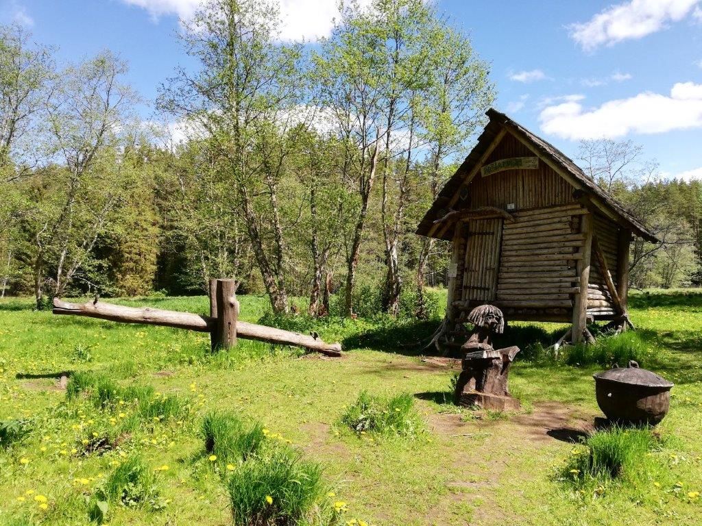
The trail starts from Jõeharu campsite and goes over the Laguja stream, after which the hiker can go to the left hiking circle. The trail is easy and suitable for hikers of all ages, especially for families with children. There are several places of interest for children on the trail: an adventure trail, fairy statues and a Witch's house. The trail is circular, at the end  the hiker returns to the starting point of the trail. The trail is indicated with RMK signposts and yellow markings on trees.

Parking

By the access road, near the campsite

Amenities

RMK indication, information boards, Witch`s house rest stop, wooden sculptures, bridges, benches, low adventure trail

Hiking Options

On foot, the trail is not fully accessible by bicycle.

Outdoor Fireplace

Jõeharu campsite

Berries-mushrooms

Blueberries, mushrooms

Sights

Witch`s house, old traces of resin picking on trees, low adventure trail, sculptures

Additional Information

Before going on a nature walk please read the Environmental code of conduct, rules of conduct and waste-sorting policy

Files

Map of the trail

Restrictions

Campsite is situated in Elva Landscape Reserve. Further information can be obtained from the Environmental Board +372 662 5999, info@keskkonnaamet.ee

Contact

Telephone: +372 676 7122

E-mail: info.kiidjarve@rmk.ee

Object type: hiking trail

Location info

Location : Tartu County, Tartu-Jõgeva Recreation Area

Ketneri village, Nõo municipality, Tartu County

Navigation instructions : The trail starts from the Jõeharu camping area - from Tartu drive along Peedu road to Elva, turn left before the Elva river bridge and drive along it for 1.2 km, turn right according to RMK sign (Illi-Laguja road). Drive 3 km, where the RMK sign leads to the right, it is 330 m to the campsite

Coordinates:

Long-Lat WGS 84
Latitude: 58.184331
Longitude: 26.423467
L-EST 97x: 642533
L-EST 97y: 6451840

Telephone:
+372 676 7122
E-mail:
info.kiidjarve@rmk.ee
Object type:
hiking trail
Location info
Location:
Tartu County, Tartu-Jõgeva Recreation Area
Ketneri village, Nõo municipality, Tartu County
Navigation instructions:
The trail starts from the Jõeharu camping area - from Tartu drive along Peedu road to Elva, turn left before the Elva river bridge and drive along it for 1.2 km, turn right according to RMK sign (Illi-Laguja road). Drive 3 km, where the RMK sign leads to the right, it is 330 m to the campsite
Coordinates:

Long-Lat WGS 84
Latitude: 58.184331
Longitude: 26.423467
L-EST 97x: 642533
L-EST 97y: 6451840