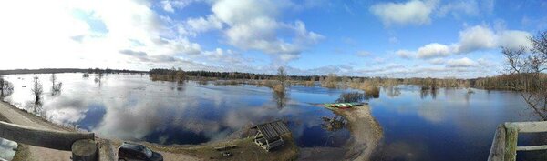
Tõramaa wooded meadow campfire site’s observation tower
Viljandi County, Soomaa National Park
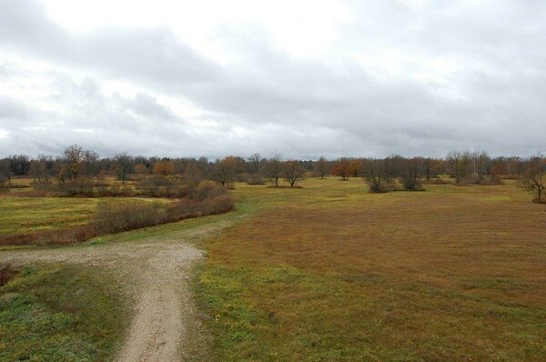
The observation tower is located near the Halliste River in the Tõramaa wooded meadow campfire site. From the tower it is possible to observe animals and birds, ancient oak trees, the undulating water field or the frozen expanse during high water.
| Phone |
+372 526 1924
|
| info.soomaa@rmk.ee | |
| Type of object | Observation Tower |
| Parking facilities |
Parking area for 3 cars
|
| Amenities | A wooden observation tower with an open top |
| Camping facilities |
Allowed is 1 tent (for 4).
|
| Campfire site | yes |
| Sights | Restored flood-meadow, the Halliste River, forested meadow, large wild animals, attractive bird species |
| Additional information |
Before going on a nature walk please read the Environmental code of conduct (freedom to roam), rules of conduct and waste-sorting policy
|
| Restrictions |
In the territory of the National Park certain restrictions. Further information can be obtained from the Environmental Board (+372 662 5999, info@keskkonnaamet.ee).
|
| Location |
Tipu village, Põhja-Sakala municipality, Viljandi County |
| Driving directions |
The observation tower’s location marker on the map shows the location of the campfire site’s parking lot. The campfire site of Tõramaa wooded meadow is located in Tipu village, on the border of Viljandi and Pärnu counties, at the end of the path going from the Kõpu-Jõesuu road (24 km from Kõpu) to the meadow. When coming from the direction of Tallinn-Pärnu-Tori, drive to Tori, turn onto the Võlli road that leads to the national park. Drive 6 km along the Jõesuu road to Jõesuu village and before driving into the village, turn right onto Kõpu-Jõesuu road. It is 14.4 km to the Nature Centre of the national park and the campfire site of Tõramaa wooded meadow from there. When you get to the sign directing you to the Nature Centre, drive 500 m, where a sign directs you to the 2.2-km trail that takes you to the campfire site. When coming from Tartu or Viljandi, drive along Tartu-Viljandi-Pärnu road to the settlement of Kõpu. After passing the cemetery, turn right to the Kõpu-Jõesuu road – it is 23.8 km to the Tõramaa campfire site. When you get to the sign, turn left, where a 2.2-km trail takes you to the campfire site. |
| Geographic coordinates | Long-Lat WGS 84 latitude: 58.422235 longitude: 24.996989 |
| L-EST 97 x: 6476195.3 y: 558253.7 |