Vanajõe valley study trail (1 km)
Hiiumaa, Hiiumaa Recreation Area
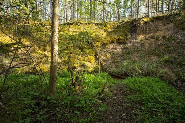
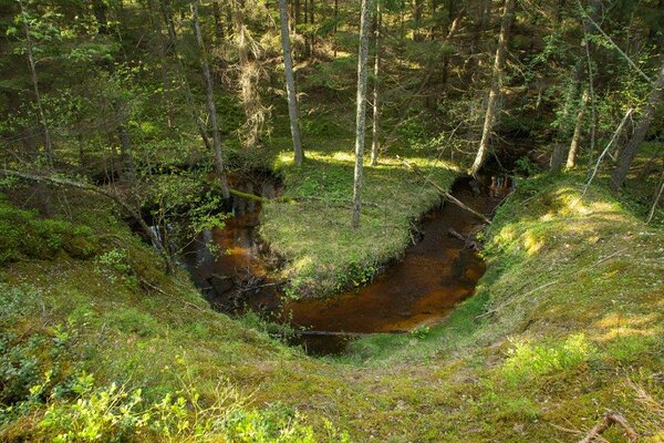
Along
the trail, the river has formed particularly enchanting curves, running deep
through the valley. The trail takes the hiker high up to the valley slope and
then back into the bottom to cross a river curve and listen to the sound of a
rapid flow.
3 km from Puski to Emmaste, on Emmaste–Puski road.
3 km from Puski to Emmaste, on Emmaste–Puski road.
| Phone | +372 676 7111 |
| info.ristna@rmk.ee | |
| Type of object | Study trail |
| Parking facilities | At the
start of the trail for 5 cars or a bus |
| Amenities | The
trail starts on the parking area. The trail is 1 km in total, a shorter loop
0.4 km. There is a large information board and 5 smaller information stands
along the trail, and an extra board introducing Tihu Nature Reserve next to the
parking area. The trail has a campfire site and is marked with wooden arrow
signs. The trail can be passed without getting feet wet, and takes about 0.5
hours to complete. The trail runs along the banks and slopes up to 6 m high
above of the most beautiful river on the Hiiumaa Island. |
| Outdoor fireplace | yes |
| Hiking options | yes |
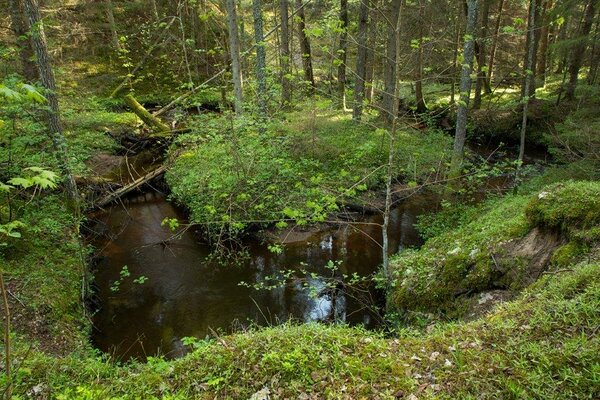
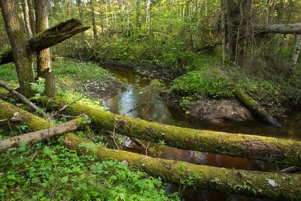
| Sights | The
Vanajõgi River is a geologically fascinating cold-water river, offering
stunning views to four sand outcrops. The river runs in total length through
pristine bogs and forests without human settlements. The mixed forest rich in
species, growing in the Vanajõe valley is a fine example of the impact of
natural conditions on the biota of the forest. The European mink introduced in
the Hiiumaa Island has found a favourable habitat here at the Vanajõgi River. |
| Berries and mushrooms | Bilberries, mushrooms |
| Additional information |
Before going on a nature walk please read the Environmental code of conduct (freedom to roam), rules of conduct and waste-sorting policy
|
| Restrictions | The
trail is situated in Tihu Nature Reserve.
Information about restrictions can be obtained from the Environmental Board (+372 662 5999, info@keskkonnaamet.ee).
|
| Location | Jõesuu village, Hiiumaa municipality Object no 32 on recreation area map |
| Driving directions | The
trail starts on Puski–Emmaste road (route 84). Drive 4 km from Puski to
Emmaste, turn right at the campfire site sign. The trail starts at the campfire
site. |
| Geographic coordinates | Long-Lat WGS 84 latitude: 58.885132 longitude: 22.434758 |
| L-EST 97 x: 6528462.7 y: 409719.3 |