RMK Keila-Joa park
Harju County, Surroundings of Tallinn Recreation Area
- The use of paper confetti is prohibited in Keila-Joa Park!
The English landscape park of Keila-Joa is mainly formed by the mother nature: there are higher hills covered with trees that alternate with valleys and meadows. The center element of the park is Keila river that has a 6,1 meter high and 70 meter wide waterfall.
| Phone |
+372 676 7842
| |
|
info.viimsi@rmk.ee
| ||
| Type of object | Other | |
| Parking facilities |
Parking for 20 cars
| |
| Amenities | Information board with a map and general information, and
along the trail there are points of interest with descriptions, introducing
the most interesting natural objects and the history of the Keila-Joa Park. By
the trail there are benches for rest stops.
| |
| Sights |
Keila-Joa waterfall, Keila-Joa
Manor, old manor park, former hydroelectric power station, park forest
| |
| Additional information |
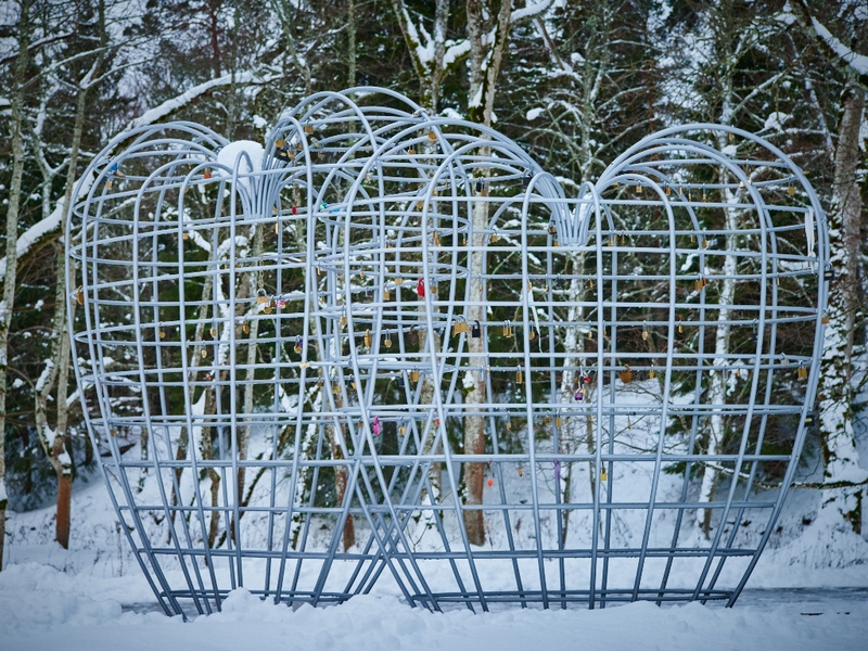
In 2015 the hearts sculpture by Estonian artist Mati Karmin was opened. The sculpture will be finished as new padlocks symbolizing commitment and everlasting love are gradually added to the construction.
In 2018 park trails and view platforms were reconstructed and stationary lighting was installed for the bridges and waterfall within the ERDF project "Lights On!". The waterfall lighting is working every half-hour and every hour from the sunset until midnight few minutes at once. In public holidays the lighting is more colourful than everyday lighting being inspired by nature - sunrise, sunset, northern lights and rainbow. The waterfall can be viewed from the observation platform at the left river bank or from Eesti Energia platform on the right river bank. | |
| Restrictions |
|
| Location |
Keila-Joa, Lääne-Harju municipality, Harju County Object no 3 on recreation area map |
| Driving directions |
Drive from Tallinn
towards Lohusalu to the sign directing to Keila-Joa. Turn right immediately
after crossing the Keila River, drive to Keila-Joa park, where there is the
parking area and information board introducing the trail.
|
| Geographic coordinates | Long-Lat WGS 84 latitude: 59.393752 longitude: 24.294685 |
| L-EST 97 x: 6584015 y: 516744 |
_medium.jpg)

_medium.jpg)
_medium.jpg)


