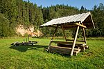
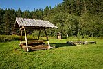
Härma campfire site
Võru County, Haanja-Karula Recreation Area
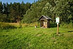
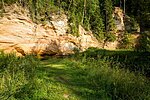
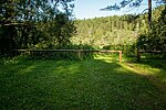
The lower Härma wall or Kõlgusniidu wall is a 20.5 m high protruding rock, one of the most beautiful in Piusa primeval valley for its bright-coloured clay layers and majestic pyramid shape. The nice campfire site is in the riverside meadow, allowing tent camping and making campfire.
| Phone | +372 501 9564 |
|
info.pahni@rmk.ee
| |
| Type of object | Campfire site |
| Parking facilities | Parking for 3 cars. |
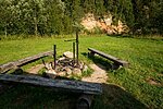
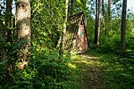
| Amenities | Fire ring with barbecue grill, table and benches with shelter, firewood shelter, dry toilet. |
| Camping facilities |
The maximum number of tents (for 4) allowed is 5 |
| Campfire site | Fire ring with barbecue grill. |
| Water |
Water can be taken from the Piusa river. |
| Hiking options |
Hiking on the Piusa River Valley hiking trail and RMK Peraküla-Aegviidu-Ähijärve hiking route. |
| Sights | Piusa river and its primeval valley, Härma wall or Kõlgusniidu wall |
| Additional information |
|
| Restrictions | The campfire site is located in the Piusa River Valley Landscape Protection Area, information about restrictions can be obtained from the Environmental Board (+372 662 5999, info@keskkonnaamet.ee). |
| Location | On the bank of the Piusa river, in Härma village, Setomaa municipality, Võru County. Object no 35 on the recreation area map. |
| Driving directions | At Kääpa, turn towards Obinitsa from Võru-Räpina Road and drive 17.5 km. After driving through Lindora village, a sign directs you to the right to sandstone outcrops. Turn right there and drive 2.7 km until signs direct you to the lower wall of Härma, where you will find the campfire site. |
| Geographic coordinates | Long-Lat WGS 84 latitude: 57.797330 longitude: 27.361249 |
| L-EST 97 x: 6411170.2 y: 699809.3 |
