RMK Peraküla-Aegviidu-Ähijärve hiking route / Piusa-Pähni (100 km)
Võru County, Haanja-Karula Recreation Area
Fire protection strips have been maintained in Värska and Piusa, which is why it is sometimes difficult to move with bikes on the sandy paths.
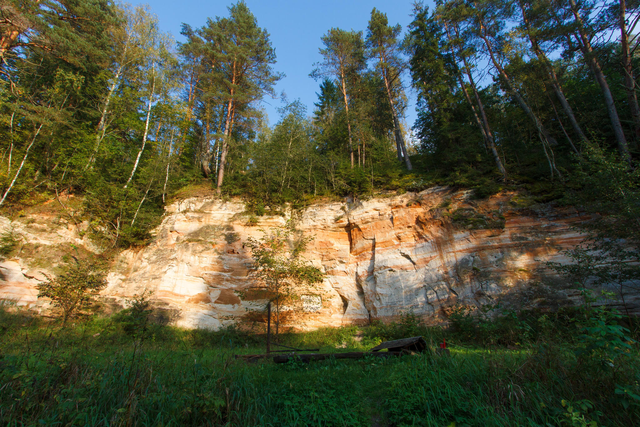
Here the route continues towards Võru County. This section could be well characterised using the words "the largest", "the tallest", "the deepest"... The trail goes along the bank of the Piusa river, the river with the greatest drop, passes Härma wall, the highest sandstone outcrop in Estonia, Suur-Munamägi, the highest peak, and Lake Rõuge Suurjärv, the deepest lake in Estonia.
After Luhasoo Landscape Protection Area the trail gets to Pähni village, where you can find RMK Pähni Nature Centre. Here it is good to start and end the hike. During the opening hours of the nature centre you can replenish your drinking water supplies and ask for information.
This part of the hiking route is definitely the most difficult one, as the trail goes up and down, meandering along the hills and valleys of the Haanja Uplands. To be able to enjoy the magnificent sights around you, it is recommended you complete this section of the hiking route on foot. Moreover, in the most exciting places cyclists and walkers are directed to different paths or roads.
| Phone | +372 501 9564 |
|
info.pahni@rmk.ee
| |
| Type of object | Hiking trail |
| Parking facilities | Parking is available in most campfire sites on this section of the hiking route. See further under the campfire sites on the hiking route. |
| Amenities | The trail is marked with white-green-white blazes, hiking trail signs and hiking route boards. The rest stops on this section of the hiking route and distances between them:
|
| Outdoor fireplace | yes |
| Campfire site | yes |
| Water |
In this section, there are no natural water-bodies at Piusa, Haanja, Saunamaa and Luhasoo campfire sites. |
| Additional information |
|
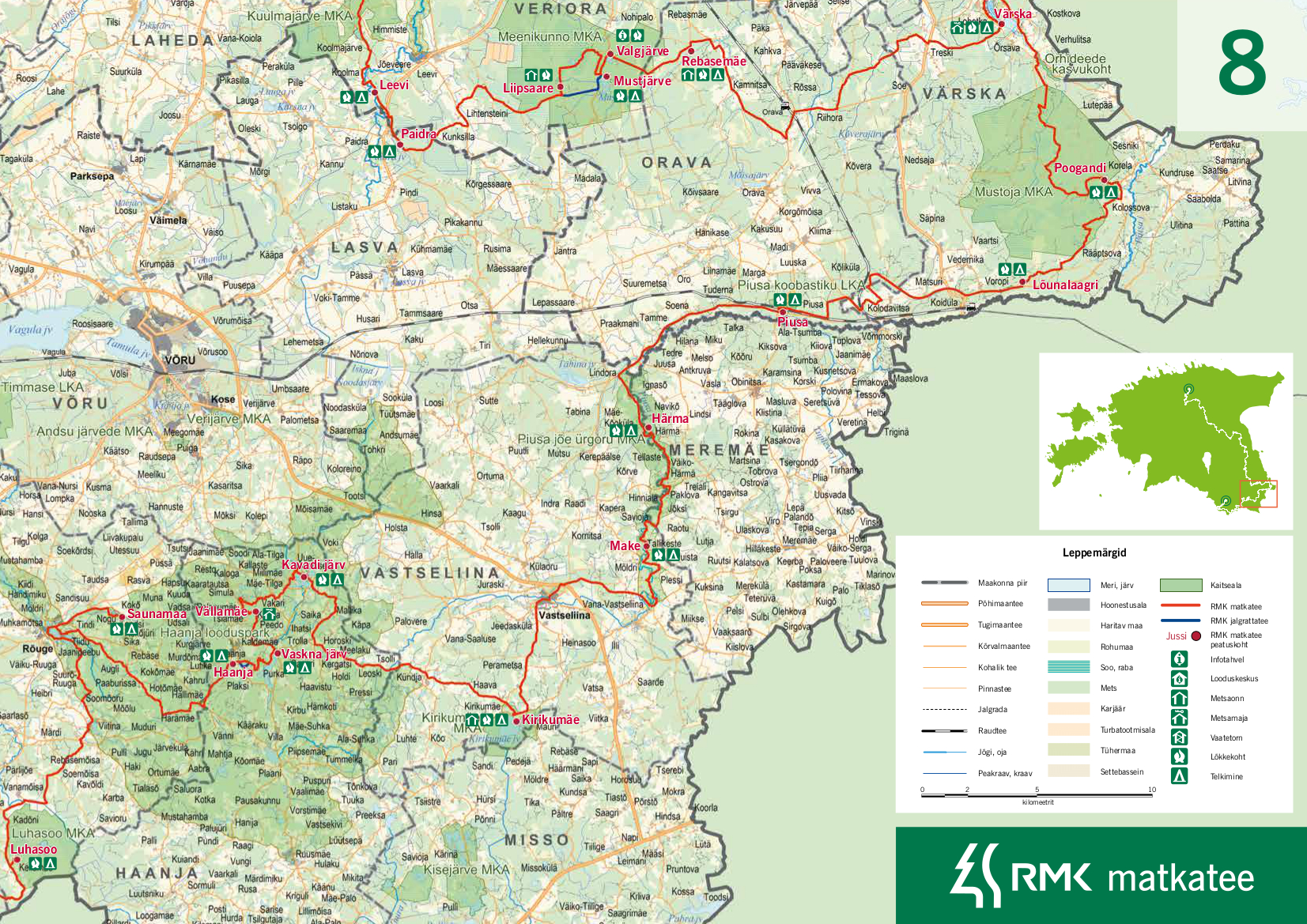
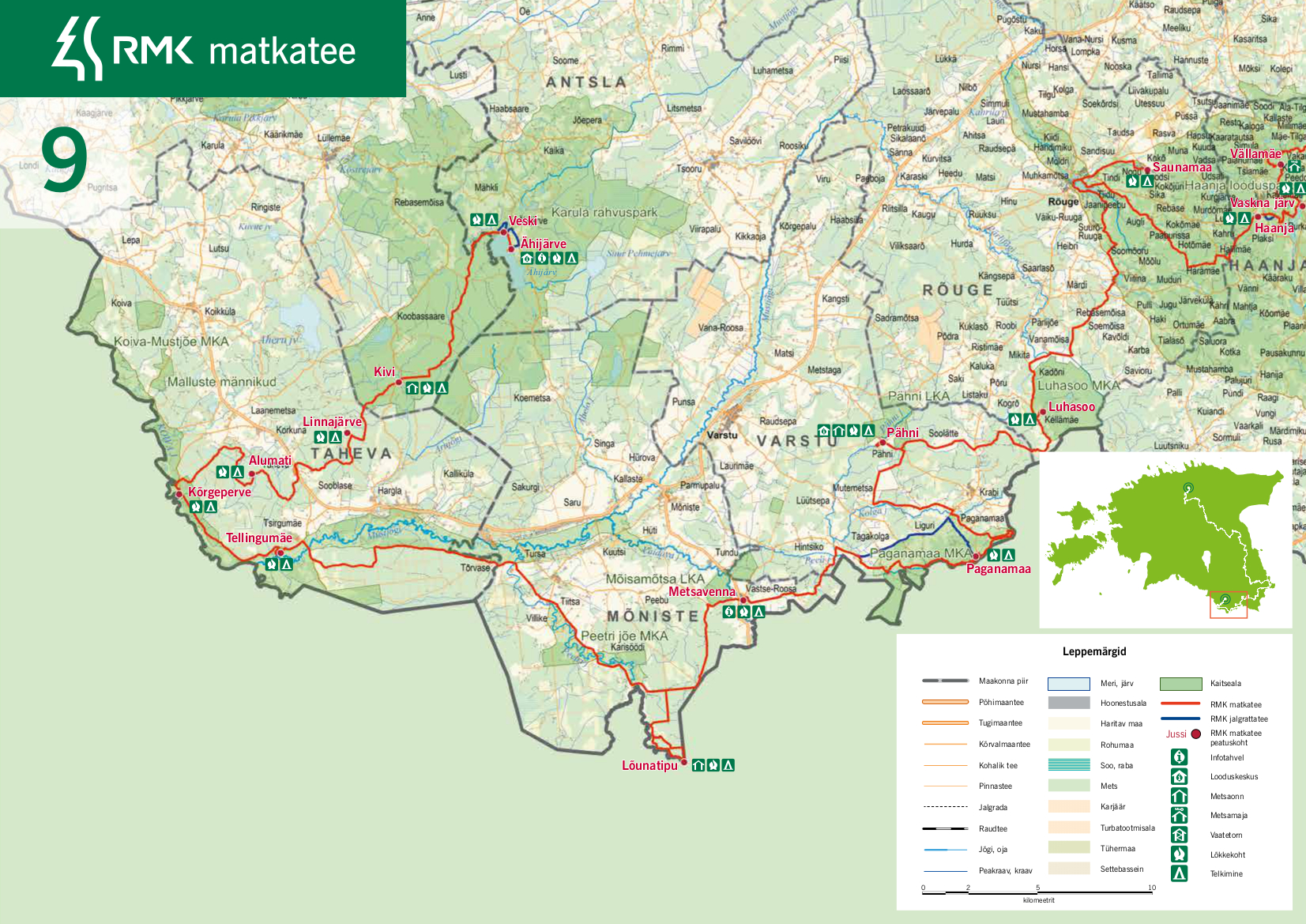
| Restrictions | The hiking route goes through Piusa River Valley Landscape Protection Area, Kirikumäe Landscape Protection Area, Haanja Nature Park, Luhasoo Landscape Protection Area and Pähni Nature Reserve. This section of the hiking route is in the territory of several protected areas, so visitors should have general knowledge of their protection rules. All along the hiking route one should not forget that camping and making a fire is allowed only at places designated for those purposes. |
| Location | The hiking trail is in the lands of Orava municipality in Põlva County and Meremäe, Vastseliina, Haanja, Rõuge and Varstu municipalities in Võru County. |
| Driving directions | In summer it is possible to take a train to Piusa. See train timetable at www.elron.ee. When coming by car, take Räpina-Koidula Road and turn towards Põlva at Karisilla. Drive 7 km, then keep to the left towards Orava. Drive 10 km to Orava, turn left there towards Piusa. Continue for about 2.5 km until you get to Kliima, and then turn right towards Piusa. After about 4 km (drive under the railway) turn left at the intersection, following the sign "Lõkkekoht". Drive about 0.2 km and the campfire site is on your left. |
Click on the map to open and download a pdf version.