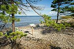
Search results
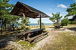
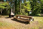
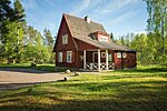
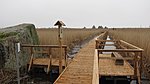
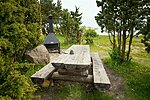
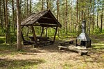
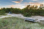
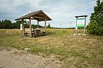
Abula campsite
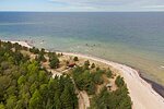
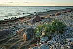
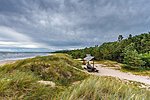
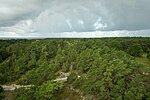
Pebbly drifts on the shore of Tagalaht bay, stunted coastal pines, the wind, the sun and a romantic atmosphere.Saaremaa
Saaremaa Recreation Area
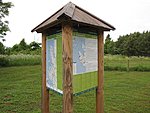
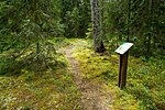
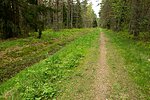
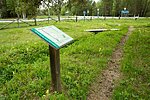
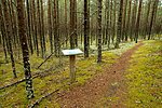
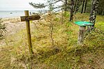
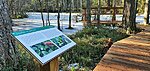
Abula-Kalasma study trail (11,2 km)
Saaremaa
Saaremaa Recreation Area

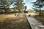
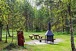
Allikajärve campfire site
A private campfire site on the shore of the beautiful Lake Allikajärv, popularly also known as Lake Tantsujärv. Anglers find nice places for fishing on the lakeshore.The lake is rich in springs and its bottom is muddy, which is why it is not good for swimming. Those who want to enjoy the water may go to the nearby recreation site on the northern shore of Lake Toatsejärv (~ 500 m) or to Peraküla campsite at the seaside (~1 km).
Lääne County
Nõva Recreation Area
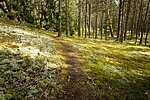
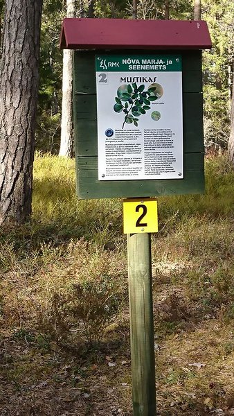
Allikasoo study trail (2,8 km)
A varied trail offering about an hour's walk between ice-age escarpment and patches of calcareous groundwater fens.The trail is marked with wooden signs and blue paint marks on trees.
Saaremaa
Viidumäe Nature Reserve

Audaku study trail (2.8 km)
Viidumäe Nature Reserve is located in the western part of Saaremaa, in the vicinity of the ancient Antsülusjärve escarpment. This is the oldest and highest part of the Saaremaa island, with its top height 59 metres over the sea level. On the escarpment a number of biotopes characteristic of western Saaremaa can be found. The hiking trail starts and ends at the parking area near the office of Viidumäe Nature Reserve.Saaremaa
Viidumäe Nature Reserve

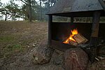
Autobaasi campfire site
The campfire site protected from the coastal winds is located at the edge of a pine forest, near Kärdla.Hiiumaa
Hiiumaa Recreation Area
Diby rest stop
Building of the former Soviet border observation point in Diby peninsula.Lääne County
Vormsi Landscape Reserve
Elda campsite
The campsite is located on the southern coast of Kööbe bay. On both sides of the campsite there are Silurian cliffs and ivy on them. A beautiful view on Vilsandi National Park aquatorium and the most western islet of Estonia. A good point for watching seals, birds and butterflys.Saaremaa
Vilsandi National Park
Forestry study trail (1.5 km)
The study trail starts next to the RMK Nõva Visitor Centre, runs on forest roads that are surrounded by different species of trees and bushes. The trail goes through clearcut areas and different types of forests.Lääne County
Nõva Recreation Area
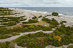
Harilaiu campsite
Harilaiu peninsula is a part of Vilsandi National Park on the north-western coast of Saaremaa. The rectangular peninsula is connected with Tagamõisa peninsula by a narrow strip of land called Harilaiu Neck.There are beautiful sand and pebble beaches and dunes on Harilaid. The sea is continually reshaping the coastline. If you visit the place repeatedly, you will see the coastline changes with your own eyes. There are several freshwater lakes in the peninsula, the largest of which is Laialepa bay. In addition to its interesting landscape, Harilaid is an area of great botanical and zoological value. It has been a protected area since 1924 already. Harilaid has always been uninhabited and when you go there it feels as if you have reached the end of the world, somewhere far away from civilization, and you are at the mercy of natural forces. To go to the campsite at Laialepa bay, you have to walk about 4 km along a hiking trail. At the other side of the campsite is the open sea.
Saaremaa
Vilsandi National Park
Harilaiu hiking trail (6 km or 11 km)
Diverse and deserted coastal nature. Low and vast horizon, wind, golden sand and mighty waves. Interesting dune landscape, trees and bushes subjected to wind, seal and bird sounds, military objects and Kiipsaare lighthouse in the sea.Saaremaa
Vilsandi National Park

Harilaiu rest stop
A stopping point for discovering the most north-west peninsula of Saaremaa. At the Harilaiu peninsula you can view rapid natural processes where the sea is in constant battle with the land.Saaremaa
Vilsandi National Park
Hirmuste campsite
A campsite on a splendid sandy beach in the shade of coastal pine forest. A cosy place to admire spectacular sunsets over the sea.The campsite is situated at the seaside, on the northern part of the Kõpu peninsula, about 1 km from the Hirmuste village.
Hiiumaa
Hiiumaa Recreation Area
Hirmuste study trail (1.3 km)
The trail starts at Hirmuste campsite, about 1 km from the Hirmuste village and runs through an old natural forest across overgrown dunes and through the marshy alder forest. On the way back along the coast, you can admire scenic sea views. The trail is most suitable for walking.The trail runs through Kõpu Nature Reserve in the immediate vicinity of the Hirmuste campsite and is marked with wooden signs.
Hiiumaa
Hiiumaa Recreation Area
Huitberg hiking trail (3 km)
One of the most captivating places on the Vormsi Island is the Huitberg limestone outcrop in the middle of a spruce forest, in the centre of the island. This more than 400 million years old coral reef smoothed by glacial abrasion has formed from calcareous exoskeletons of animals living in the shallow tropical seas during the Ordovician. On the outcrop, where it is not covered with moss, you can admire fossils or rare protected ferns growing in limestone cavities.The trail starts by Suuremõisa and is marked with signposts and an information board.
Lääne County
Vormsi Landscape Reserve
Järve rest stop
Long beach with golden sands, interesting protected plant species can be found under the pine trees.Saaremaa
Saaremaa Recreation Area

Jugapuulaane study trail (3.5 km)
The study trail that both starts and ends at Peraküla village at RMK Nõva Visitor Centre, square goes through the varied landscape characteristic to this area. Cycling is recommended, but the trail is also suitable for walking.Lääne County
Nõva Recreation Area
Kaali rest stop
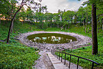
One of the best exposed and accessible meteorite craters in the world.About 3470 - 3545 years ago, a huge rock from space came hurtling toward the Earth. Several kilometers above the Earth’s surface, the meteorite broke into pieces from the pressure and heat of the atmosphere. The explosion left nine total craters, now known as the Kaali Meteorite Crater Field. The largest crater (which measures 110 meters across) is believed to have been a sacred site for many centuries due to its cosmic origin.
Saaremaa
Saarema Recreation Area
Kabeli rest stop
The most remarkable of the remaining buildings on Osmussaare Island is the chapel (Jesu Kapell) that was built in 1766 using limestone. The chapel was renovated in 2006-2011.Lääne County
Osmussaare Landscape Reserve
Käkisilma campsite
A campsite under the pine trees by the sea at tip of the Kuusnõmme peninsula. There is a parking area by the campsite.Saaremaa
Vilsandi National Park
Kaksikute campfire site
Here you can view the blackish brown boulders gneissic breccias. The boulders have been formed 540 million years ago when 10 km North-West of the island the Neugrund meteorite landed in the sea.The most famous of these boulders are the Twins (Estonian Kaksikud).
Lääne County
Osmussaare Landscape Reserve
Kalasma campsite
Beautiful pebble beach. Ideal for enjoying peace, quite and sunsets.Saaremaa
Saaremaa Recreation Area
Kaleste campsite
The campsite on the southern coast of the Kõpu peninsula boasts one of the best sandy beaches on the peninsula. Also, it is the best bathing place for families with children.Hiiumaa
Hiiumaa Recreation Area
Kaleste study trail (1.8 km)
The trail runs in the immediate vicinity of Kaleste campsite on the northern coast of the Kõpu peninsula in Kõpu Nature Reserve and is marked with wooden signs. The trail starts and ends in the campsite at the information post, where you can also see the trail map. The trail takes 30-50 minutes to complete. There are 7 information boards introducing the sights.Hiiumaa
Hiiumaa Recreation Area
Kalja study trail (1 km)
Kalja study trail introduces karst forms and their causes. Waters that go underground in Kalja sinkholes run as a subterranean river and appear on the ground again near Jauni village, Hiieniidi (Iilasmaa) spring area, to the north of Kalja sinkholes.Saaremaa
Saaremaa Recreation Area

Kallaste cliff rest stop
Kallaste cliff is about 400 m and 10 m high lime stone disclosure.An old pine forest grows on the cliff and there's a forest trail under the trees.
At the southern part of the cliff you can see fossilized plants.
Folk tales tell that during the ancient freedom battle of Estonia Kallaste cliff was the hiding place of the Devil where he made swords for the fighters.
Hiiumaa
Hiiumaa Recreation Area

Kalurikoja forest hut
The forest hut is situated in the shade of coastal pines on the northern coast of the Kõpu peninsula. The beach is a few steps away.The forest hut is a nice resting point for fishermen and hikers both in the summer and the winter.
The forest hut is 2.5 km from the road, but the unpaved road to the hut is not accessible with large tour buses.
Hiiumaa
Hiiumaa Recreation Area

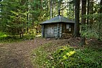
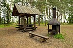
Kapasto forest hut
The forest hut deep in the heart of the Hiiumaa Island, in a place of an old forest keeper’s house.Hiiumaa
Hiiumaa Recreation Area
Kärdla hiking trail (4 km)
The 4 km hiking trail is suitable for a longer walk on a day off. The trail goes circular and stretches through various forest.The trail starts at the end of Tiigi Street in Kärdla, is marked with signs and is suitable for all seasons. The trail takes 1 hours to complete and in the summer can be walked through without getting feet wet.
NB! Kärdla hiking trail is not passable by bicycles or motor vehicles.
Hiiumaa
Hiiumaa Recreation Area
Karjääri campsite
The shaded campsite is in a former gravel quarry, which now looks natural. Located at Abula-Kalasma study trail.Saaremaa
Saaremaa Recreation Area
Keskranna rest stop
Beautiful long sandy beach not far from town, pine forest on dunes and under the pines, interesting plant species rarely occurring in Estonia.Saaremaa
Saaremaa Recreation Area

Kividemaa cycling trail (68 km)
The cycling trail runs on the lands of Noarootsi and Nõva. It is possible to take the shorter track of 32 km or the longer one, 68 km. The trail goes along different types of road (tarmac, gravel or dirt roads). You will see the new densely populated area around Spithami – Põõsaspea and experience the tranquil rhythm of life and the Swedish atmosphere of Rooslepa, you will be on your own with the forest and the rocks on lonely forest tracks.The cycling trail starts at the RMK Nõva Visitor Centre.
Lääne County
Nõva Recreation Area
Koigi study trail (5,7 km)
The trail runs in the largest bog of Saaremaa, where different development stages of the mire can be observed. A popular legend goes that in the bog lake of Koigi a treasure was once buried, and it is guarded by spirits who occasionally reveal themselves to people.Saaremaa
Koigi Landscape Protection Area
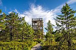
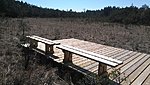
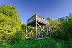
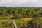
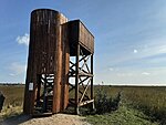
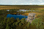
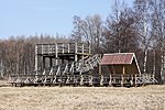
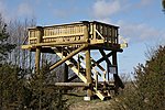
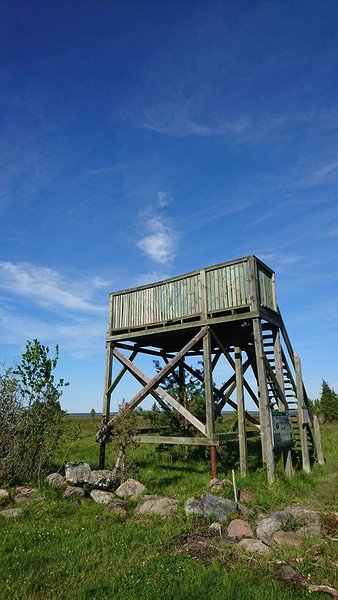
Koigi study trail’s observation tower (1.5 km from the parking)
The observation tower is located on Koig study trail at the edge of the raised bog, 1.5 km from the parking lot and it is 9 m high. The tower offers a view of the bog forest, the open bog area and the bog lakes. The surroundings are especially beautiful in early mornings, when - if you are lucky - you can see a sea eagle or a bald eagle in the sky. In early spring it is possible to hear the calls of grouse.Saaremaa
Saaremaa Recreation Area
Konati campsite
The campsite is located in a former gravel quarry which offers a good place for camping, safe from winds. This is an excellent example of mine reclamation.Saaremaa
Saaremaa Recreation Area
Kõpu Suurkivi rest stop
About 2,3 km from Kõpu village lays the second largest erratic boulder of Hiiumaa - Kõpu Suurkivi or Lepistpao Erratic Boulder. The diameter of the boulder is 28.4 m and it is 5.3 m high. There is a staircase leading to the top of the boulder.Hiiumaa
Hiiumaa Recreation Area
Kõrgessaare orchids' study trail (100 m)
The self-guided study trail offers a chance to learn about local orchids in a short time. Accessible also for tourists travelling by tour buses. The educational flower bed is primarily intended for learning about different species of the orchid family, but it also provides opportunities for outdoor study for schoolchildren and biology enthusiasts.In the middle of Kõrgessaare small town, next to the parking area.
The boardwalk trail takes 15 minutes to complete.
Hiiumaa
Hiiumaa Recreation Area
Kulpri campsite
Campsite is located in the south-west part of Vilsandi Island. It has a beautiful view to the open sea and is a known swimming place with beautiful white sand among the islanders.Saaremaa
Vilsandi National Park

Laasimetsa campfire site
A suitable place for rest and relaxation for off-track hikers and picnickers, but also for hunters after a successful hunt.Drive 3.5 km from Hüti towards Käina, at the left side of Hüti–Käina road.
Hiiumaa
Hiiumaa Recreation Area
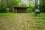
_medium.jpg)
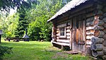
Laugu forest keeper’s rental hut
Laugu forest keeper’s cottage was built for the military forest ranger in 1856. This old, 32-metre farmhouse has been in service of Estonian forestry for 150 years, regardless of the political regime.Saaremaa
Saaremaa Recreation Area
Leemeti forest hut
Here you can make campfire inside a conical tent while staying protected from the weather. The tent is perfect for warming hands and feet after a ski trip in winter.2 km towards Lelu from Puski–Emmaste road, at the left side of the road.
Hiiumaa
Hiiumaa Recreation Area
Leemeti hiking trail (2+3 km)
The physically rather demanding circular trail with its ups and downs can be completed as 2 km or 3 km loops. In the winter it is also suitable for cross-country skiing. After having a walk, you are welcome to have a picnic at Leemeti forest hut.Hiiumaa
Hiiumaa Recreation Area
Leemeti rental hut
Enjoy a private stay both in the summer and the winter. Although easily accessible, the hut is located in the middle of the forest, far from major settlements. The Leemeti hiking trail, where you can enjoy cross-country skiing in the winter and nice walks in the summer, is within view.Hiiumaa
Hiiumaa Recreation Area

Lepaaugu campfire site
Lepaauk is a small lake, which is a favourite place for fishermen. Early in summer the small lake is also used for swimming. Later in summer, when sea water in the Keibu Bay has warmed up, people usually prefer to walk a few hundred metres along the boardwalk to the sea, where it is possible to enjoy the beautiful beach and the sandy sea bottom.Lääne County
Nõva Recreation Area

Lepajõe parking area
A nice place at the Lepajõe River mouth, on the left bank for people, who come to visit the magic of the Keibu Bay just for one day. A boardwalk runs from the parking area to the sea.Lääne County
Nõva Recreation Area

Liivanõmme study trail (7.5 km)
The study trail starts and ends at Lake Allikajärv, passing the varied landscape characteristic to this area. There is much to discover both for nature observers and those interested in heritage. The signposted trail is passable without getting your feet wet. It runs along the stone road dating from the period of the World War I.Lääne County
Nõva Recreation Area

Liivaseranna-Peraküla study trail (4.4 km)
The study trail starts and ends at Peraküla campsite, Liivase rand (Sandy beach), goes through the typical landscape of the area. Along the trail we can see both young and older pine forests, sand dunes, swampy areas and lakes.Lääne County
Nõva Recreation Area

Loode oak stand study trail (2.8 km)
The oak belonging to the oldest generation of the Loode oak stand, dedicated to the linguist Johannes Aavik, was measured to be 450-500 years old in October 2000. The oldest generation of the oak stand is presumably formed of trees that remained from the shipbuilding campaign initiated by Peter I.Saaremaa
Saaremaa Recreation Area
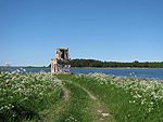
Loodenina observation tower
A place by the sea good for bird and nature observations. To get to the observation tower you must hike through Loode oak-wood. From the tower you get a beautiful view of Kuressaare Bay.Saaremaa
Saaremaa Recreation Area
Lõunasadama campfire site I
This an exciting place during midsummer when thousands of Charadriiformes stop in the Bay closeby.Lääne County
Osmussaare Landscape Reserve
Lõunasadama campfire site II
This an exciting place during midsummer when thousands of Charadriiformes stop in the Bay closeby.Lääne County
Osmussaare Landscape Reserve
Luidja campsite
Luidja campsite is situated close to a sandy beach which is famous for its “singing sands”. The campsite is sheltered from the burning sun and sea winds by a lush black alder forest. The alder roots protect the beach from sand drift in the winds.The campsite is situated in Luidja, at the beginning of the Kõpu peninsula, 25 km from Kärdla.
Hiiumaa
Hiiumaa Recreation Area
Mägipä campsite
On a sandy beach, under coastal pines on the northern coast of the Kõpu peninsula, you can find campfire sites and picnic tables. Situated right next to the campsite, the Kalurikoja forest hut offers shelter from rainy weather.Hiiumaa
Hiiumaa Recreation Area
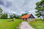
Mändjala Nature House
Mändjala Nature House is located by the Suur Katel Bay in RMK Saaremaa Recreation Area. The Nature House welcomes all who are interested in nature and who value quiet and privacy and respect the vulnerable nature.Saaremaa
Saaremaa Recreation Area
%20Foto%20%C3%9Cllar%20Soonik_medium.JPG)
Mändjala study trail (1,6 km)
The trail starts from the parking lot. It leads around RMK Mändjala Nature House, goes through various stages of development of the dune system, reaches the picturesque sandy beach and meanders in a beautiful pine forest on dunes. It takes about 1 hour to cross the trail, 7 information boards introduce the biota and heritage there.Saaremaa
Saaremaa Recreation Area
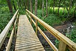
Marimetsa hiking trail (9 km)
The 9 km out-and-back trail offers a good opportunity to get acquainted with different habitats—the surface road at the start of the trail runs along a forest divide, across a meadow and through a spruce forest along the banks of the Marimetsa stream. The boardwalk at the end of the trail leads you across the fen, raised bog and transitional mire to bog pools.Lääne County
Marimetsa Nature Reserve
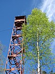
Marimetsa hiking trail’s observation tower (4.5 km from the parking)
At the end of the Marimetsa hiking trail, 4.5 km from the parking lot, there is a 7.6 m high wooden observation tower. From there you can see a picturesque view of the Marimetsa bog. which covers approximately 5000 ha. The bog is surrounded by forested dunes.Lääne County
Marimetsa Nature Reserve

Marimetsa parking area
Parking area is the starting point for Marimetsa hiking trail. There is an information board with the map of the trail and general information about Marimetsa Nature Reserve.Lääne County
Nõva Recreation Area
Marjatasku parking area
A place to leave your car when you go to pick berries in the forest. In autumn you can also gather mushrooms, so you can bake mushroom pies in winter.Lääne County
Nõva Recreation Area
Meiuste campsite
Campsite on a beautiful sand beach partly covered with coniferous forest. A view of Hiiumaa over the sea.Saaremaa
Saaremaa Recreation Area
Metsapere forest hut
The forest hut amidst a forest rich in wild berries and mushrooms is situated inland, unlike other forest huts in the Hiiu County. There is a pond with a swim deck next to the hut. The hillock behind the pond offers enjoyable sledding experience in the snowy season.Hiiumaa
Hiiumaa Recreation Area

Metskonna campsite
Here you can go discover the sandy beach of the Keibu Bay and the river mouths that change their location. New land is formed at the Keibu Bay, where all dune types are represented: foredunes, white dunes, grey dunes, reddish-brown dunes with crowberries, and wooded dunes.Lääne County
Nõva Recreation Area

Mihkel Rand’s arboretum
Mihkel Rand (1871-1958), local blacksmith, collected more than 200 tree and shrub species in his arboretum during his lifetime.Saaremaa
Saaremaa Recreation Area
Neljateeristi study trail (3 km)
A versatile one-hour trail between glacial terraces and patches of spring-fed bogs.In Kõpu Nature Reserve on the northern coast of Kõpu peninsula, in the middle of the forest about 1 km from Mägipe village.
Hiiumaa
Hiiumaa Recreation Area
Ninanuki forest hut
A nice seaside spot surrounded by forest to stay with family or friends, or spend the night for free. Principles of freedom to roam must be observed!Saaremaa
Saaremaa Recreation Area

Ninaotsa campsite
The campsite on the top of the Ninametsa peninsula offers beautiful views of the coast, but there are no sandy beaches here. The coast is grassy and the bay water shallow. This is the place for making campfire and enjoying sunsets!Hiiumaa
Hiiumaa Recreation Area
Norrby rest stop
A rest stop on the northeastern coast of Vormsi with former Soviet border observation point and a landing place.Lääne County
Vormsi Landscape Reserve

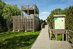
Nõva Visitor Centre
Nõva Visitor Centre is the centre of RMK Nõva recreation area, located in North-West Estonia at Peraküla, near sandy beaches and forests full of wild berries and mushrooms. Here is the start of the 192 km branch of the RMK Hiking Route from Peraküla to Aegviidu, opened in 2015. Before you go to discover the recreation area, take a quick look at our sights in the film "Maa, mis tõuseb merest" ("Land that Rises from the Sea"). We give information about the sights in this neighbourhood, and advice on planning hiking routes. The centre provides activities for both the young and the elderly. You can enjoy our exhibitions, forest games or discover the world of sand with a microscope. The visitor centre offers guided and self-study nature education programmes on various topics for different interest groups.Lääne County
Nõva Recreation Area
Nurga rest stop
In the former hay barn of Nurga farm at the Kiideva-Puise nature trail, the visitor can take a break and enjoy the scenic wooded meadows and the close-by Matsalu Bay. At the hay barn you will find information about plants that grow in the vicinity.Lääne County
Matsalu National Park
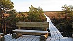
Orjaku study trail (0.7 km to 2 km)
The trail starts at the parking area near the Orjaku bay, consists of the longer Orjaku trail (2 km) and the shorter Roostikuring (Reed loop) (0.7 km). Accessible without getting your feet wet, the trail is marked with arrow signs. Enjoy the vistas to the Käina and the Jausa bay, and observe the birds’ activities and migration. The short circular boardwalk trail (Roostikuring) takes you through the tall reeds to Silmakare.Hiiumaa
Hiiumaa Recreation Area
Orjaku study trail’s Silmakare observation tower (700 m from the parking)
The observation platform is located on the Orjaku study trail, on the former islet Silmakar. You can get there by passing approx. 700m on a boardwalk running through the reeds or by going approx. 200m in a straight line from the cattle gates. The tower offers a view of Käina Bay, where you can observe birds nesting in the bay as well as numerous migrations in spring and autumn. There are a total of 23 islands in the bay, which are shallow and mostly surrounded by reeds. The birdlife of Käina bay is interesting and rich in species. In autumn and spring, 10-15 thousand, maximum 20 thousand water and coastal birds stop at the bay.Hiiumaa
Hiiumaa Recreation Area
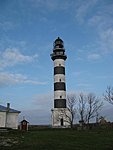
Osmussaare hiking trail (9 km)
On the North coast of the island you can view the cliff that is part of the 1200 km long Baltic Klint. The cliff is highest (7 m) around the lighthouse and becomes lower towards North-East where the so called "Crocodiles" are located.There are the coastal lagoons, open to the sea;
cliffs; meadows; fens and old broad-leaved forests.
Osmussaar`s jewels are Alvar meadows.
Lääne County
Osmussaare Landscape Reserve
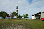
Osmussaare information point
The Osmussaare information point is situated on the northern coast by the lighthouse.Lääne County
Osmussaare Landscape Reserve

Palli campsite
Here you have sandy beaches close at hand to take kilometres long strolls and admire the vistas of the sea. You can set up your tent under coastal pines and make campfire. A sheltered campfire site offers protection in less favourable weather.The campsite is situated at the seaside, on Palli spit, about 0.5 km from the road on the northern coast of the Kõpu peninsula.
Hiiumaa
Hiiumaa Recreation Area
Palli study trail (1.5 km)
This study trail features ancient spruce and pine forests, alternating with occasionally flooded marshy forest. On the coast you can learn about coastal plant communities.The trail starts at the seaside Palli campsite on Palli spit, about 0.5 km from the road on the northern coast of the Kõpu peninsula, and is marked with wooden signs.
The trail takes 30 to 50 minutes to complete.
Hiiumaa
Hiiumaa Recreation Area
Parunikivi rest stop
The “Baron’s boulder” has a thick moss cover and the shape of an irregular polyhedron, and is situated 100 m south of the Vormsi roundabout. The stone bears a commemorative inscription in German dedicated to the Baron von Stackelberg by his sons.Lääne County
Vormsi Landscape Reserve
Peetri stone rest stop
Stone of cultural heritage. This stone is said to have been scraped by the wheel of Russian emperor Peter the Greats coach after he visited Ungru in 1715. The stone is the starting point for the forestry study trail.Lääne County
Nõva Recreation Area

Peraküla campsite
The Peraküla beach is famous for its singing sands and the clean sea. The campsite has been established to protect the fragile dunes and to provide an opportunity for holiday-makers to come as close to the seashore as possible. The sea water is refreshingly cool and warms up by the end of the summer. One can take nice walks along the shore here. Nearby is also the start of the 4.4 km study trail that offers an alternative to beach pleasures. The sea is suitable for surfers.Lääne County
Nõva Recreation Area

Põõsaspea rest stop
Cape Põõsaspea is the north-westernmost tip of mainland Estonia, which is important for the entire Baltic Sea. Here starts the line, which extends over Osmussaare Island to Cape Hanko and divides the sea into the Gulf of Finland and the Baltic Sea. The place is one of the best sites for watching the migration of arctic seabirds.Lääne County
Nõva Recreation Area
Raketi campsite
The former Karujärve military area has been transformed into a sports and leisure area. Visitors can camp and hike here in summer, and ski, sledge and enjoy other winter pleasures in winter.Saaremaa
Saaremaa Recreation Area
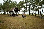
_medium.jpg)
Ränkaja campfire site
Ränkaja campfire siteHiiumaa
Rannajõe observation tower
From the observation tower in the northern part of the Kasari floodplain, not far from the Haapsalu–Laiküla road you can enjoy a broad view of the floodplain, which is particularly captivating in spring when it is flooded. Thousands of geese, swans and dabbling ducks, in the summer several species of waders, warbles, corn crakes and many others nest in the floodplain. Moose and roe deer wander around in search of food.Lääne County
Matsalu National Park
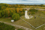
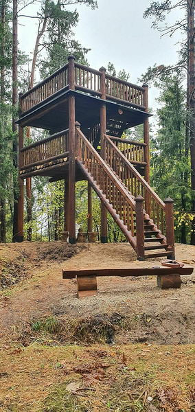
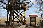
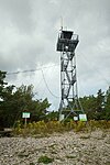
Rauna rest stop and observation tower
The former forest watch tower, nearly 30 m high, on Raunamägi hill in the highest part of Saaremaa.Saaremaa
Viidumäe Nature Reserve
Rebastemäe study trail (1.5 km)
The trail is situated in the oldest and highest place in the entire western Estonia, on the Kõpu peninsula. Scenic views over the forests and the sea open up from observation towers on the hills of Kaplimägi, the second highest peak (63.5 m) on the Hiiumaa Island, and Rebastemägi.Hiiumaa
Hiiumaa Recreation Area
Rebastemäe study trail’s Kaplimäe observation tower (700 m from the parking)
The Rebastemäe study trail is circle, it starts and ends at the same point. After the Rebastemäe tower, the trail forks. If you go along the left branch, the observation tower is 800 m away, and if you go along the right branch, it is 700 m away.Hiiumaa
Hiiumaa Recreation Area

Rebastemäe study trail’s Rebastemäe observation tower (70 m from the parking)
Rebastemäe study trail’s Rebastemäe observation tower (70 m from the parking)The observation tower is located at the beginning of the Rebastemäe study trail in the oldest and highest part of West Estonia, on the Kõpu peninsula, on Rebastemäe. The tower offers views of the Hiiumaa forests and Mardihansu bay. In good weather, the neighboring island of Saaremaa can be seen.
Hiiumaa
Hiiumaa Recreation Area
_medium.jpg)
Remmelko campfire site
Remmelko campfire siteHiiumaa
Hiiumaa Recreation Area

Ristna study trail (1.5 km)
The study trail begins from the yard of Rista Visitor Centre and takes you on a discovery to and old-growth forest full of forestry heritage. It might feel as if you've entered a different world as you pass by this pine forest of dignified age.The trail is marked with wooden signs, takes 30 to 50 minutes to complete.
Before starting your discovery we advise you to stop at the Ristna Visitor Centre. You might get some valuable tips.
Hiiumaa
Hiiumaa Recreation Area

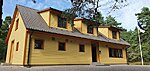
Ristna Visitor Centre
Ristna Visitor Centre is located in a distant part of Hiiumaa recreation centre amid the forests of Kõpu peninsula in Kalana village. The more than a hundred-year-old former forest ranger's place is easy to find at the road both by walkers and those coming by car. The Metsavahi bus stop is next to the outhouse. All hikers, holiday-makers and others interested are welcome to ask for information or just look around, relax and have a picnic in the yard here. In the main building, visitors may enjoy exhibitions, solve puzzles, play and craft or watch a nature documentary. In the outbuilding there is an exciting exhibition "Mere kaubamaja" ("Sea store") and the natural treasures of the Kõpu peninsula are introduced. In the yard of the centre you can study local herbs and then go on the study trail to learn about forest heritage and life in the primeval forest. Reference books and collections are available for use at the centre. Free WiFi is available. Information point gives information about the outdoor recreation and holiday opportunities in state forests. The centre has a wide range of study programmes for both guided and independent activities.Hiiumaa
Hiiumaa Recreation Area
RMK hiking route Heltermaa-Ristna-Sarve/Heltermaa-Kärdla (32 km)
The first section of the Heltermaa-Ristna-Sarve branch of the RMK Hiking Route (aka Hiiumaa branch of the RMK Hiking Route) starts at the Port of Heltermaa.For the first kilometre, the hiking route goes along the road, then turns off and goes across the Heltermaa-Vahtrepa alvar grassland.
There are bovines on the grassland.
On the other side of the grassland, the trail takes a smaller road but quite soon turns to the forest and goes along a forest path to Kallaste cliff. The first stop on the trail is a few hundred metres further, at an old farmstead – the Remmelko campfire site.
After the campfire site, the trail goes mainly along larger and smaller village roads and local roads.
The next stop is at Sääreküla village – the Säärenina campfire site. The campfire site is not directly on the trail, so hikers need to walk the path to the campfire site and back.
A few kilometres further, at Kukka village, the trail turns off the local road and runs along a forest road up to Kärdla airport.
After passing the airport, the hiking trail goes along the coastal road to the town of Kärdla.
In Kärdla, hikers will find everything they need – stores, restaurants, hotels.
This section of the hiking route ends at the centre of Kärdla, but hikers will find a very good place for camping – the Autobaasi campfire site – at the western border of the town, next to Kärdla hiking trail.
Hiiumaa
Hiiumaa Recreation Area
RMK hiking route Heltermaa-Ristna-Sarve/Kärdla-Ristna (107 km)
The second section of Hiiumaa branch of the RMK Hiking Route starts at the centre of Kärdla.While the first section runs mainly along village roads and local roads, the second section is different. Covering a total of 107 km, it is also the longest part of the hiking route’s Hiiumaa branch.
Starting at the central square of Kärdla, the route runs along Tiigi street up to the edge of the town where it gets to Kärdla hiking trail and follows it out of the town. Autobaasi campfire site is at Kärdla hiking trail.
The hiking route departs from Kärdla hiking trail to a sandy forest road, crosses a roadside ditch and turns to a forest path.
On the other side of the forest, the hiking trail goes for a short distance along the road, then returns to a forest path and gets to Tõrvanina campsite.
After the campsite, the hiking route heads towards the centre of Tahkuna peninsula, and through uninhabited areas in the forest to the northern coast of the peninsula.
The hiking route takes a detour to Lõimandi beach and goes along the ridges of old dunes on the northern shore of the peninsula, passing the coastal defence and fortifications dating from the period of World War I and II on Tahkuna peninsula. Tahkuna lighthouse is in the northwestern part of the peninsula.
The trail of the hiking route turns back towards the centre of the peninsula and there, in the middle of the woods, is Ränkaja campfire site, where hikers can put up tents and stop for the night.
Next, the hiking route heads towards the centre of Hiiumaa island, and passes the Kaibaldi heath and sand area. This is the largest sand area in Estonia; it developed as a result of forest fires and use as a Soviet Army training site for heavy military machinery.
After passing Kaibaldi sand area, the trail goes through Sakkasoo heath. Back on the forest road, the trail goes past the recently restored former peat extraction area, curves round the Mõdumaa marshland and along a gravel road to Kapasto forest hut.
Near Kapasto forest hut are the lands of Aruselja farm, where you can also find one of the oldest windmills of Hiiumaa – the Aruselja windmill.
Going on towards Luidja, the trail passes the Pihla bog, the largest wetland of Hiiumaa, and finally gets back to Laasimetsa campfire site.
After Laasimetsa, the trail goes through Hüti village, where Hüti glass workshop, the first glass factory that operated in Estonia, was located.
The hiking trail runs between fields to the coast of Kõpu peninsula and goes through the alder grove of Luidja.
Hiiumaa
Hiiumaa Recreation Area
_medium.jpg)
RMK hiking route Heltermaa-Ristna-Sarve/Ristna-Tihu (36 km)
The third section of Hiiumaa hiking route starts at Ristna visitor centre and ends at Tihu forest hut.Some of the best known sights of Hiiumaa are located at this section: the idyllic Kaleste beach, Kõpu lighthouse, Korbi hills, etc.
This section of the route also runs mostly in unpopulated forest areas.
From Ristna visitor centre, the hiking route heads to the coast, where it runs along dune ridges and in a heath pine forest to Kaleste campsite.
Kaleste beach is one of the most beautiful sandy beaches in Hiiumaa: it is the paradise beach author Tõnu Õnnepalu wrote about in his novel “Paradise”.
From Kaleste campsite, the trail follows the Kaleste study trail and diverges from it to Hiiumaa’s most powerful coastal formations – the Korbi hills.
After passing Korbi hills, there are other hills – Järvemäed, where the trail also goes up and down the dunes.
Finally, the hiking trail crosses the road and gets to the foot of Tornimäe hill, the highest point of both Hiiumaa and the whole of western Estonia. Tornimäe hill is where Kõpu lighthouse, one of the world’s oldest still functioning lighthouses, stands.
Ascent to Tornimäe is quite steep and on rainy days, the path can be slippery and muddy.
Hiiumaa
Hiiumaa Recreation Area
_medium.jpg)
RMK hiking route Heltermaa-Ristna-Sarve/Tihu-Sarve (56 km)
The final part of the Hiiumaa branch of RMK Hiking Route starts at Tihu forest hut and takes the hikers back towards Heltermaa – to Sarve campsite, located just 3 km from the port. Hikers may also want to head for Sõru harbour, where they can take the ferry to Saaremaa island.On this section of the trail, distances between rest stops are very long and therefore hikers need to prepare for the journey more carefully.
This section also includes a sea crossing between the eastern coast of Kassari island and Hiiumaa, where the water level is low most of the time but you should still be prepared to get your feet wet.
Hiiumaa
Hiiumaa Recreation Area

RMK Peraküla-Aegviidu-Ähijärve hiking route / Peraküla-Vihterpalu (27 km)
Estonia's longest hiking route starts at Nõva Visitor Centre at Peraküla and runs at first along a nearly century-old cobblestone road to solitary woods and then to the seaside. Along the trail there are spectacular lakes, amazing sandy beaches and wonderful villages.Lääne County
Nõva recreation area
Rumpo hiking trail (6,7 km)
The Rumpo peninsula with its junipers of different density and age is the habitat of unique and rare lichen communities and the only habitat of the curled snow lichen (Flavocetraria cucullata) in Estonia. The lichen patches are fragile and vulnerable to trampling. Cows, sheep and horses are grazed on the peninsula. The hiking trail takes you from the village to the end of the peninsula, the decks along the trail offer views to the bays of Hullo and Sviby and islets.Lääne County
Vormsi Landscape Reserve
Saare observation tower
From this observation tower you can view with binoculars the birds swimming on the Sutlepa sea. During spring and autumn migration you can see thousands of aquatic birds stopping here (swans, ducks, aythyas, long-tailed ducks etc). On April and May nights you can hear the load low voice eurasian bittern from the reed, that is similar to blowing into a glass bottle. Over the sea you can see gliding the white-tailed eagle.Lääne County
Silma Nature Reserve
Saare study trail (1 km)
The most striking feature in Silma Nature Reserve is the reed beds. The Sutlepa Sea is a relict lake separated from the sea as a result of post-glacial rebound and its shores are hemmed with wide expanses of reeds. Here you can listen to the song of great reed warbler, the incessant reeling of Savi’s warbler, and the call of the Eurasian bittern, which resembles the sound of blowing in a bottle.Lääne County
Silma Nature Reserve
Säärenina campfire site
Visitors are greeted by the small cape with junipers, shingle beach and a sea view from a sheltered observation platform.On Säär, 15.5 km from Kärdla.
Hiiumaa
Hiiumaa Recreation Area

Sääretirbi campsite
A campsite between juniper bushes, which are highly characteristic of the island, in one of the most popular sites on Hiiumaa Island. Here the sun warms the sea water quite early in the summer. The few-kilometre walk on the Sääretirp neck is captivating throughout seasons.Hiiumaa
Hiiumaa Recreation Area
Salajõe rest stop
The rest stop is at the edge of Salajõe Landscape Reserve. Salajõe is the largest karst area in Lääne county.Lääne County
Nõva Recreation Area
Salajõe study trail (1,5 km)
On the study trail that runs along the bank of Salajõgi, you can get to know the karst phenomena - the karst forms of Salajõgi were created before the last ice age, more than 13,000 years ago. From the trail, views of the riverbed and sinkholes of Salajõgi open up. They are dry during part of the year, but high water causes the water to flow and creates a karst lake.Lääne County
Nõva Recreation Area
Sarve campsite
A good place for people arriving from or leaving with ferry, because of its vicinity to the port. This is limestone beach, but still suitable for enjoying water sports. Ten private camping spaces for tents under pine trees.The campsite is situated at Helternmaa–Sarve road.
Hiiumaa
Hiiumaa Recreation Area
Saxby rest stop
The shingle beach in the western part of the island is rich in fossils. Being open to storm waves from the sea, the coastline is changing and because of the constant movement of the surface, vegetation here is in constant state of formation and evolution. The beach boasts a lighthouse built in 1864, and young calcareous alvars with a thin soil layer further away from the sea.Lääne County
Vormsi Landscape Reserve
Sopi forest hut
This is the earliest known forest keeper’s place in Saaremaa, dating from 1795, when Campenhausen prepared the first forest management plan for state forest and appointed Kiviste Andres as the forest keeper of Sopi forest. Around the hut there is old-growth forest with interesting erratic boulders, former anti-tank lines, old stone farm fence; the access road is built on brushwood.Saaremaa
Saaremaa Recreation Area

Suure Tõllu kerisekivi rest stop
Suur Tõll's sauna stone is an erratic boulder transported by the continental glacier of the last Ice Age from the territory of Finland or Åland to Saaremaa.Saaremaa
Saaremaa Recreation Area
Tahu study trail (1,4 km)
The marked trail begins at the old Tahu manor park and leads to the seaside where there is an observation tower. From the tower you get a beautiful view of the coastal grassland.Lääne County
Silma Nature Reserve
Taimeaia rest stop
A place close to Kuressaare - a popular destination as a summer resort - with a beautiful white sand beach.Saaremaa
Saaremaa recreation area
Tihu forest hut
Tihu forest hut can be accessed by foot only. The forest hut is a good place for hikers to rest their tired feet and make fire. Making fire outside the hut is not permitted. When visiting the area, it is always a good idea to take along mosquito repellent.At Tihu study trail, about 300 m from the start in the forest on the left hand side.
Hiiumaa
Hiiumaa Recreation Area
_medium.jpg)
Tihu study trail (1.2 km)
One-way study trail leads to the largest lake in Hiiumaa, located in a hollow between dunes. The paludification process can be observed here. At the end of the trail, a 200 m boardwalk leads to an observation deck at Lake Tihu. Take binoculars with you and watch the interesting water and wetland birds, enjoy the silence or the voices of the surrounding nature.Hiiumaa
Hiiumaa Recreation Area
Tiidu campfire site
A private campfire site on the beautiful southern coast of Osmussaare Island. A spacious view over the unusually shaped juniper groves.Lääne County
Osmussaare Landscape Reserve

Toatsejärve rest stop
The recreation site is situated on the northern shore of a picturesque forest lake, which is the favourite place for swimmers in spring due to its warm water. Here the protected leech species of Hirudo medicinalis can be found, as well as rare plant species. The recreation site is a stop on the Liivaseranna - Peraküla study trail focusing on valuable ecosystems.Lääne County
Nõva Recreation Area
Tõrvanina campsite
The campsite is situated in the left corner of the parking area. There is a picnic table and an outdoor fireplace. And a view of the sea and the coastal pines, rustling in the wind.8 km from Kärdla, on the Tahkuna peninsula, by Lehtma road.
Hiiumaa
Hiiumaa Recreation Area
Tõrvanina study trail (4 km)
Tõrvanina study trail runs through different types of forest in the varied landscape of the Tareste Landscape Protection Area. Along the 4 km long trail with red indication there are small bog areas between the sand dunes, as well as Tareste bay, reedbed and military heritage from World War II. The trail passes through the habitats of protected plant species and bats.In the second half of summer and in autumn, it is worth of taking a basket with you. There can be blueberries, lingonberries and mushrooms on the trail.
Hiiumaa
Hiiumaa recreation area

Triigi campsite
A seaside campsite near the Port of Triigi, where ferries travel to Hiiumaa.On the beautiful sandy beach on the Triigi peninsula.
Saaremaa
Saaremaa Recreation Area
Tuhkana campsite
Very beautiful beach with white sand, suitable for swimming. The beach is about 600 m walk from the parking area. The boardwalk leads to the dunes where you can enjoy a beautiful view to the seaside.Near the campsite there is a volleyball court. The surrounding forests are good for picking berries and mushrooms.
Saaremaa
Saaremaa Recreation Area

Uuejõe campfire site
The campfire site is in a peaceful location on the shore of the disappearing Lake Flyvae and the Uuejõe River, wonderfully sheltered from the sea winds. Early in summer the continuous chirping of the Savi’s warbler can be heard from the reed.Lääne County
Nõva Recreation Area
Uuejõe parking area
You can use this parking area to go enjoy the beautiful beach with it's singing sands and have a refreshing swim in the sea. You can also go on the Liivanõmme hiking trail or pick berries and mushrooms.Lääne County
Nõva Recreation Area
Uuejõe sauna campfire site
The campfire site is located in a river bend and has the advantage of privacy on the wild bank of the Uuejõgi River, with varied vegetation and the vicinity of the sea. Here you can also start the Liivanõmme study trail.Lääne County
Nõva Recreation Area
Väike-Vilsandi rest stop
When the water level is low and the weather is warm, it is possible to go from Saaremaa to the island of Vilsandi on foot. Wading through the sea from one islet to another, you will first get to Väike-Vilsandi. At the rest stop you can take a break and, if needed, change your shoes. Coming from the sea, there is a coastal plain on one side of the rest stop and a pine stand on the other side. Between them a path leads towards Suure-Vilsandi.Saaremaa
Vilsandi National Park
Vanajõe valley campfire site
A campfire site under the shade of a pine grove. Sand outcrop of the Vanajõe valley is a short walk away. After the walk you can have a pleasant picnic by the study trail.At Emmaste–Puski road, 3 km from Puski towards Emmaste.
Hiiumaa
Hiiumaa Recreation Area
Vanajõe valley study trail (1 km)
Along the trail, the river has formed particularly enchanting curves, running deep through the valley. The trail takes the hiker high up to the valley slope and then back into the bottom to cross a river curve and listen to the sound of a rapid flow.3 km from Puski to Emmaste, on Emmaste–Puski road.
Hiiumaa
Hiiumaa Recreation Area
Veere campsite
A lengthy seaside campsite on Tagamõisa peninsula on the shore of the Tagalaht bay. Beautiful sea views. Good camping sites in the pine forest right on the pebbly beach.Marked trails to seaside starting from 5th km along Pidula-Veere road.
Saaremaa
Saaremaa Recreation Area
Veere observation platform
A good view of the sea, especially in the evening, when boats arrive at the harbour. The nearby sights of interest include the Harilaid peninsula with the tilted lighthouse of Kiipsaare, the interesting wooded meadow at Tagamõisa, Kihelkonna church, Mihkli Farm Museum, Viidumäe Nature Reserve and Loona manor, which houses the Visitor Centre of the Vilsandi National Park.Saaremaa
Saaremaa Recreation Area

Veski quarry rest stop
An old sand quarry from the soviet time that has now been taken under protection. The hollows in the bottom of the quarry have filled with water and the protected natterjack toad has been populated there.In the surrounding you can see the recovery of the nature that suffered in the 2008 forest fire.
The 30 m high dunes date back 8000 years to the times when the Littorina Sea lay here.
Lääne County
Nõva Recreation Area

Veskijärve campfire site
The 2008 forest fire opened up a view to the interesting landforms of the area, which appeared thousands of years ago, when Lake Veskijärv was separated from the Littorina Sea. Here you can take a 4-km walk through the bog to Lake Tänavjärv and back. It is a good fishing lake, but it is not possible to fish from the shore.Lääne County
Nõva Recreation Area

Viidumäe study trail (1,6 km)
The “backbone” of the Saaremaa Island is the highest and oldest part of the island which began to emerge about 10,000 years ago. The coastal escarpment has been preserved at the height of 18 m to the present day. Viidumäe Nature Reserve is home to over 660 species of vascular plants, among which 59 rare species are under protection in Estonia. The most famous of these is the endemic Rhinanthus osiliensis, a species of rattle. The escarpment is surrounded by a belt of springs, 70 to 80 according to the count. In some places crooked oak trees grow in the understory of pine forests. Bogs and fens cover about 10% of the nature reserve.The trail starts at Viidumäe Nature Reserve Centre in Viidu, 28 km from Kuressaare.
Saaremaa
Viidumäe Nature Reserve
Viieristi rest stop
Viieristi nature reserve, coastal escarpment, different forest types that have evolved from former wooded meadows.Saaremaa
Saaremaa Recreation Area
Viieristi study trail (1 km)
The trail runs alongside the historic Sõrve postal route and offers a view on the coastal terrace with species-rich protected mire below it. 35 km along Kuressaare–Sõrve road.Saaremaa
Saaremaa Recreation Area
Vikati information hut and campfire site
The information room and campfire site is located in the territory of Vikati port. In the information room you can find maps and brochure.Saaremaa
Vilsandi National Park
Vilsandi hiking trail (6 km and 8 km)
The two hiking trails start in the middle of the island close to the biology stations observation tower.Saaremaa
Vilsandi National Park
Vilsandi hiking trail’s observation tower (900 m from Vikati Harbour)
The observation tower is located on the island of Vilsand 900 m from Vikati harbor and is 16 m high. Two hiking trails start from there in the middle of Suur-Vilsand. The tower is located on an elevation formed by an old pebble rampart, surrounded by dry alvars that have been covered with higher vegetation (juniper, Sorbus intermedia, rowan, buckthorn) only recently. From the top of the tower viewing to the north, you can see a forest and to the south the sea.A maximum of 6 people are allowed on the observation platform with railings at the same time. Safety instructions are at the foot of the tower.
Saaremaa
Vilsandi National Park
Visitor Centre of Vilsandi National Park
The Visitor Centre of Vilsandi National Park is located near the western coast of Saaremaa island, in an ancient Loona manor complex in Rootsiküla village.The centre provides information about the unique nature and the marine heritage in the islands and coastal areas. The nature as well as the centre are open all the year round and have something to offer in any season of the year. The permanent exhibition in the centre gives you good ideas of what more to discover in addition to the planned. The centre provides all possibilities for wheelchair users. Visitors can watch nature documentaries and read literature on nature, get information about recreation opportunities in the area, and boat trips to the Vilsandi island. The centre gives directions to hiking trails that introduce birds' life, rich vegetation and geological treasures of the national park. Also you will get information on Viidumäe nature reserve and other protected areas.
Vilsandi Nature Park Visitor Centre organises pre-announced free nature events and nature education programmes for all interested.
Saaremaa
Vilsandi National Park
Võnnussaare observation tower
Suitable for a solitary wanderer interested in birds and nature. Beautiful view to the Tahu Bay. The road is not marked, it is necessary to bring a GPS device.Lääne County
Silma Nature Reserve