Search results
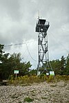
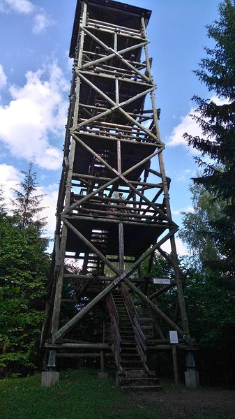
Tõramaa wooded meadow campfire site’s observation tower
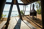
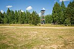
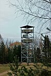
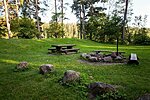
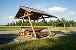
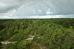
The observation tower is located near the Halliste River in the Tõramaa wooded meadow campfire site. From the tower it is possible to observe animals and birds, ancient oak trees, the undulating water field or the frozen expanse during high water.Viljandi County
Soomaa National Park
Tuhu hiking trail’s observation tower (50 m from the parking)
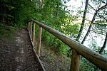
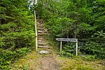
At the beginning of the Tuhu hiking trail is the 5 m high unique observation tower TREPP (stairs), which was completed in 2017 by RMK in cooperation with the Estonian Academy of Arts.If you come to the boardwalk of the hiking trail from the side of Karuse-Kalli road, the distance to the observation tower is 900 m.
Pärnu County
Tuhu Nature Reserve
Abula campsite
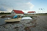
Pebbly drifts on the shore of Tagalaht bay, stunted coastal pines, the wind, the sun and a romantic atmosphere.Saaremaa
Saaremaa Recreation Area
Abula-Kalasma study trail (11,2 km)
Saaremaa
Saaremaa Recreation Area
Aegviidu Visitor Centre
Aegviidu Visitor Centre provides information on the recreation opportunities in the area and conducts nature study programmes. The Visitor Centre is easy to find – it is accessible by car, by bus or by train.Harju County
Aegviidu-Kõrvemaa Recreation Area
Agusalu campfire site
The campfire site is in Agusalu Nature Reserve, which features mires alternating with long narrow and high sandy ridges, locally called the 'kriivas'. These are dunes of the former Ice-Age lake of Peipus. From the campfire site a trail leads to the nearby Imatu bog lake.Ida-Viru County
Alutaguse National Park
Agusalu cycling trail
The cycling trail is ca 38 km, it starts and ends at Iisaku observation tower. Introducing the nature of Agusalu protected area the trail also goes through local villages: Vaikla, Imatu and Varesmetsa.Ida-Viru County
Alutaguse National Park
Ähijärve rest stop
The recreation site is situated in the yard of the visitor centre of Karula National Park. The recreation site has a table and benches and an outdoor shower with fresh drinking water. A good picnic site. The parking area of the visitor centre is next to the recreation site.Võru County
Karula National Park
Ähijärve roads and paths trail (4 km)
The trail starts near the largest lake in Karula National Park. Lake Ähijärv (total area 176 ha) and Ähijärve village are situated right in the heart of the national park. Biologists refer to the lake as a typical eutrophic lake, while fishermen speak of it as a good spot to catch zander, bream, pike, perch, eel and smaller species.Ähijärve village is located on the transition of two types of landscape—the expanse of natural landscape and semi-natural landscape. Peräjärve–Labassaare forests cover the southern shore of the lake. The southern peaks of Karula upland—Lossi and Kõrgemägi hills—are seen from the lakeshore, in the west the Plaagi hill rises against the horizon. Ähijärve village and freehold farms were established in the mid-nineteenth century, whereas human settlement in the area dates back to the 13th century—Sarik-Siimani farm, for example, was built on a burial ground from this period. Ähijärve village is surrounded by a dense network of roads, the layout of which has changed. The Ähijärve roads and paths trail brings these once often treaded paths back to life and runs along the pasture road, the shore path of Lake Ähijärv, footpath, forest paths, winter roads, horse roads and gravel road.
Võru County
Karula National Park
Ahja campfire site
The campfire site has been established as a rest stop on the hiking route near Ahja-Võnnu Road in Põlva County.Põlva County
Kiidjärve-Kooraste Recreation Area
Ahvena campfire site
A campfire site with simple equipment, especially for fishermen, before or after going to Lake Peipus. Be sure to bring your own camping stove or campfire material.Tartu County
Peipsiveere Nature Reserve
Aidu-Liiva campfire site
Located in a young pine forest on the high bank of the old mine filled with blue water.Ida-Viru County
Northern Shore of Lake Peipus Recreation Area
Aidu-Nõmme campfire site
Located in a young pine forest on the high bank of the old mine filled with blue water.Ida-Viru County
Northern Shore of Lake Peipus Recreation Area
Alakonnu campfire site
The campfire site is situated on the shore of Lake Ähijärv. A wonderful place for holiday-makers and fishermen. In rainy weather you can make campfire comfortably under a wooden shelter.Võru County
Karula National Park
Alavere campfire site
A small campfire site near Alavere village at Kose-Kehra roadHarju County
The Surroundings of Tallinn Recreation Area
Allikajärve campfire site
A private campfire site on the shore of the beautiful Lake Allikajärv, popularly also known as Lake Tantsujärv. Anglers find nice places for fishing on the lakeshore.The lake is rich in springs and its bottom is muddy, which is why it is not good for swimming. Those who want to enjoy the water may go to the nearby recreation site on the northern shore of Lake Toatsejärv (~ 500 m) or to Peraküla campsite at the seaside (~1 km).
Lääne County
Nõva Recreation Area
Allikasoo study trail (2,8 km)
A varied trail offering about an hour's walk between ice-age escarpment and patches of calcareous groundwater fens.The trail is marked with wooden signs and blue paint marks on trees.
Saaremaa
Viidumäe Nature Reserve
Altja nature and culture historical trail (3 km)
The small northern coastal village Altja was mentioned for the first time in 1465 as a fishing site at the mouth of the Oandu River. Since 1838 the whole village belonged to the Sagadi manor.
Fishing was the way of life, the transport of firewood, trading and salt smuggling brought wealth to the villagers. This money was used for buying and building sailing vessels. There were three village pubs and three shipyards at Altja, two manors had summerhouses on the beach in the 19th century. In 1923 the Altja-Mustoja educational and Cultural Society was founded.
During the Soviet occupation the traditional village life came to an end. People were closed off from the sea by a border zone, there was a barbed wire fencing and a strip of harrowed area along the coast, boats were sawn in half, burnt or taken away. Families escaped to the West or moved to towns.
When Lahemaa National Park was created in 1971 Altja was found to be a coastal village where it was possible to restore the overall appearance and original architecture. Now Altja is a village where life continues. The unique atmosphere and surrounding nature from the stony beach to river floodplain offer the feeling of past, present and future.
Lääne-Viru County
Lahemaa National Park
Altmetsa campfire site
The campfire site is in the lands of the old Altmetsa farm, 1,5 km from the parking lot of Kirna study trail. The observation tower at the campfire site is visible from the very start of Kirna study trail and it offers a good view on the Pedja river and flooded meadow.Jõgeva County
Alam-Pedja Nature Reserve
Altmetsa observation tower (ca 1.5 km from the parking)
Altmetsa observation tower is located on the circular Kirna study trail. The tower is 1.5 km from the parking lot along the right branch of the trail and 5.3 km along the left branch. The so-called watchtower-type massive log tower, is located on the Altmetsa campfire site on the former farm land. From the observation tower, you can enjoy pleasant views of the Pedja River and the meadows.Jõgeva County
Alam-Pedja Nature Reserve
Alulinna campfire site
Located in Aa Village 1 km south from Tallinn-Narva RoadIda-Viru County
Northern Shore of Lake Peipus Recreation Area
Alumati campfire site
The campfire site is located by a small forest lake, Lake Alumati. The place is well hidden naturally and may be difficult to find, because the hills conceal the campfire site and the lake. However, when you find it, it is a nice surprise, as it is a very lovely place.Valga County
Haanja–Karula Recreation Area
Aluoja observation platform
The view platforms are right next to the Aluoja cascade, giving a powerful spectacle. The cascade gets its waters from the Mägara stream. Before falling to the Pühajõe river valley, the Mägara stream forms a canyon that is about 700 m long and about 10 m deep (Aluoja canyon). The cascade includes five bigger stages.Ida-Viru County
Northern Shore of Lake Peipus Recreation Area
Angerja campfire site
A campfire site with simple equipment, especially for fishermen, before or after going to Lake Peipus. Be sure to bring your own camping stove or campfire material.Tartu County
Peipsiveere Nature Reserve
Apteekrimägi forest trail (4 km)
Apteekrimägi forest trail is a 4 km loop trail with varied terrain and is excellent for jogging or walking. The trail starts and ends in Mäe street, Otepää, in front of Otepää Sports School.Valga County
Otepää Nature Park
Audaku study trail (2.8 km)
Viidumäe Nature Reserve is located in the western part of Saaremaa, in the vicinity of the ancient Antsülusjärve escarpment. This is the oldest and highest part of the Saaremaa island, with its top height 59 metres over the sea level. On the escarpment a number of biotopes characteristic of western Saaremaa can be found. The hiking trail starts and ends at the parking area near the office of Viidumäe Nature Reserve.Saaremaa
Viidumäe Nature Reserve
Autobaasi campfire site
The campfire site protected from the coastal winds is located at the edge of a pine forest, near Kärdla.Hiiumaa
Hiiumaa Recreation Area
Beaver trail (1 km)
Oandu Beaver trail is a kilometre from Oandu towards Altja. Introducing the Altja river valley and its biota, the trail runs along the high slopes of the esker, where scenic views open on the river rapids. The most important inhabitants here are the beavers who have also given the name to the trail. Despite the people on the trail, beavers have always built dams on the Altja river, as the primeval valley offers them perfect conditions for that. The beavers are very shy animals, and you can hardly ever see them. In addition to the beaver dams on the riverbanks, you will also see pointed stumps and felled logs here, and sliding tracks ending in the Altja river.Lääne-Viru County
Lahemaa National Park
Beaver trail study trail (1,8 km)
The trail starts next to the Visitor Centre of Soomaa National Park and its start is accessible by car all year round. During the winter and spring floods, most of the boardwalk is under water. The beaver trail guides you through different types of forest – dark spruce forest, light fern birch forest, wet marshy forest to the Mardu stream, in which beavers live. Traces of beaver activity can be observed more closely. There are information boards on the study trail, drawing your attention to interesting objects of nature and the results of beavers’ construction works.Viljandi County
Soomaa National Park
Cycling trails campfire site
The Cycling trails campfire site is the start for 4 bicycle trails and 1 heritage trail. Of course, you can also use the campfire site if you are not cycling. The site is easy to find and use. At the campfire site there are information boards with information on the recreation area and the cycling trails. Also the Tellingumäe observation tower is nearby.Valga County
Haanja–Karula Recreation Area
Diby rest stop
Building of the former Soviet border observation point in Diby peninsula.Lääne County
Vormsi Landscape Reserve
Eesjärve campsite
Campsite located by Lake Neeruti EesjärvLääne-Viru County
Neeruti Landscape Reserve
Elda campsite
The campsite is located on the southern coast of Kööbe bay. On both sides of the campsite there are Silurian cliffs and ivy on them. A beautiful view on Vilsandi National Park aquatorium and the most western islet of Estonia. A good point for watching seals, birds and butterflys.Saaremaa
Vilsandi National Park
Elistvere animal park and visitor centre
Elistvere Visitor Centre is situated in RMK Tartu–Jõgeva Recreation Area, on the second floor of the entrance building of the highly popular Elistvere Animal Park. Elistvere Animal Park was established in 1997 and aims to share nature education and offer visitors a chance to watch wild animals in their natural environment. The visitor centre contributed to this aim by offering nature study programmes and organising events. It also introduces the recreation opportunities in the entire Tartu–Jõgeva area and offers educational programmes in the surrounding nature.Tartu County
Tartu–Jõgeva Recreation Area
Elistvere campfire site
The campfire site is not far from the centre of the historic park at Elistvere manor, at a meadow in the park, near Elistvere Animal Park (entrance to the animal park for a small fee).Tartu County
Tartu-Jõgeva Recreation Area
Elistvere study trail (2 km)
The trail, which starts and is located in the territory of the animal park is about 1 km long and the same way back. It is suitable for a pleasant walk for the visitor of the animal park. The trail is supported with information boards and observation platforms, information about birds is in the observation tower by the lake. The trail can be accessed with a ticket during the opening hours of the animal park.Tartu County
Tartu-Jõgeva Recreation Area
Elistvere study trail’s observation tower (ca 500 m from the parking)
Elistvere study trail’s observation tower is located at the end of the trail, by Elistvere Lake. The tower offers a great view of the lake. There are information boards about the birds living on the lake in the tower. You can access the study trail during the opening hours of the animal park. There is a fee to visit Elistvere animal park.Tartu County
Tartu-Jõgeva Recreation Area
Elva river primeval valley hiking trail (15 km)
The trail starts and ends in a small parking pocket before reaching the Tartu County Recreational Sports Centre near Elva. The trail runs along forest roads and trails of the primeval valley of the Elva River, where you can see several lakes, streams and sandstone outcrops. The trail is indicated with RMK signposts and white-red-white markings on trees.Tartu County
Tartu-Jõgeva Recreation Area
Emajõe study trail (3 km)
The Emajõgi River study trail starts by Kantsi Tavern and forms a loop on the river floodplain, across grassland in sedge fen and through a bog birch grove.Tartu County
Peipsiveere Nature Reserve
Endla rental hut
Endla rental hut is located in the middle of Endla Nature Reserve on the shore of Lake Endla. Endla rental hut is perfect for people who value peace and quiet and who are willing to carry their sleeping equipment through the mires and bogs. Near Endla rental hut there is a large boulder called Juta Kivi (Juta’s Rock). According to the legend, both the lake and its inhabitants, the birds and fish, were under the protection of Juta, the beautiful daughter of Vanemuine. Sitting on this boulder, Juta longed for her beloved one.Jõgeva County
Endla Nature Reserves
Erastvere park campsite
Roadside rest stop by the lake. Offers a possibility to swim and walk in the park. The graveyard of the Ungern-Sternberg family, founded on the hill in the Erastvere oak stand in 1883, is maintained in good condition. The memorial chapel to the last manor lord Gerhard was built in 1997 on the ruins of the former Marie Chapel. The old red brick building at the lake is used as a place of worship and is called Conrad's Chapel.Põlva County
Kiidjärve–Kooraste Recreation Area
Esku rest stop
At Esku recreation site you can enjoy the beauty of the forest and listen to the birds sing. In autumn it is a good place to pick mushroomsLääne-Viru County
Lahemaa National Park
Estonian-Latvian joint cultural heritage trail (60 km)
22 km of the trail is in Estonia, back and forth 44 km. On the trail it is possible to explore different heritage objects, like Taheva manor, windmill, ruins of hay barn and shooting range, European spindle (Euonymus europaeus) plantation, ancient and tapped pine trees. There are information boards in Estonian, Latvian and English at the objects along the trail. Signs at intersections are colour-coded and marked with symbols. NB! In Latvia the indication and information boards are partly depreciated.Valga County
Haanja–Karula Recreation Area
Fairy trail (1,4 km)
The trail starts from Jõeharu campsite and goes over the Laguja stream, after which the hiker can go to the left hiking circle. The trail is easy and suitable for hikers of all ages, especially for families with children. There are several places of interest for children on the trail: an adventure trail, fairy statues and a Witch's house. The trail is circular, at the end the hiker returns to the starting point of the trail. The trail is indicated with RMK signposts and yellow markings on trees.Tartu County
Tartu-Jõgeva Recreation Area
Forest megaphones
The forest megaphones are an installation consisting of three giant wooden megaphones where the sounds of nature can be listened to in an amplified manner. It is a project that was born in the cooperation of RMK and the first year interior architecture students of Estonian Academy of Arts. The project aimed to realize the idea of a forest library. What kind of construction would enrich the journey of a hiker? How would you read the book of nature?Sitting in the giant megaphone you can listen to the sounds and silence of the forest. The megaphones can be used as an exciting outdoor classroom, but they are also suitable for small-scale cultural events. And an undemanding hiker can even pass the night in one.
Võru County
Haanja-Karula recreation area
Forestry study trail (1.5 km)
The study trail starts next to the RMK Nõva Visitor Centre, runs on forest roads that are surrounded by different species of trees and bushes. The trail goes through clearcut areas and different types of forests.Lääne County
Nõva Recreation Area
Giants of Ootsipalu Valley
Many grand and magnificent trees grow in Ootsipalu valley in Räpina municipality, Põlva County, but two of them are particularly worthy of attention. These are the tallest spruce in Estonia and the tallest pine in Estonia – 48.6 and 46.6 metres tall, respectively.Põlva County
Räpina-Värska Recreation Area
Green energy trail of Oru Park
The green energy trail that runs in the area of Hõbeallika Spring and ponds of Oru Park opens up the complex topic of renewable energy in a simple and understandable way. The trail starts above the Hõbeallika cave, descends to the ponds and crosses the Pühajõe River Valley. Information points of interest help to understand how the energy we need is produced with the help of wind, sun or water and to think about the problems of green energy. On the trail, you can use virtual reality solutions to test how a hydroelectric station would look like on Pühajõe River or windmills in the local landscape.Landscape-wise, Oru park is located on a sandstone bank in the Pühajõe River valley at the mouth of klint bay. The alternating relief with the seaside plain, Neide Bank and the banks of the Pühajõe RiverValley makes the landscape of the park very varied and beautiful. Here you can see a high limestone bank, a river floodplain, a terraced valley bank on the edge of a bank cliff, an alvar and a bank slope with a deep sandy bottom. Thanks to the naturally diverse landscape, the park offers beautiful and interesting views of the surrounding landscape, the sea and the park itself.
Ida-Viru County
Northern Shore of Lake Peipus Recreation Area
Haanja campfire site
The campfire site is near the Suur Munamägi hill, about 300 m from the Suur Muna cafe. Parking by the side of the access road. A nice place for making campfire and having a picnic. In the peace and quiet here you can stay in a tent and enjoy the natural environment in the rolling Haanja area. There are no swimming places nearby, but you are near the highest peak of the Baltic countries!Võru County
Haanja Nature Park
Harilaiu campsite
Harilaiu peninsula is a part of Vilsandi National Park on the north-western coast of Saaremaa. The rectangular peninsula is connected with Tagamõisa peninsula by a narrow strip of land called Harilaiu Neck.There are beautiful sand and pebble beaches and dunes on Harilaid. The sea is continually reshaping the coastline. If you visit the place repeatedly, you will see the coastline changes with your own eyes. There are several freshwater lakes in the peninsula, the largest of which is Laialepa bay. In addition to its interesting landscape, Harilaid is an area of great botanical and zoological value. It has been a protected area since 1924 already. Harilaid has always been uninhabited and when you go there it feels as if you have reached the end of the world, somewhere far away from civilization, and you are at the mercy of natural forces. To go to the campsite at Laialepa bay, you have to walk about 3 km along a hiking trail. At the other side of the campsite is the open sea.
Saaremaa
Vilsandi National Park
Harilaiu hiking trail (6 km or 11 km)
Diverse and deserted coastal nature. Low and vast horizon, wind, golden sand and mighty waves. Interesting dune landscape, trees and bushes subjected to wind, seal and bird sounds, military objects and Kiipsaare lighthouse in the sea.Saaremaa
Vilsandi National Park
Harilaiu rest stop
A stopping point for discovering the most north-west peninsula of Saaremaa. At the Harilaiu peninsula you can view rapid natural processes where the sea is in constant battle with the land.Saaremaa
Vilsandi National Park
Harimäe campfire site
A nice place for recreation and picnic. From the tower (28 m high) is a scenic view of Southern Estonian landscape.Valgamaa
Otepää Nature Park
Harimäe observation tower
A scenic view of Southern Estonian landscape. An observation tower stands at Tartu Marathon trail.Valga County
Otepää Nature Park
Harku forest nature trail (5,7 km)
Harku forest nature trail introduces the varied Harku forest, different forest types, bogs and the species found in them. The length of the trail is 5.7 km and it is indicated with green dots in nature. In the middle of the trail, on the sand dunes, there is an open gazebo where hikers can have a rest.Harju County
Surroundings of Tallinn Recreation Area
Härma campfire site
The lower Härma wall or Kõlgusniidu wall is a 20.5 m high protruding rock, one of the most beautiful in Piusa primeval valley for its bright-coloured clay layers and majestic pyramid shape. The nice campfire site is in the riverside meadow, allowing tent camping and making campfire.Võru County
Haanja-Karula Recreation Area
Haugi campfire site
A campfire site with simple equipment, especially for fishermen, before or after going to Lake Peipus. Be sure to bring your own camping stove or campfire material.Tartu County
Peipsiveere Nature Reserve
Heimtali study trail (2.5 km)
The study trail is an excellent supplement to the Heimtali manor complex. To get to the start of the trail, drive towards Viljandi from the centre of Heimtali Manor. The parking area is near a small castle-like building – the old distillery. The trail passes the only Estonian lime forest in Heimtal and is intended for nature-lovers, who are interested in mighty broadleaved trees. The trunks of giant trees are covered with various rare mosses, many of which are characteristic species of the valuable habitat.Viljandi County
Sakala Recreation Area
Hiieveski campsite
Campsite by the Paunküla reservoir.Harju County
Aegviidu-Kõrvemaa Recreation Area
Hinni canyon
Hinni canyon is a ravine 15-20 m in depth. This majestic natural monument in Devonian sandstone is unique in Estonia for its depth. No other deep sandstone canyons are known. The canyon is about 200 m long, 6-10 m wide, narrowing quickly to 3 m. Uniqueness is added by the crisscross of fallen trees and a small cave with a spring. According to the lore, the spring water has a treating and rejuvenating effect. Boardwalk and stairs are provided to access to the narrow and steep canyon.Võru County
Haanja Nature Park
Hirmuste campsite
A campsite on a splendid sandy beach in the shade of coastal pine forest. A cosy place to admire spectacular sunsets over the sea.The campsite is situated at the seaside, on the northern part of the Kõpu peninsula, about 1 km from the Hirmuste village.
Hiiumaa
Hiiumaa Recreation Area
Hirmuste study trail (1.3 km)
The trail starts at Hirmuste campsite, about 1 km from the Hirmuste village and runs through an old natural forest across overgrown dunes and through the marshy alder forest. On the way back along the coast, you can admire scenic sea views. The trail is most suitable for walking.The trail runs through Kõpu Nature Reserve in the immediate vicinity of the Hirmuste campsite and is marked with wooden signs.
Hiiumaa
Hiiumaa Recreation Area
Hirvelaane campfire site
A small secluded campfire site surrounded by forest, in a low density area.Hikers must bring along all the water they need, as there are no waterpoints near the campfire site. The campfire site is located by RMK Hiking Route.
Rapla County
The Surroundings of Tallinn Recreation Area
Hirvepargi campfire site
Campfire site situated in Vana-Vigala deer park (hirvepark) Jakobi Island with camping possibilities.Rapla County
Matsalu National Park
Huitberg hiking trail (3 km)
One of the most captivating places on the Vormsi Island is the Huitberg limestone outcrop in the middle of a spruce forest, in the centre of the island. This more than 400 million years old coral reef smoothed by glacial abrasion has formed from calcareous exoskeletons of animals living in the shallow tropical seas during the Ordovician. On the outcrop, where it is not covered with moss, you can admire fossils or rare protected ferns growing in limestone cavities.The trail starts by Suuremõisa and is marked with signposts and an information board.
Lääne County
Vormsi Landscape Reserve
Hülkari rest stop
The recreation site offers a magnificent view on Tallinna Bay and Tallinn City. The site is located in the south-east tip of the island, close to the boarder guard radar, in the midst of wide and clean sand dunes. The sea by the recreation site is suitable for swimming.Harju County
Naissaare Nature Park
Hundissaare campfire site
A modest campfire site at a fire pond, designed to serve as a rest stop on the hiking route.Jõgeva County
Tartu-Jõgeva Recreation Area
Hüpassaare campfire site
Hüpassaare campfire site is at the beginning of Hüpassaare study trail. The campfire site provides a place to picnic and camp also if you come with a larger company. A solid shelter protects you against poor weather conditions.Viljandi County
Soomaa National Park
Hüpassaare study trail (4.4 km)
The first part of the trail (~1 km) goes through drained peatland forest. The drained peatland forest has formed from a swamp as a result of drainage. Next, the ground starts to rise gradually, and you arrive at the edge of Kuresoo raised bog. Mires are wetlands in which plant remains are partly undegraded and deposited as peat. The wetland landscape of Kuresoo is varied. At the end of the trail there is the Mart Saar museum.Viljandi County
Soomaa National Park
Iisaku hill campfire site
The campfire site is located at the foot of Iisaku hill. There are health trails for walking and cycling in summer and skiing in winter. Wonderful views open from Iisaku observation tower on the top of the hill.Ida-Viru County
Alutaguse National Park
Iisaku observation tower
Iisaku hill is the second-highest place in Ida-Viru County after Uljaste esker. In clear weather, you can see the towers of Pühtitsa Convent and Lake Peipus from the 28 m observation tower on top of the hill.Ida-Viru County
Alutaguse National Park
Illi campsite
Camping area located in a beautiful pine forest near Elva is suitable for a versatile holiday - you can stay here for a longer period of time, it is also suitable for a hiker and there is enough space for smaller events. Numerous forest roads and trails are enjoyable for walking.Tartu County
Tartu-Jõgeva Recreation Area
Ilumetsa rental hut
A wonderful place to spend time. The Nohipalo hiking trail is near the rental hut.Põlva County
Räpina–Värska Recreation Area
Ilumetsa rest stop (Meteorite Craters)
Ilumetsa recreation site is situated near meteorite craters.There is a tourist information cabin, boardwalk, parking area and dry toilet at the recreation site. Camping with tents is not allowed. The site leads to a fascinating walk to the largest meteorite crater here, called Põrguhaud or “Grave of hell”. Wheelchair accessibility.
Võru County
Räpina–Värska Recreation Area
Ingatsi study trail (4.3 km)
The first half of the trail goes through marsh forest, followed by a rise along the high bog ridge to the Kuresoo bog. There is an observation tower on the bog ridge. Next, the boardwalk meanders between bog pools. On the trail there are several recreation sites that offer scenic views of the Kuresoo bog.Viljandi County
Soomaa National Park
Ingatsi study trail’s observation tower (ca 1 km from the parking)
The observation tower is located on the Ingatsi study trail on one of the highest bog ridges in Estonia. You can enjoy the view of bog pools and pine trees of Kuresoo bog.Viljandi County
Soomaa National Park
Jalase nature trail (2 km)
Jalase landscape reserve aims to protect mire, alvar and forest communities, protected species, geological objects and the unique village landscape of Jalase. There are three western capercaillie courting grounds in the reserve area.Jalase nature trail starts at the rest stop on Jalase-Ohukotsu road. At first the trail goes for 1 km through the varied forests of Arbumetsa Special Management Zone, then 300 metres along the edge of a field to the start of the 0.7 km boardwalk. The boardwalk runs in Sõbessoo Special Management Zone and leads the visitor to Lake Sõbessoo aka Lake Jalase. From the lake, hikers are recommended to take the same route back to the start.
Rapla County
Jalase Landscape Reserve
Rapla County
The Surroundings of Tallinn Recreation Area
Järve rest stop
Long beach with golden sands, interesting protected plant species can be found under the pine trees.Saaremaa
Saaremaa Recreation Area
Järveotsa campfire site
A nice small campfire site at Lake Järveotsa near the Valgejärve nature trail.Harju County
The Surroundings of Tallinn Recreation Area
Järvi Pärnjärve campsite
A quite spacious campsite that is suitable for all kinds of events. Easily accessible by car. The Järvi-Aegviidu hiking trail and RMK hiking trail pass by the campsite.Harju County
Aegviidu-Kõrvemaa Recreation Area
Järvi Pikkjärve campsite
Campsite is located by Lake Järvi Pikkjärve in the forest under spruce trees. Järvi-Aegviidu hiking trail and RMK hiking trail pass by the campsite.Harju County
Aegviidu-Kõrvemaa Recreation Area
Järvi-Aegviidu hiking trail (27 km)
ATTENTION!
IN CONNECTION WITH LOCAL LANDOWNERS THE TRAIL HAS BEEN CHANGED: IT IS NOW 27 KM FOM JÄRVI PIKKJÄRVE CAMPSITE TO AEGVIIDU! The 5 km between Liiapeksi to Järvi Pikkjärve has been liquidated. THE TRAIL STARTS NOW FROM JÄRVI PIKKJÄRVE CAMPSITE (TOTAL LENGHT 27 km)
This is a well known hiking trail among Estonians. With it's 27 km (previous 32 km) length and several campsites the trail offers hiking possibilities for up to 2-3 days. The beautiful and varied landscape is worth visiting.Harju County
Aegviidu-Kõrvemaa Reacreation Area
Jõeharu campsite
The camping area located near Elva River between forest and meadow is suitable for varied holidays.Tartu County
Tartu-Jõgeva Recreation Area
Jõemõisa campfire site
Coming from Saare–Pala–Kodavere road, Jõemõisa campfire site is the first of the five campfire sites around Kaiu lakes. The campfire site is situated on the high shore of Lake Jõemõisa, where you can enjoy the wonderful view of Kaiu lakes and the charms of lakeside or forest holiday.Jõgeva County
Tartu–Jõgeva Recreation Area
Jõemõisa hiking trail (0.5 km)
The 0.5 km forest path offers a fascinating walk for visitors of the recreation area. Those who wish to continue their hike can walk the 3 km Tammeluha hiking trail.Jõgeva County
Tartu–Jõgeva Recreation Area
Jõuga lakes campfire site
The campfire sites are on the bank of Lake Pesujärv. It is a popular swimming place. There is a boardwalk leading to the lakeside and a convenient pier for taking a dip. The Jõuga lake system comprises four lakes that emerged as a result of the melting of loose ice: Lake Jõuga Pesujärv, Lake Jõuga Linajärv, Lake Jõuga Liivjärv and Lake Armise. Several rare plant and animal species can be found in the lakes, e.g. the common water frog.Ida-Viru County
Alutaguse National Park
Jugapuulaane study trail (3.5 km)
The study trail that both starts and ends at Peraküla village at RMK Nõva Visitor Centre, square goes through the varied landscape characteristic to this area. Cycling is recommended, but the trail is also suitable for walking.Lääne County
Nõva Recreation Area
Juminda campsite
A campsite at the top of the westernmost peninsula in Lahemaa National Park.Harju County
Lahemaa National Park
Jussi campsite
Campsite is located by Lake Jussi Väinjärv. It is a small and private campsite, the Jussi study trail and RMK Oandu-Aegviidu-Ikla hiking trail pass by the campsiteHarju County
Aegviidu-Kõrvemaa Recreation Area
Jussi nature trail (8 km)
The nature trail is surrounded with varied nature and landscapes. It goes up and down on the hills surrounding Jussi Lakes and takes the hiker to the Jussi Moor. The Jussi Moor is a unique natural community in Estonia that conditioned by the activities of the Soviet Army's activity and the several forest fires caused by that.Harju County
Aegviidu-Kõrvemaa Recreation Area
Kaali rest stop
One of the best exposed and accessible meteorite craters in the world.About 3470 - 3545 years ago, a huge rock from space came hurtling toward the Earth. Several kilometers above the Earth’s surface, the meteorite broke into pieces from the pressure and heat of the atmosphere. The explosion left nine total craters, now known as the Kaali Meteorite Crater Field. The largest crater (which measures 110 meters across) is believed to have been a sacred site for many centuries due to its cosmic origin.
Saaremaa
Saarema Recreation Area
Kabeli rest stop
The most remarkable of the remaining buildings on Osmussaare Island is the chapel (Jesu Kapell) that was built in 1766 using limestone. The chapel was renovated in 2006-2011.Lääne County
Osmussaare Landscape Reserve
Kabelimäe campfire site
The campfire site is located on the dunes of the former Baltic Ice Lake. The place got its name (Chapel hill) according to the Swedish general who was buried there during the Great Northern War. The campfire site is often a “lifesaver” for those who planned to overnight in the nearby Saeveski forest hut, but there was not enough room for them.Järva County
Sakala Recreation Area
Kaberneeme campfire sites
Campfire sites are located 40 km from Tallinn, near the coastal village, by the quarry and the sea.Harju County
North-Estonian Recreation Area
Kabli nature study trail (1.8 km)
The 1.8 km trail features versatile terrains and diverse habitats, including key habitats. There are points of interest with information boards introducing the attractions along the trail. The trail is marked with wooden arrow signs and takes 1 to 2 hours to complete. The trail ends at Priivitsa campfire site, which is a good place for making campfire and having a meal.Pärnu County
Pärnumaa Recreation Area
Kabli Visitor Centre
Kabli Visitor Centre is situated in the pine forest on the shore of the Gulf of Riga. Coastal sea and meadows, versatile forests, fascinating bogs and the local scenery are the most characteristic features of the nearest surroundings. Priivitsa campfire site, a good spot for setting up a tent or making fire, is situated near the nature centre. Kabli nature study trail is also nearby.We share information about RMK hiking trails and various activities in the area. We conduct nature education programs for children and adults on various topics. It's possible to watch the migration of birds and bird ringing in autumn. Find out more about our programs and events!
NB! Camping in the visitor centre's yard is not allowed! Please use Priivitsa campfire site!
Pärnu County
Pärnumaa Recreation Area
Kaiu cycling trail (45 km)
The 45 km long trail runs largely across the Kaiu kames. With its length and versatile terrain, the trail is sufficiently demanding even for experienced cyclists. The trail runs south from the Kääpa village through airy pine forests, in some parts the track goes up and downhill on loose sand. You can restore your energy at campfire sites on the shores of Kaiu lakes or freshen up in the lakes. One of the most interesting spots along the trail is Sõõru village and its more than a century-old fire watchtower (visitors are not allowed in the tower!). At Pala you can replenish your food and drink supplies to have stamina for the second half of the trail. In Kääpa village you can visit Kalevipoeg Museum, dedicated to the Estonian epic hero, a theme park, the treasure-bringing goblin’s adventure trail and, with a little luck, meet some goblins along the way.Jõgeva County
Tartu–Jõgeva Recreation Area
Kakerdaja nature trail (7 km)
The nature trail can be enjoyed in different sections: bog lovers have the opportunity to walk along the boardwalk (4 km) through the Kakerdaja bog. Different forest types and lakes can be seen on the Kalajärve trail section while passing the Noku campfire site, making a circle around the small and large Kalajärv you can reach back the Noku campfire site along the road. The trail is also on the RMK Oandu-Aegviidu-Ikla and RMK Peraküla-Aegviidu-Ähijärve hiking trail.Järva County
Aegviidu-Kõrvemaa Recreation Area
Käkisilma campsite
A campsite under the pine trees by the sea at tip of the Kuusnõmme peninsula. There is a parking area by the campsite.Saaremaa
Vilsandi National Park
Kaksikute campfire site
Here you can view the blackish brown boulders gneissic breccias. The boulders have been formed 540 million years ago when 10 km North-West of the island the Neugrund meteorite landed in the sea.The most famous of these boulders are the Twins (Estonian Kaksikud).
Lääne County
Osmussaare Landscape Reserve
Kalajärve campfire site
The campfire site is located in a deep pine forest by Kakerdaja study trail.Harju County
Aegviidu-Kõrvemaa Recreation Area
Kalamehe campfire site
The “Fisherman’s” campfire site is situated on the northern shore of Lake Kaiu, right next to Tammeluha campfire site. It is suitable for enthusiasts of recreational water sports and hikers who like to walk in the forest on alternating terrain, rich in wild berries and mushrooms.Jõgeva County
Tartu–Jõgeva Recreation Area
Kalasma campsite
Beautiful pebble beach. Ideal for enjoying peace, quite and sunsets.Saaremaa
Saaremaa Recreation Area
Kaleste campsite
The campsite on the southern coast of the Kõpu peninsula boasts one of the best sandy beaches on the peninsula. Also, it is the best bathing place for families with children.Hiiumaa
Hiiumaa Recreation Area
Kaleste study trail (1.8 km)
The trail runs in the immediate vicinity of Kaleste campsite on the northern coast of the Kõpu peninsula in Kõpu Nature Reserve and is marked with wooden signs. The trail starts and ends in the campsite at the information post, where you can also see the trail map. The trail takes 30-50 minutes to complete. There are 7 information boards introducing the sights.Hiiumaa
Hiiumaa Recreation Area
Kalja study trail (1 km)
Kalja study trail introduces karst forms and their causes. Waters that go underground in Kalja sinkholes run as a subterranean river and appear on the ground again near Jauni village, Hiieniidi (Iilasmaa) spring area, to the north of Kalja sinkholes.Saaremaa
Saaremaa Recreation Area
Kaljupealse campfire site
The “cliff top” campfire site is situated in the Toolamaa village on the banks of the Võhandu River. It is a nice place to rest for campers and for canoers, offering a scenic view of the outcropping of the Võhandu River.Põlva County
Räpina–Värska Recreation Area
Kallaste cliff rest stop
Kallaste cliff is about 400 m and 10 m high lime stone disclosure.An old pine forest grows on the cliff and there's a forest trail under the trees.
At the southern part of the cliff you can see fossilized plants.
Folk tales tell that during the ancient freedom battle of Estonia Kallaste cliff was the hiding place of the Devil where he made swords for the fighters.
Hiiumaa
Hiiumaa Recreation Area
Kalmeoja campfire site
The campfire site near the Viru bog is a nice stop for hikers on RMK Oandu-Aegviidu-Ikla Hiking RouteHarju County
Lahemaa National Park
Kalurikoja forest hut
The forest hut is situated in the shade of coastal pines on the northern coast of the Kõpu peninsula. The beach is a few steps away.The forest hut is a nice resting point for fishermen and hikers both in the summer and the winter.
The forest hut is 2.5 km from the road, but the unpaved road to the hut is not accessible with large tour buses.
Hiiumaa
Hiiumaa Recreation Area
Kamari-Kärevere water route (75 km)
The recommended start of the journey is behind the dam on Kamari water reservoir. The water trail is 75 km long. The journey may take 2-3 days. The water trail is meant to be completed by non-motorised watercraft.Jõgeva County
Alam-Pedja Nature Reserve
Kapasto forest hut
The forest hut deep in the heart of the Hiiumaa Island, in a place of an old forest keeper’s house.Hiiumaa
Hiiumaa Recreation Area
Kärdla hiking trail (4 km)
The 4 km hiking trail is suitable for a longer walk on a day off. The trail goes circular and stretches through various forest.The trail starts at the end of Tiigi Street in Kärdla, is marked with signs and is suitable for all seasons. The trail takes 1 hours to complete and in the summer can be walked through without getting feet wet.
NB! Kärdla hiking trail is not passable by bicycles or motor vehicles.
Hiiumaa
Hiiumaa Recreation Area
Kärgandi campfire site
Kärgandi campfire site is located in a beautiful open area in the middle of diverse forests. The forest landscape with a very varied relief around the campfire site (Selgise Mountains) is well suited for walking on your own and picking berries and mushrooms in autumn. The campfire site is a possible resting place on the Selgise cycle path, the road leading to it has moody curves and ups and downs.Tartu County
Tartu–Jõgeva Recreation Area
Karjääri campsite
The shaded campsite is in a former gravel quarry, which now looks natural. Located at Abula-Kalasma study trail.Saaremaa
Saaremaa Recreation Area
Karjamaa campsite
The campsite is hidden from winds from the lake, yet it is just 100 m from the beautiful sand dunes.Ida-Viru County
Northern Shore of Lake Peipus Recreation Area
Karula cycling trail (50 km
The trail starts at the foot of the Tellingumägi hill at the Cycling trail campfire site and partly coincides with Koiva cycling trail. The second part of the trail goes mainly along roads and forest rides in pine forests, ascending and descending and offering magnificent views.The cycling trail goes along forest roads and rides on the rolling terrain of Karula uplands.
Valga County
Haanja–Karula Recreation Area
Karula long cycling trail (38 km)
The trail runs through Karula National Park and has no marked starting or end point. The easiest access to the trail is at the Karula National Park’s visitor centre, where you can park your car and ask for the National Park map at the information desk. The trail is marked with plastic and tin signs.Võru County
Karula National Park
Karula long hiking trail (36 km)
The hiking trail runs through Karula National Park and has no marked starting or end point. The circular trail is marked with signs leading to both directions; however, it is advisable to move counter-clockwise. The trail is marked with yellow blazes on trees, plastic hiker pictograms on sign posts and tin signs along major trail sections.Võru County
Karula National Park
Karula Pikkjärve campfire sites
The campfire sites are located in a unique east-west oriented primeval valley by the lake. The lake has high, mostly sandy banks. A peaceful place for making campfire, camping, enjoying the beauty of the lake.Valga County
Haanja–Karula Recreation Area
Karula short cycling trail (15 km)
The trail runs through Karula National Park and has no marked starting or end point. The easiest access to the trail is at the visitor centre of Karula National Park, where you can park your car and ask for the National Park map at the information point. The trail is marked with signs.Võru County
Karula National Park
Karuskose rental hut
This rental hut – former forest keeper’s place – is suitable for an undemanding hiker. In cold weather the sauna stove can be heated. The hut is on the bank of the Raudna River, with a campfire site nearby. It is possible to go walking on Ingatsi study trail.Viljandi County
Soomaa National Park
Karusselja rest stop
At Karusselja rest stop in Kloostri forest you can enjoy the beauty of the ancient lime-tree and listen to birdsong. In autumn it is good to take a basket for mushrooms with you.Pärnu County
Matsalu National Park
Käsmu cycling trail (11.6 km)
The rocky beaches force bikers into the forests on the peninsula—you can catch glimpses of the sea on the Palganeem cape and between Kõrgekalda and Palganeem, Järvekael and on the trail between the lake and the sea. The trail is perfect for cyclists who wish to take a break from civilisation and cars rushing past. The total length of the trail, including the section back and forth to Palganeem cape, is 16 km.Lääne-Viru County
Lahemaa National Park
Käsmu hiking trail (15 km)
The hiking trail makes the circle around the peninsula, 10 km of it run along the coastline where the forest and sea meet.Lääne-Viru County
Lahemaa National Park
Käsmu nature and culture historical trail (4.2 km)
The trail introduces the history of the smallest peninsula in Lahemaa National Park, the largest boulder field in Estonia and the rich cultural heritage of the Käsmu village.Lääne-Viru County
Lahemaa National Park
Kassinurme campfire site
Kassinurme campfire site is at Vaiga-Kassinurme hillfort. The site is one of the oldest sacred places in Estonia. This is the favourite place for history lovers, where ancient war games are organised, old folk customs are revived and holidays of the folk calendar are celebrated. A fragment of the ancient fort has been restored, there are several information boards.Jõgeva County
Tartu-Jõgeva Recreation Area
Katku campfire site
The campfire site is a good resting spot at the edge of large coniferous forests and the protected Katkusoo (Rüütli) bog. With some luck you can even spot a wood grouse. It is a nice place to rest your tired feet, make campfire, or have a picnic.Pärnu County
Pärnumaa Recreation Area
Kaubaru forest hut
The forest hut is located in Nigula Nature Reserve. The place is suitable for overnight stay or rest for hikers who want to explore the surrounding area.Pärnu County
Nigula Nature Reserve
Kauksi beach forest campsite
The campsite with clean, "singing" sands is located in one of the most beautiful tourist areas on the northern shore of Lake Peipus.Ida-Viru County
Northern Shore of Lake Peipus Recreation Area
Kauksi campsite
The largest RMK recreation site in Estonia, located on the west bank of the Kauksi stream. With its golden sand and light pine forest, Kauksi campsite is among the most highly valued campsites among our visitors.Ida-Viru County
Northern Shore of Lake Peipus Recreation Area
Kauksi stream study trail (3.6 km)
The hiking trail goes through a beautiful pine forest, meandering along the banks of Kauksi stream, and offering lovely views.Ida-Viru County
Northern Shore of Lake Peipus Recreation Area
Kautsi forest hut
Over the years this forest hut has become a meeting place for hunters. However, all visitors who have planned a stop or a rest site on their hiking route are welcome here. It is a perfect place to clear your mind and enjoy the silence. Good berry and mushroom forests are nearby.Võru County
Haanja–Karula Recreation Area
Keemu observation tower
The little Keemu port on the southern coast of the Matsalu bay offers a view of the midbay islands and the shallow inland bay and coastal meadows pockmarked with tufts of reed. The inshore islets provide a good nesting place for seagulls, terns, graylag geese and gadwalls; the large coastal meadows are a stopover site for black geese, geese and common crane and a magnificent stopover and nesting place for waders.Pärnu County
Matsalu National Park
Keemu rest stop
The recreation site right next to the Keemu port is a nice place for a lunch break, a picnic under the shelter or as an open-air seating area. You can also take a walk on the rubble seawall of the port, admire the views of the surrounding landscape or watch birds from the observation tower.Pärnu County
Matsalu National Park
Keibu campfire site I
A site for camping and resting with a good swimming place.Harju County
Nõva Recreation Area
Keibu campfire site II
A site for camping and resting with a good swimming placeHarju County
Nõva Recreation Area
Keila-Joa Park nature trail (2,1 km)
Keila-Joa Park nature trail starts at the parking area, goes along the riverbank, passes the waterfall to the corner of the park closest to the sea, and then returns to the parking area. All in all, it makes a 2-3 hour walk in a unique park forest.Keila-Joa park is a popular destination among brides and grooms. It was a custom to attach padlock to the suspension bridge to symbolize the commitment to each other.
In 2013 the stairways and suspension bridges were renovated and the padlocks removed. This was due to the padlocks causing rusting on the bridges.
In 2015 the hearts sculpture by Estonian artist Mati Karmin was opened. The sculpture will be finished as new padlocks symbolizing commitment and everlasting love are gradually added to the construction.
The nature trail is marked with red dots on the trees.
Harju County
Surroundings of Tallinn Recreation Area
Kellissaare campfire site
Kellissaare campfire site is located at the lake formed in a former sand quarry. The lake is suitable for swimming. A nice and peaceful place.Pärnu County
Sakala Recreation Area
Keskranna rest stop
Beautiful long sandy beach not far from town, pine forest on dunes and under the pines, interesting plant species rarely occurring in Estonia.Saaremaa
Saaremaa Recreation Area
Kiidjärve Visitor Centre
Kiidjärve Visitor Centre is located on the bank of the picturesque Ahja river in Kiidjärve village, at the heart of the Kiidjärve-Kooraste recreation area, surrounded by historical sights and scenic nature: the sandstone outcrops, the "ant kingdom", Valgesoo bog and Roiupalu primeval forest.Whether you walk or cycle here, or come by car, bus or train – here you can look around, have a rest and plan your further trip. It is possible to rent rooms in the centre for seminars and meetings.
Those interested may view the displays and exhibitions, watch nature documentaries and register for nature education programmes. From the visitor centre you can go to the 3.2 km Roiupalu study trail or the 11.8 km Kiidjärve-Taevaskoja-Kiidjärve hiking trail.
The visitor centre gives information about RMK recreation and hiking opportunities. You can buy maps of RMK recreation areas, protected areas and hiking trails, as well as souvenirs.
We offer various nature education programmes and study trips for schools, kindergartens and adults, and organise forest and nature events.
Põlva County
Kiidjärve–Kooraste Recreation Area
Kiidjärve Wood Ants Trail (1 km)
The 1 km study trail introduces the life of ants. Here the hiker can feel like Gulliver among ants. The trail is for walking only!Põlva County
Kiidjärve-Kooraste Recreation Area
Kiidjärve-Taevaskoja-Kiidjärve hiking trail (11,8 km)
The 11,8 km trail starts and ends next to Kiidjärve Visitor Centre and runs along the picturesque bank of Ahja River up to Saesaare weir and bridge and comes back along the ohter bank of the river. The hiking trail is marked with blue dots on signposts and trees.Põlva County
Kiidjärve–Kooraste Recreation Area
Kiigemäe campfire site
The campfire site a beautiful view opens on the landscape of Otepää and Lake Pühajärv.Valga County
Otepää Nature Park
Kilingi-Nõmme campfire site
Campsite is located by RMK Oandu-Aegviidu-Ikla hiking route and Kilingi-Nõmme forest trail. It is a good place for hikers having a rest and cooking a meal. For rainy days there is a shelter with a fireplace. Kilingi-Nõmme rental hut is located about 1km from the campfire sitePärnu County
Pärnumaa Recreation Area
Kilingi-Nõmme forest trail (shorter circle 3 km, longer circle 5 km)
The trail starts from RMK Kilingi-Nõmme forest house and outdoor classroom; see the trail map on the information board. There are a number of stairs and boardwalk sections along the trail and a barbecue hut at the end of the trail. This is a forestry-themed study trail, devised by Hendrik Relve. In the shelter of the outdoor nature classroom, hikers can rest their feet and have a picnic, and schools can teach biology classes.Pärnu County
Pärnumaa Recreation Area
Kilingi-Nõmme rental hut
The house is located in a beautiful pine forest near Kilingi-Nõmme. The Kilingi-Nõmme forest trail also begins in the courtyard of the forest house. A barbecue hall is located in the yard, where the users of the rental hut can spend time and grill.Pärnu County
Pärnumaa Recreation Area
Kirikumäe campfire site
A campfire site located on the bank of the Põltsamaa River.Järva County
Endla Nature Reserve
Kirikumäe campfire site
The campfire site at the picturesque Lake Kirikumäe is an excellent rest stop for hikers in the RMK Peraküla-Aegviidu-Ähijärve hiking route.Võru County
Haanja-Karula Recreation Area
Kirikumäe hiking trails (3.2 km)
The 3,2 km long hiking trail goes around lake Kirikumäe and is situated in Kirikumäe Landscape Protection Area. The trail is supplied with wooden signs and information boards.Võru County
Haanja–Karula Recreation Area
Kirna study trail (6.8 km)
Kirna study trail gives an excellent opportunity to get familiar with the meadows and floodplain forest of the Pedja river. To get a better overview of the flood meadows and the river, an observation tower has been built at Altmetsa farmstead. Further on the trail there is a suspension bridge across the river.Jõgeva County
Alam-Pedja Nature Reserve
Kisejärve hiking trail (6 km)
Lake Kisejärv hiking trail offers a 6 km walk, introducing the area, which is rich in lakes, and the history of its formation. The trail goes around Lake Kisejärv with its uneven and jutted shoreline, passes by Lake Luikjärv and leads to Lake Pahijärv, known for rare algae. The trail also passes the pastures of the well known Nopri dairy.Võru County
Haanja–Karula Recreation Area
Kivi forest hut
The forest hut is situated by Hargla–Koobasaare road. You can park next to the hut. The forest hut is an old non-heated barn with bunks, and a fire ring outside. There are ruins of an old threshing barn and cowshed nearby.Valga County
Karula National Park
Kividemaa cycling trail (68 km)
The cycling trail runs on the lands of Noarootsi and Nõva. It is possible to take the shorter track of 32 km or the longer one, 68 km. The trail goes along different types of road (tarmac, gravel or dirt roads). You will see the new densely populated area around Spithami – Põõsaspea and experience the tranquil rhythm of life and the Swedish atmosphere of Rooslepa, you will be on your own with the forest and the rocks on lonely forest tracks.The cycling trail starts at the RMK Nõva Visitor Centre.
Lääne County
Nõva Recreation Area
Kloostri observation tower
From the observation tower on the left bank of the Kasari River, you can enjoy the view of the wide expanse of the river floodplain, where flocks of ducks, geese, swans and waders gather during spring floods. In the summer white storks and eagles nest in the surroundings and fly around, often you can spot moose or roe deer going about their business on the floodplain.Pärnu County
Matsalu National Park
Kogrejärve campfire site
The campfire site on the shore of the small forest lake is a nice place for fishermen, nature-lovers and those who pick berries and mushrooms. The lake is surrounded by a wonderful 80-year-old mixed pine forest with numerous good places for gathering mushrooms and berries.Valga County
Haanja–Karula Recreation Area
Koha campfire site
A campfire site with simple equipment, especially for fishermen, before or after going to Lake Peipus. Be sure to bring your own camping stove or campfire material.Tartu County
Peipsiveere Nature Reserve
Koigi study trail (5,7 km)
The trail runs in the largest bog of Saaremaa, where different development stages of the mire can be observed. A popular legend goes that in the bog lake of Koigi a treasure was once buried, and it is guarded by spirits who occasionally reveal themselves to people.Saaremaa
Koigi Landscape Protection Area
Koigi study trail’s observation tower (1.5 km from the parking)
The observation tower is located on Koig study trail at the edge of the raised bog, 1.5 km from the parking lot and it is 9 m high. The tower offers a view of the bog forest, the open bog area and the bog lakes. The surroundings are especially beautiful in early mornings, when - if you are lucky - you can see a sea eagle or a bald eagle in the sky. In early spring it is possible to hear the calls of grouse.Saaremaa
Saaremaa Recreation Area
Koiva cultural heritage cycling trail (18 km)
The trail introduces heritage objects near the border of Estonia. The trail passes Taheva manor, windmill, shooting range, European spindle (Euonymus europaeus) plantation, ancient and tapped pine trees.Valga County
Haanja–Karula Recreation Area
Koiva cultural heritage walking trail (2 km)
An interesting and varied 2 km trail, introducing the objects of cultural heritage that were important for our ancestors. For example, sacrificial rock, Tellingumäe village square and observation tower, European spindle plantation, and ancient and resin-tapped pine trees. The trail is equipped with information boards.Valga County
Haanja–Karula Recreation Area
Koiva cycling trail (20 km)
The trail starts at the foot of the Tellingumägi hill at the Cycling trails campfire site and goes through the forests along the Mustjõgi and Koiva rivers. Along the trail, you can see a sacrificial rock, a sacrificial pine tree, the confluence of rivers, an interesting community of oaks. It is possible to measure the circumference of the large oak, go through dense pine forests and see resin-tapped trees. The trail goes along gravel forest roads, forest rides and paths. Equipped with 8 information boards. Along the trail there are several campfire sites where it is possible to stop and have a meal.Valga County
Haanja–Karula Recreation Area
Kolga nature study trail (1.5 and 3.5 km)
The circle trail is located near the Kolga stream. It is a sandy area with pines. The oldest pines are more than 170 years old. Trail is suitable for short hikes.Pärnu County
Pärnumaa Recreation Area
Koljaku rest stop
At Koljaku recreation site you enjoy the beauty of the forest, listen to the birds song and pick mushrooms in autumn.Lääne-Viru County
Lahemaa National Park
Konati campsite
The campsite is located in a former gravel quarry which offers a good place for camping, safe from winds. This is an excellent example of mine reclamation.Saaremaa
Saaremaa Recreation Area
Kõnnu Suursoo observation tower (ca 2.3 km from the parking)
The observation tower is located on the Järvi-Aegviidu hiking trail in the middle of Kõnnu Suursoo - it translates into English as Kõnnu Big Bog. To visit the observation tower, follow the left branch of the Paukjärve nature trail for 1 km from the Kaksiksilla parking lot to the Pauljärve esker. There the nature trail crosses the Järvi-Aegviidu hiking trail. Turn left to Kõnnu Suursoo and after 1.2 km you will reach the observation tower.The tower offers a view of the bog landscape and pools.
Harju County
Aegviidu-Kõrvemaa Reacreation Area
Konsu campsite
The campsite is located on the high bank of Lake Konsu. It is the largest lake in the Kurtna lake system, and its main species are the common roach, the European perch, and the pike.Ida-Viru County
Northern Shore of Lake Peipus Recreation Area
Kooliranna campfire site
The campfire site at Lake Pühajärv is a wonderful rest stop for hikers, suitable for tent camping and swimming.Valga County
Otepää Nature Park
Koolmajärve campfire site
The campfire site is situated at Lake Koolmajärve. Tent camping is not allowed. The lake is one of the darkest black-water lakes in the middle of the pine forest.Põlva County
Räpina–Värska Recreation Area
Kooraste cycling trail (38 km)
The trail goes along gravel roads through beautiful pine forests and offers views of several lakes and rivers and objects of cultural heritage.Põlva County
Kiidjärve–Kooraste Recreation Area
Kooraste Kõrgeperve campsite
A place for a forest vacation on the high eastern shore of Lake Kõvvõrjärve. Here it is possible to make a fire and camp, catch fish or simply enjoy nature while walking in the beautiful pine forest of the surrounding area, as well as pick berries or mushrooms.Põlva County
Kiidjärve–Kooraste Recreation Area
Kooraste Kõverjärve campfire site
A nice lakeside site for a hiker for a forest holiday. Here it is possible to catch fish, make a campfire and camp, but there is also enough space for a smaller event. Kooraste cycling trail passes the campfire site, which is also suitable for walking. A lot of nice walks can be done on the numerous forest trails along the lake.Põlva County
Kiidjärve–Kooraste Recreation Area
Kooraste rental hut
The rental hut is perfect for visitors of Pokuland, people who come to gather berries and mushrooms and those in search of silence.Põlva County
Kiidjärve–Kooraste Recreation Area
Kooraste Suurjärve campfire site
A nice place for forest and beach recreation.Põlva County
Kiidjärve-Kooraste Recreation Area
Koorküla Valgjärve campfire sites
The lakeshore with the most beautiful sandy beaches in this area is an ideal place for family holiday. The first campfire site is large enough for several groups of people and the sandy beach also provides an opportunity for swimming. However, watch out when swimming, because the location of the onetime manor is on the bottom of the lake, and according to the local lore, also water-dwellers live there. The second campfire site is suitable for a modest lonely wanderer.Valga County
Sakala Recreation Area
Koosa campfire site
A favourite spot for overnight stay for fishermen at the crossing of the Emajõgi and Koosa rivers.Tartu County
Peipsiveere Nature Reserve
Kopra campfire site
The campfire site is situated on a small island in the middle of a drainage ditch, and can be accessed across a bridge. This is a suitable resting and overnight stop for hikers. The Kopra –Ikla section (74 km) of RMK Hiking Route passes the campfire site.Pärnu County
Pärnumaa Recreation Area
Kõpu Suurkivi rest stop
About 2,3 km from Kõpu village lays the second largest erratic boulder of Hiiumaa - Kõpu Suurkivi or Lepistpao Erratic Boulder. The diameter of the boulder is 28.4 m and it is 5.3 m high. There is a staircase leading to the top of the boulder.Hiiumaa
Hiiumaa Recreation Area
Kõrgekalda campfire site
The campfire site on the high bank of the picturesque Kääpa River is a place to enjoy a peaceful forest holiday. The campfire site is situated at the forest road, in the immediate vicinity of the Koseveski cycling trail.Jõgeva County
Tartu–Jõgeva Recreation Area
Kõrgeperve campfire site
The campfire site is located in a naturally beautiful place, where the foaming waters of the Koiva river flow by. The place is also constantly changing, as the bank in the river bend is gradually worn away by the water. A wonderful place for recreation and enjoying the beauty of nature.Valga County
Haanja–Karula Recreation Area
Kõrgessaare orchids' study trail (100 m)
The self-guided study trail offers a chance to learn about local orchids in a short time. Accessible also for tourists travelling by tour buses. The educational flower bed is primarily intended for learning about different species of the orchid family, but it also provides opportunities for outdoor study for schoolchildren and biology enthusiasts.In the middle of Kõrgessaare small town, next to the parking area.
The boardwalk trail takes 15 minutes to complete.
Hiiumaa
Hiiumaa Recreation Area
Kõrtsi-Tõramaa campfire site
Kõrtsi-Tõramaa campfire site is located near the Visitor Centre. It is a good place for bigger group to have a picnic, camp or park a caravan.Viljandi County
Soomaa National Park
Kõrtsikraavi campfire site
The campfire site is by the main ditch of Iisaku, called Kõrtsikraavi 'tavern ditch', after the former tavern of Iisaku. The ditch is 13 km long and runs into the Rannapungerja river.Ida-Viru County
Alutaguse National Park
Rapla County
The Surroundings of Tallinn Recreation Area
Koseveski cycling trail (20 km)
The trail starts in Koseveski at the Kääpa River and is suitable for a leisurely cycling trip along forest paths and rides. The trail passes through versatile forests rich in wild berries and mushrooms, rivers and several recreation and campfire sites to enjoy peace and quiet, and the beauty of nature.Jõgeva County
Tartu–Jõgeva Recreation Area
Kotka campfire site
The campfire site is suitable for a suburban vacation and a stop by the Ilmatsalu River for fishermen or walkers.Tartu County
Tartu–Jõgeva Recreation Area
Kotka hiking trail (6,7km)
Kotka hiking trail introduces the fen and the transition mire and sandy eskers. Its sights include the high wooded sandy eskers, which developed when Lake Peipus receded, and the mystic bog islands in Rüütli bog, which developed from the sediments accumulated at the end of the Ice Age. The transition from sandy eskers to the mire is unexpected, this kind of varied landscape offers a pleasant change for hikers.Ida-Viru County
Alutaguse National Park
Kõverajärve rental hut
The “crooked lake” rental hut is situated near Lake Kõvera, Võru municipality, Võru County. A perfect place for a lakeside holiday.NB! At the forest house, you can meet the neighbor's friendly dogs (Malamutes). If the dogs bother you, please call the owner +372 5061141.
Võru County
Räpina–Värska Recreation Area
Kõverjärve rest stop
A rest stop in Ohepalu Landscape Protection Area near Lake Vatku Kõverjärv (Vohnja Kõverjärv).Lääne-Viru County
North-Estonian Recreation Area
Krani campfire site
A small and secluded camping site with a shelter located by the Liivoja stream.Järva County
Aegviidu-Kõrvemaa Recreation Area
Krapi campsite
The campsite is situated in the shade of old coastal pines on the ca 1,5 km stretch of the seashore.Pärnu County
Pärnumaa Recreation Area
Kubja rest stop
The rest stop is on the shore of Lake Kubija. The main attraction here is an artesian well, from which water flows under natural pressure to the ground.Võru County
Haanja-Karula Recreation Area
Kublitsa campfire site
The campfire site is 2 km south of the town of Võru by Lake Kublitsa. This is a small forest lake without an inflow and outflow. The campfire site is a nice place to have a picnic with family. Around the site there are good places for picking mushrooms and berries.Võru County
Haanja–Karula Recreation Area
Kukemetsa forest hut
The easily accessible forest hut is situated by the gravel forest road. The surrounding forests are rich in wild berries and mushrooms and suitable for just walking. The forest hut is a good resting spot along the Selgise cycling trail and Peraküla-Aegviidu-Ähijärve hiking trail.Tartu County
Tartu–Jõgeva Recreation Area
Kukeseene campfire site
The “Chanterelle” campfire site is one of the campfire sites at Kaiu lakes and is suitable for enthusiasts of recreational water sports and hikers who like to walk in the forest of alternating terrain, rich in wild berries and mushrooms.Jõgeva County
Tartu–Jõgeva Recreation Area
Kulli campfire site
Campfire site located in North-Kõrvemaa near Lake Kulli.Harju County
Aegviidu-Kõrvemaa Recreation Area
Kulpri campsite
Campsite is located in the south-west part of Vilsandi Island. It has a beautiful view to the open sea and is a known swimming place with beautiful white sand among the islanders.Saaremaa
Vilsandi National Park
Kurisoo campfire site
Campfire site located near Aravete surrounded by vast spruce forest.Järva County
Aegviidu-Kõrvemaa Recreation Area
Kurtna hiking trail (9 km)
The hiking trail is located in the Kurtna Lake District and is part of the Alutaguse National Park. The trail starts from the parking lot of Nõmmejärve campfire site. The density of lakes of different types, variable landscapes, beauty of wetlands and vegetation form an enchanting mosaic to enjoy.Ida-Viru County
Alutaguse National Park
Kütioru hiking trail (9.6 km)
The 9.6 km trail starts at the parking area near Kütioru Alpine Skiing Centre. The trail is varied and the terrain is quite steep and difficult. This is why you should allow 4-5 hours to go through this trail. The trail has been prepared so that the hiker gets the best possible overview of Estonia’s largest and mightiest primeval valley – the Kütiorg, with former mill sites and other objects of cultural heritage. In the forests on the slopes of the Kütiorg valley there are spruce forests that are more than a century old and extraordinarily big and tall aspens.Võru County
Haanja Nature Park
Kütioru short hiking trail (2.8 km)
Instead of the longer hiking trail of Kütioru (9.6 km), it is possible to choose the shorter trail, which is about 2.8 km long, indicated with white colour marks. The trail starts at the parking area near Kütiorg Alpine Skiing Centre and leads to the bottom of the valley first. The first half of the trail is the same as the beginning of the 9.6 km hiking trail. There are sections with steep slopes which can be slippery in wet weather.Kütiorg, the grandest primeval valley in Estonia, is up to 70 metres deep. The valley is characterised by steep slopes and a relatively narrow bottom (250-600 m). Its slopes are intersected by numerous gullies, called 'tsoris' in the local dialect, which are the largest ones in Estonia. The main sight of Kütioru short hiking trail is the deep valley called Suurtsori.
Võru County
Haanja Nature Park
Kuueristi rest stop
You can enjoy the beauty of the forest and listen to the birds song in this recreation site.The site is located by the RMK hiking route.
Lääne-Viru County
Lahemaa National Park
Kuuraniidu study trail (1,8 km)
The boardwalk goes through ancient drained peatland forest and back to the starting point. The attractions of the trail are the enormous mighty aspens, which have weathered storms and time. There is a campfire site and camping area at the beginning of the trail. The Kuuraniidu forest has been formed from swamp forest as a result of drainage. The forest can be dangerous in strong winds due to falling trees!Viljandi County
Soomaa National Park
Laagriplatsi campfire site
The camfire site is in a picturesque place: in the bend of the Koiva river - in a grove between the water meadows and the river bank. A peaceful place to have a rest and enjoy the beauty of nature.Valga County
Haanja–Karula Recreation Area
Laari campfire site
A nice place to stay for forest recreation in a pine forest by Tartu-Põlva road. At the campfire site starts Laari forestry study trail (3 km).Põlva County
Kiidjärve–Kooraste Recreation Area
Laari forestry study trail (3 km)
The 3 km long circular forestry study trail starts at Laari campfire site. It is suitable for a peaceful walk for holidaymakers, nature lovers and walkers with pets. The trail is very diverse - it runs along pine, spruce and birch forest roads and paths, over the Lambiniidu and a ditch, over which wooden bridges have been built. You can "meet" the three biggest predators of Estonia on the trail.Põlva County
Kiidjärve–Kooraste Recreation Area
Laasimetsa campfire site
A suitable place for rest and relaxation for off-track hikers and picnickers, but also for hunters after a successful hunt.Drive 3.5 km from Hüti towards Käina, at the left side of Hüti–Käina road.
Hiiumaa
Hiiumaa Recreation Area
Labidakivi campfire site
The campfire site amidst the pine forest and sand dunes is perfect for hikers who prefer privacy. The keywords of this site could be “peace and quiet”. Years ago journalist Aime Jõgi described the site saying “The air is full of molecules of happiness in this place”.Viljandi County
Sakala Recreation Area
Lagedi campsite
You can admire coastal pines of Lake Peipus and rushes in the campsite sitated by Raadna stream.Jõgeva County
Northern Shore of Lake Peipus Recreation Area
Lagle campfire site
Lagle campfire site is a separately situated campfire site on the left bank of the Ilmatsalu River.Tartu County
Tartu–Jõgeva Recreation Area
Laho forest hut
Laho campfire site for camping in tents and forest hut are situated on the shore of Lake Laho. The forest hut has no heating, but has fire ring with barbecue grill, picnic table with shelter, woodshed and dry toilet. A great place for a lakeside forest holiday.Põlva County
Kiidjärve-Kooraste Recreation Area
Laiksaare forest hut
The forest house is situated on Laiksaare nature study trail, which introduces riparian forests. This is an excellent place to watch birds and listen to their singing. The forest hut is a good overnight stop for hikers on the Kopra tare – Ikla section (74 km) of RMK Hiking Route.Pärnu County
Pärnumaa Recreation Area
Laiksaare nature study trail (1,5 km)
The trail runs in the riparian forest of the Rannametsa River, with rich vegetation and versatile terrain. The trail aims to introduce riparian forests, which are rare in Estonia, and characteristic bog plant communities. About halfway through the trail you will arrive at the forest hut, which is an excellent place to rest and listen to the singing of birds.Pärnu County
Pärnumaa Recreation Area
Lake Ähijärv campfire site
The campfire site is situated on the shore of scenic Lake Ähijärv. There is a beach with a swim deck and changing cabin near the campfire site. Tents are not allowed at the campfire site, but you can pitch your tent at Suuremäe campsite up on the hill.Võru County
Karula National Park
Lake Endla hiking trail (8 km)
The trail starts at the information board in Kärde and ends at Tooma. It takes 3 h on average to walk the trail. Near Tooma the trail coincides with Lake Männikjärv bog study trail. During flood the trail can be partly flooded. The trail is intended for walking and is marked with yellow spots on trees.Jõgeva County
Endla Nature Reserve
Lake Jõksi campfire site
A nice lakeside spot for forest recreation very close to the small town of Kanepi.Põlva County
Kiidjärve-Kooraste Recreation Area
Lake Kaiu campfire site
The campfire site is situated on the eastern bank of Lake Kaiu and is the last one of the campfire sites at Kaiu lakes. The campfire site is suitable for enthusiasts of recreational water sports and hikers who like to walk in the forest of alternating terrain, rich in wild berries and mushrooms.Jõgeva County
Tartu–Jõgeva Recreation Area
Lake Kavadi campfire site
The campfire site is in the protected manor park of Uue-Saaluse, near Lake Kavadi, which is known for its uneven shoreline and numerous islands. The water surface area of Lake Kavadi is 27 ha, and the lake is located 210.7 m above the sea level. Max depth 8.2 m, average depth approximately 3.5 m. There are two separate fire rings, a camping area and a swimming beach. One of the campfire rings is on the hill, where a wonderful view opens on the lake. In summer you can find cowslips and wild strawberries near the site. There is a bus stop at the driveway into the manor park.Võru County
Haanja Nature Park
Lake Kavadi hiking trail (2.2 km)
The pearl of the Haanja area – Lake Kavadi with its winding shoreline and numerous islands can justly claim the title of the most beautiful lake in Estonia. The hiking trail starts in Uue-Saaluse manor park, goes along the shore of Lake Kavadi to the road. The out-and-back trail is 2.2 km long, running on the shore path and in the forest. In autumn hikers can find cowberries, bilberries and several edible forest mushrooms near the trail. The trail is equipped with wooden signs and information boards. In Uue-Saaluse manor park there are 2 fire rings with barbecue grill, where it is possible to camp and swim and enjoy the magnificent view of Lake Kavadi.Võru County
Haanja Nature Park
Lake Öördi forest hut
It is possible to picnic, camp or have a rest in the forest hut. Hikers can take a relaxing walk to the bog lake of Öördi in Öördi bog.Viljandi County
Soomaa National Park
Lake Öördi study trail (2.4 km)
The Öördi bog is the only bog in Soomaa National Park, in which a residual lake of the former large Ice Lake has survived at the edge of the bog.Viljandi County
Soomaa National Park
Lake Prossa recreation site
This relatively isolated recreation site offers you a chance to see one of the largest erratic boulders in Jõgeva County.Jõgeva County
Tartu–Jõgeva Recreation Area
Lake Pühajärv hiking trail (14 km)
Lake Pühajärv hiking trail is a 14 km trail designed for walkers. This hiking trail offers the best way to get familiar with Lake Pühajärv and its surrounds. Natural objects near the trail: Lake Pühajärv, Armuallikas (the Spring of Love), head of the Väike-Emajõgi river, Koolirand, Murrumets, Pühajärve War Oak and oak stand.Valga County
Otepää Nature Park
Lake Pühajärv sensation trail (1.5 km)
The circular hiking trail, equipped with bridges and boardwalks, is suitable for a pleasant walk and enjoying nature, even for younger and older hiking enthusiasts. Next to the trail, on the shore of Lake Pühajärv, there is Kooliranna campfire site, where you can grill and have a rest, and cool off in the lake water in summer.Valga County
Otepää Nature Park
Lake Rae campsite
The campsite is situated at Lake Rae and is a nice place for a forest recreation, swimming, fishing or hiking on Lake Rae hiking trail. The Kopra –Ikla section (74 km) of RMK Hiking Route passes the campsite.Pärnu County
Pärnumaa Recreation Area
Lake Rae hiking trail (1.7 km)
The 1.7 km hiking trail starts at Lake Rae campsite and leads along the lakeshore, where you can spot common kingfishers or beaver activities. The trail offers fascinating views for photography enthusiasts and families with children.Pärnu County
Pärnumaa Recreation Area
Lake Saare study trail (3.5 km)
You can start the 3.5 km trail, which introduces different forest communities, at the parking area at the start of the trail, or at Sihi or Papi campfire sites. The trail runs along forest surface paths, forest rides, boardwalk and footpaths across a varied terrain. The trail passes the Manteuffel family’s burial and an environmental monitoring station. It offers an interesting and educational walk for visitors of all ages.Jõgeva County
Tartu–Jõgeva Recreation Area
Lake Tündre campfire site
On the shore of the beautiful Lake Tündre you can spend more time than just a short break. The solid shelter protects against poor weather. The lake is rich in fish and in summer the water is convenient for swimming. To launch the boat, please go to the nearby Tündre Suurekivi campfire site. The lake is surrounded by forests where you can pick berries and mushrooms.Valga County
Sakala Recreation Area
Lake Umbjärv campfire site
The lakeside campfire site, located in a beautiful pine forest south of Elva, is suitable for a shorter stop and a swim, as well as a longer stop - camping. Numerous forest roads and trails are also suitable for just fun walksTartu County
Tartu-Jõgeva Recreation Area
Lake Vaskna campfire site
The campfire site is on the shore of Lake Vaskna and offers a magnificent view of the rolling terrain. A nice place for making campfire, camping, swimming and enjoying nature. Lake Vaskna is 242 m above the sea level; its area is 25 hectares, max depth 10 m. There are several legends about Lake Vaskna.Võru County
Haanja Nature Park
Lake Viti hiking trail (2,5 km)
The trail starts from the parking lot on Vitipalu Road and runs along the kames to Viti observation tower, then a few hundred meters along the Tartu Marathon trail until reaches Primeval valley campfire site above the sand outcrop of the Elva primeval valley. From there, the hiking trail runs along the edge of the ancient valley back to the parking lot. There are lots of ups and downs on the trail. The trail is indicated with RMK signposts and yellow markings on trees.Tartu County
Tartu-Jõgeva Recreation Area
Langevoja campfire site
The campfire site is located next to the Langevoja water cascade. You can hear the water falling as you picnic, and enjoy the view from the bridge. The view is particularly breathtaking during the flood, early in the spring.Ida-Viru County
Northern Shore of Lake Peipus Recreation Area
Lasajärve campfire site
In the still of the bog pine forest a beautiful lake glimmers, and on its shore a small group of hikers can comfortably spend the night. The lake is quite shallow – you have to walk nearly 50 m before it gets deep enough for swimming. In summer there are lots of bilberries, in autumn you can go mushrooming.Valga County
Sakala Recreation Area
Laskevälja cycling trail (43 km)
Laskevälja cycling trail introduces the military history and cultural heritage of the Värska area. The trail goes along the former military shooting area used before WWII. On the 43 km trail, it is possible to experience the charm and the challenge of the largest and most elevated kame area in south-eastern Estonia – the Mustoja kame area.Võru County
Räpina-Värska Recreation Area
Läti campfire site
In Läti campfire site it is possible to picnic and camp. A solid shelter protects you against poor weather. For a change, you can climb to the observation tower and enjoy the view of vast flooded meadows.Viljandi County
Soomaa National Park
Läti campfire site’s observation tower
Läti observation tower is located in the campfire site of the same name, right next to the Kõpu-Jõesuu road. From the tower, you can look at the meadows and, during high water, on the water field.Viljandi County
Soomaa National Park
Latika campfire site
A campfire site with simple equipment, especially for fishermen, before or after going to Lake Peipus. Be sure to bring your own camping stove or campfire material.Tartu County
Peipsiveere Nature Reserve
Laugu forest keeper’s rental hut
Laugu forest keeper’s cottage was built for the military forest ranger in 1856. This old, 32-metre farmhouse has been in service of Estonian forestry for 150 years, regardless of the political regime.Saaremaa
Saaremaa Recreation Area
Laululuige campfire site
Laululuige campfire site by the Ilmatsalu River is a suitable place for a walkers or fisherman.Tartu County
Tartu–Jõgeva Recreation Area
Leemeti forest hut
Here you can make campfire inside a conical tent while staying protected from the weather. The tent is perfect for warming hands and feet after a ski trip in winter.2 km towards Lelu from Puski–Emmaste road, at the left side of the road.
Hiiumaa
Hiiumaa Recreation Area
Leemeti hiking trail (2+3 km)
The physically rather demanding circular trail with its ups and downs can be completed as 2 km or 3 km loops. In the winter it is also suitable for cross-country skiing. After having a walk, you are welcome to have a picnic at Leemeti forest hut.Hiiumaa
Hiiumaa Recreation Area
Leemeti rental hut
Enjoy a private stay both in the summer and the winter. Although easily accessible, the hut is located in the middle of the forest, far from major settlements. The Leemeti hiking trail, where you can enjoy cross-country skiing in the winter and nice walks in the summer, is within view.Hiiumaa
Hiiumaa Recreation Area
Leetse campsite
Leetse campfire sites are at the beautiful Lahepere Bay in the pine forest. There are 5 campfire sites, located far enough from each other for some privacy.Harju County
Surroundings of Tallinn Recreation Area
Leevaku campfire site
Leevaku campfre site is situated on the banks of the Võhandu River. It is a nice spot for fishing and for resting on a canoe trip. Wheelchair accessible.Põlva County
Räpina–Värska Recreation Area
Leevi campfire site
Leevi campfire site for camping with tents is situated on the bank of the Võhandu River. A favourite spot for canoers.Põlva County
Räpina–Värska Recreation Area
Leivaahjumäe campfire site
The campfire site is a nice place to stop for hikers on RMK Penijõe-Aegviidu-Kauksi Hiking Route and on Neeruti nature trail. Neeruti lakes are situated nearby.Lääne-Viru County
North-Estonian Recreation Area
Lemme campsite
Lemme campsite has been a popular holiday destination among domestic and foreign tourists for dozens of years. The campsite is situated on the seashore in the shade of pine trees and is surrounded by fence.Pärnu County
Pärnumaa Recreation Area
Lemmjõe forest study trail (5.8 km)
The trail goes along the bank of the Raudna River up to the place where the Raudna and Lemmjõgi rivers join. Next the trail runs along the bank of the Lemmjõgi River and ends at Kuusekäära again. The “keelemets” is an often flooded floodplain forest by the Lemmjõgi River. Traces of beaver activity can be seen near the study trail.Viljandi County
Soomaa National Park
Lepaaugu campfire site
Lepaauk is a small lake, which is a favourite place for fishermen. Early in summer the small lake is also used for swimming. Later in summer, when sea water in the Keibu Bay has warmed up, people usually prefer to walk a few hundred metres along the boardwalk to the sea, where it is possible to enjoy the beautiful beach and the sandy sea bottom.Lääne County
Nõva Recreation Area
Lepajõe parking area
A nice place at the Lepajõe River mouth, on the left bank for people, who come to visit the magic of the Keibu Bay just for one day. A boardwalk runs from the parking area to the sea.Lääne County
Nõva Recreation Area
Liipsaare forest hut
Liipsaare forest hut is situated near the Meenikunno bog. The forest hut is furnished with a stove and bunk beds. There is fire ring with barbecue grill, picnic table, woodshed, dry toilet and observation tower near the forest hut.Camping and parking is forbidden near the Liipsaare forest hut. Enjoy a wonderful forest holiday!
Põlva County
Räpina–Värska Recreation Area
Liipsaare observation tower
From Liipsaare observation tower hikers get a wonderful view of the Meenikunno bog landscape.Põlva County
Räpina–Värska Recreation Area
Liivanõmme study trail (7.4 km)
The study trail starts and ends at Peraküla campsite, passing the varied landscape characteristic to this area. There is much to discover both for nature observers and those interested in heritage. The study trail is marked with an orange color marking and passable without getting your feet wet.Lääne County
Nõva Recreation Area
Liivaseranna-Peraküla study trail (3,7 km)
The study trail starts and ends at Peraküla campsite, Liivase rand (Sandy beach), goes through the typical landscape of the area. Along the trail we can see both young and older pine forests, sand dunes, swampy areas and lakes. It runs along the stone road dating from the period of the World War I.The study trail is marked with a green color marking.
Lääne County
Nõva Recreation Area
Liivjärve campfire site
The campfire site is on the bank of Lake Liivjärv, one of the poorest in species among the Kurtna lakes. Years ago there were extensive forest fires on the banks of Lake Liivjärv. Surface area 4.7 ha and maximum depth 10 m.Ida-Viru County
Alutaguse National Park
Lilli study trail (2.9 km)
The trail has been prepared mainly for conducting the study programmes of Lilli Nature House, and one can go it through by smaller sections. One of the most frequently visited sections of the trail is the rowan tree stand with the “witch’s rock” and the site where the tree lungwort (Lobaria pulmonaria) grows, about 1 km from the start. The start of the trail is impressive – after the huge larch trees in the park the hiker is guided to a path lined by 150-year old lime trees. With the help of the map it will be easier to find the former nest tree of the black stork, the Virapuu rock and the place where the half-a-metre beard lichens (genus Usnea) grow.Viljandi County
Sakala Recreation Area
Linajärve campfire site
The campfire site is located at Lake Linajärv.Jõgeva County
Endla Nature Reserve
Lindora campfire site
Lindora is the place where the traditions and skills of three municipalities meet and where a country fair is held at the end of October every year. This is a long tradition, as the first fair was held here in early 1920s already. The fairs were held in the dry sandy pine forest near the intersection of the Vastseliina, Obinitsa and Lepassaare roads. The fair took place every year on 28 October aka the feast day of Saint Simon and Jude. At first only farm animals were traded. Later also manufactured goods, handmade items, handicraft and gardening products were added.Võru County
Haanja–Karula Recreation Area
Linnajärve campfire site
The campfire site is on the shore of a small forest lake. The lake is surrounded by transition mire with 80-year-old pine forest and middle-aged mixed pine forest. At the beginning of the summer it is possible to admire the beauty of the cowberry blossoms, and in late summer eat the refreshing cowberries.Valga County
Haanja–Karula Recreation Area
Lõhavere campfire sites
The campfire sites and their surrounds are perfect both for a lonely wanderer and a larger group of hikers. The expansive hill fort area is suitable for organising party games and competitions. There is no drinking water available on site, but there is a stream flowing at the start of the forest path about twenty metres away, where campers can freshen up in the morning. Those who need to have their car nearby when sitting at the campfire, can use the campfire site and shelter at the parking area.Viljandi County
Sakala Recreation Area
Lõhavere hill fort
The hill fort of Lõhavere was occupied by a local Estonian chieftain Lembitu during the Late Iron Age. It is one of the most thoroughly studied hill forts in Estonia. Major archaeological excavations have been conducted on the site since the late 19th century and almost two thirds of the stronghold has been excavated. Many of the stronghold’s details correspond to the description of the castle written in the Livonian Chronicle by a priest called Henry of Latvia in 1215. The stronghold has been built on a moraine hill which rises 8 to 10 meters above the surrounding terrain. Encircling the top of the hill is a man-made sand wall, which was originally supported from inside by a 2.5 meter timber wall. Timber structures were built on the top of the wall. The main gate of the hill fort was on the north side and was probably protected by a wooden tower.Viljandimaa
Sakala puhkeala
Loode oak stand study trail (2.8 km)
The oak belonging to the oldest generation of the Loode oak stand, dedicated to the linguist Johannes Aavik, was measured to be 450-500 years old in October 2000. The oldest generation of the oak stand is presumably formed of trees that remained from the shipbuilding campaign initiated by Peter I.Saaremaa
Saaremaa Recreation Area
Loodenina observation tower
A place by the sea good for bird and nature observations. To get to the observation tower you must hike through Loode oak-wood. From the tower you get a beautiful view of Kuressaare Bay.Saaremaa
Saaremaa Recreation Area
Loodi campfire site
Access to Loodi campfire site through the yard of Loodi Manor. Car parking in the spacious parking area. On the shore of the artificial lake at the start of the hiking trail there is a large campfire site and camping area. Those who go on the trail should be ready for several difficult ascents, but the red sandstone outcrop with its several springs is worth visiting.Viljandi County
Sakala Recreation Area
Loodi larch stand hiking trail (0.2 km)
The trail is near Karksi-Nuia–Viljandi road. Car parking in a spacious parking area. The larch stand covers about half a hectare and is impressive with its huge European larch trees. The tallest tree is 43.3 m; the average height of the larches is 38.5 m. The trail takes you to visit the cemetery of von Bock family, the manor lords of Loodi.Viljandi County
Sakala Recreation Area
Loodi valley hiking trail (2 km)
You can go to Loodi hiking trail both from the side of Paistu or through the yard of Loodi Manor. At the start of the hiking trail near the manor there is a large campfire site and camping area on the lakeshore. Those who go on the trail should be ready for several difficult ascents, but the red sandstone outcrop with its several springs is worth visiting.Viljandi County
Sakala Recreation Area
Loosalu campfire site
Loosalu campfire site is in the north-eastern corner of Loosalu bog. The bog can be explored on Loosalu–Paluküla study trail. The beautiful Loosalu bog is a classical representative of Estonian bog landscapes. The campfire site is located by RMK Hiking Route.Rapla County
Kõnnumaa Landscape Reserve
Loosalu-Paluküla nature trail (7.7 km)
Nature trail is 7.7 km long, of this 4 km is boardwalk. The trail goes over the bog and passes Lake Loosalu. After crossing the bog the trail rises a bit higher and enters the forest reaching eventually the Paluküla village's Hiiemägi hill.Rapla County
Kõnnumaa Landscape Reserve
Lõunalaagri campfire site
A nice campfire site on the Lõunalaagri hiking trail at an artificial lake. Nearby forests are rich in berries and mushrooms.Võru County
Räpina-Värska Recreation Area
Lõunalaagri hiking trail (1.8 km)
Beautiful nature, varied landscape and the events of the past from the time of the first Republic of Estonia offer excitement here for both history and nature lovers. In 1926, the shooting range of the South Camp and a military camp with barracks, residential houses, an ambulance and casinos were built in this area. You can still see the ruins the buildings in some places. The length of the trail is 1.8 km.Võru County
Räpina–Värska Recreation Area
Lõunasadama campfire site I
This an exciting place during midsummer when thousands of Charadriiformes stop in the Bay closeby.Lääne County
Osmussaare Landscape Reserve
Lõunasadama campfire site II
This an exciting place during midsummer when thousands of Charadriiformes stop in the Bay closeby.Lääne County
Osmussaare Landscape Reserve
Võru County
Hanja Karula Recreation Area
Luhasoo campfire site
A campfire site at the beginning of Luhasoo study trail, where it is nice to stop and have a picnic.Võru County
Haanja-Karula Recreation Area
Luhasoo study trail (5 km)
Luhasoo, the only mire protection area in Võru County, is interesting because all the stages of bog formation can be seen here from fens to raised bogs. The study trail in Luhasoo is 5 km long; in its wet parts in the fen and bog there is a boardwalk. The trail passes by a bog lake and leads to a mineral soil island with a nice forest hut on it. Interesting information about wildlife is available on information boards in Estonian and English.Võru County
Haanja–Karula Recreation Area
Luidja campsite
Luidja campsite is situated close to a sandy beach which is famous for its “singing sands”. The campsite is sheltered from the burning sun and sea winds by a lush black alder forest. The alder roots protect the beach from sand drift in the winds.The campsite is situated in Luidja, at the beginning of the Kõpu peninsula, 25 km from Kärdla.
Hiiumaa
Hiiumaa Recreation Area
Luige rental hut
The “Swan’s” rental hut is situated on the shore of Lake Õrsava (about 200 meters from the lake). Enjoy your holiday at Lake Õrsava.Võru County
Räpina–Värska Recreation Area
Luite campfire site
The campfire site is on the historical Sakala Road and is suitable for hikers both for a brief stop or an overnight stay, even for larger groups. The sandy dune ridge is a remnant of the Baltic Ice Lake. When you walk barefoot on the sand, you may easily feel that the sea is not far. The pine forest with its well-groomed undergrowth offers joy of discovery for gatherers, who pick loads of berries and mushrooms there. Lovers of medicinal herbs can find here relief for kidney problems – the bearberry.Viljandi County
Sakala Recreation Area
Luite hiking trail (4.4 km)
The trail runs in parallel with the dune up to the mouth of the Rannapungerja river, passing through Kauksi campsite on its way.Ida-Viru County
Northerh Shore of Lake Peipus Recreation Area
Määrumäe campfire site
A gravel forest road leads to the campfire site. It is a good stop for cyclists on the Koseveski cycling trail or for gatherers of wild berries and mushrooms.Tartu County
Tartu–Jõgeva Recreation Area
Mäekonnu campfire site
The campfire site is situated in Mähkli village and has an open observation tower nearby.Võru County
Karula National Park
Mäekonnu observation tower
The observation tower was built for the first time in 2007, and after amortization, it was reopened as a new building in the summer of 2023.In winter the parking area and access to the tower are kept clear of snow. Stunning views of the semi-natural landscapes and forests of Karula open from the top of the tower.
Võru County
Karula National Park
Mägede campfire sites
Mägede campfire sites are located by a lake in an old sand quarry. There are 3 campfire sites that are all located separately allowing a private being. The lake is suitable for swimming.Järva County
Aegviidu-Kõrvemaa Recreation Area
Mägipä campsite
On a sandy beach, under coastal pines on the northern coast of the Kõpu peninsula, you can find campfire sites and picnic tables. Situated right next to the campsite, the Kalurikoja forest hut offers shelter from rainy weather.Hiiumaa
Hiiumaa Recreation Area
Majakivi-Pikanõmme nature trail's observation tower (ca 3000 m from the parking)
Majakivi-Pikanõmme nature trail is 7 km long and number eight-shaped, starts and ends at the parking lot on the Hara-Juminda road. If you take the left branch from the parking lot, it is about 3 km to the tower and about 4 km if you take the right branch. To go to the tower, you should park in the parking lot at the beginning of the trail, because the forest road leading from Aabla to the Pikanõmme dunes is narrow, with large holes and often very wet and soft. The observation tower is located on the Pikanõmme dunes at the highest point of the Juminda peninsula, 33 m above sea level. From the 24.5 m high tower you can enjoy the view of the entire peninsula. In the east you can see Hara Bay, in the west Kolga Bay with Suur- and Väike-Malusi, Rammu and other islets of Kolga Bay. Tallinn can be seen across the sea in the background.Harju County
Lahemaa National Park
Majakivi–Pikanõmme nature trail (7 km)
The trail introduces Majakivi, the third largest erratic boulder in Estonia (7 m in height, 32 m in perimeter), old accretion ridges, alternating bog types and forests of the Juminda peninsula.Harju County
Lahemaa National Park
Make campfire site
The campfire site is next to one of the largest outcrops in the southern part of the Piusa River Valley Landscape Protection Area – the "Make or Möldre Wall". The height of the bank is 20 m here and the outcrop is 14 m high.Võru County
Haanja-Karula Recreation Area
Mändjala Nature House
Mändjala Nature House is located by the Suur Katel Bay in RMK Saaremaa Recreation Area. The Nature House welcomes all who are interested in nature and who value quiet and privacy and respect the vulnerable nature.Saaremaa
Saaremaa Recreation Area
Mändjala study trail (1,6 km)
The trail starts from the parking lot. It leads around RMK Mändjala Nature House, goes through various stages of development of the dune system, reaches the picturesque sandy beach and meanders in a beautiful pine forest on dunes. It takes about 1 hour to cross the trail, 7 information boards introduce the biota and heritage there.Saaremaa
Saaremaa Recreation Area
Männikjärve bog study trail (7.3 km)
The trail starts and ends at Tooma. On average, it takes 2 hours to walk the trail. The entire 210-hectare Lake Männikjärv bog is visible from the 7-metre observation tower built at the study trail. There are more than 120 pools located in a curve around the paludification centres of Lake Männikjärv bog.Jõgeva County
Endla Nature Reserve
Männikjärve bog study trail’s observation tower (ca 2.3 km from the parking)
The observation tower is located in the middle of the boardwalk and offers a view of the entire 210 ha Männikjärve bog.Jõgeva County
Endla Nature Reserve
Männikjärve hiking trail (2.2 km)
Männikjärve hiking trail is just long enough for a beginner. Wonderful views open along the trail on Lake Männikjärv and the surrounding bog.The trail goes around Lake Männikjärv, in the bog and through the coniferous forest. The trail is marked with red spots on trees and on average it takes 1 hour to walk it.
Jõgeva County
Endla Nature Reserve
Mardihansu campfire site
The campfire site is a nice place for hikers to stop on RMK Penijõe-Aegviidu-Kauksi Hiking Route. Located in Porkuni Landscape Reserve.Lääne-Viru County
North-Estonian Recreation Area
Marimetsa hiking trail (9 km)
The 9 km out-and-back trail offers a good opportunity to get acquainted with different habitats—the surface road at the start of the trail runs along a forest divide, across a meadow and through a spruce forest along the banks of the Marimetsa stream. The boardwalk at the end of the trail leads you across the fen, raised bog and transitional mire to bog pools.Lääne County
Marimetsa Nature Reserve
Marimetsa hiking trail’s observation tower (4.5 km from the parking)
At the end of the Marimetsa hiking trail, 4.5 km from the parking lot, there is a 7.6 m high wooden observation tower. From there you can see a picturesque view of the Marimetsa bog. which covers approximately 5000 ha. The bog is surrounded by forested dunes.Lääne County
Marimetsa Nature Reserve
Marimetsa parking area
Parking area is the starting point for Marimetsa hiking trail. There is an information board with the map of the trail and general information about Marimetsa Nature Reserve.Lääne County
Nõva Recreation Area
Marjatasku parking area
A place to leave your car when you go to pick berries in the forest. In autumn you can also gather mushrooms, so you can bake mushroom pies in winter.Lääne County
Nõva Recreation Area
Martiska campfire site
The campfire site is on the bank of Lake Martiska, the water level of which has dropped in recent decades due to industrial causes more than that of any other lake at Kurtna. The surface area of the lake is 2.5 ha and maximum depth 9 m.Ida-Viru County
Alutaguse National Park
Matsimäe Pühajärve campsite
A spacious campsite by Lake Matsimäe Pühajärv. The lake is suitable for swimming and there is ample room for sunbathing.Järva County
Aegviidu-Kõrvemaa Recreation Area
Matsimäe quarry campfire site
The campfire site is located on a high bank by a lake formed in an old quarry.Järva County
Aegviidu-Kõrvemaa Recreation Area
Matsiranna campsite
The seaside campsite is an attractive place for swimming and camping in the summer months.Pärnu County
Pärnumaa Recreation Area
Meelva rental hut
The rental hut is situated in Meelva, Räpina municipality, Põlva County, in an isolated place in the middle of forests near Lake Meelva.Põlva County
Räpina–Värska Recreation Area
Meenikunno hiking trail (5.8 km)
The 5.8 km circular hiking trail runs on 2.4 km boardwalk and 3.4 km forest path. There are 13 information points introducing the bog and forest along the trail. There is an observation tower on the Liipsaare end of the hiking trail. It is a fascinating trail for nature enthusiasts—hikers, berry-pickers, bird-watchers, etc.Põlva County
Räpina–Värska Recreation Area
Meiekose boater's campfire site
Meikekose boater's campfire site is located on the bank of the beautiful Raudna River. It is possible to have a picnic and camp there. The landing bridge installed for the summer is for those who wish to go to the river with a non-motorized floating device.Pärnu County
Soomaa National Park
Meiekose oak forest hut
Tamme forest hut is located on the bank of the Raudna River under a big oak-tree. It is possible to have a picnic or camp at the campfire site or use the forest hut for accommodation.Pärnu County
Soomaa National Park
Meiekose Saarte campfire site
Meiekose Saarte campfire site is on the bank of the beautiful Raudna River. In the campfire site it is possible to picnic and camp for a longer period.Pärnu County
Soomaa National Park
Meiekose study trail (5.6 km)
Meiekose hiking trail takes you on a tour along the former Kõpu–Jõesuu roadbed to see the flooded meadows of the Tõramaa river mouth, which are a part of the semi-natural landscapes of Soomaa. The attractions of the trail are flooded meadows, different plant species, scenic river bends, and ancient oak trees.Viljandi County
Soomaa National Park
Meiuste campsite
Campsite on a beautiful sand beach partly covered with coniferous forest. A view of Hiiumaa over the sea.Saaremaa
Saaremaa Recreation Area
Memorial of Prof. Eerik Kumari
Not far from the birthplace of Prof. Eerik Kumari (1912–1984), a memorial is placed in honour of the famous Estonian ornithologist on the Kirbla terrace. The memorial stone was designed by Kalju Reitel in 1987 and has an inscription which reads “The birds’ calls in springtime gave the boy no rest, so he often sneaked off to the floodplain to observe wilderness and listen to the singing of birds for hours.”The Kirbla terrace is part of the Silurian Klint, which stretches from western Estonia to the coast of Gotland.
Pärnu County
Matsalu National Park
Meremõisa campsite
The campsite is at the seaside, by Lohusalu bay. There are 7 campfire rings in the area, scattered along the seafront. At each campfire site there is a table and benches, a waste bin and a shelter for firewood. There are also dry toilets near the campfire sites. There are 3 maps on the campsite, showing the locations of all the campfire sites and dry toilets. The maps are at the entrance roads to the campsite.Harju County
Surroundings of Tallinn Recreation Area
Metsanurga rest stop
A good recreation site for car tourists, because the campfire site is just by the road. The distance from Metsanurga recreation site to Metsanurga springs is ~1.3 km. The thirteen springs in the Oostriku River are not easy to find. They are located on a 500 m section on the bottom of the river on both sides of the river. The path from the recreation site to the springs is natural and unmarked.Järva County
Endla Nature Reserve
Metsanurme campfire site
The small campfire site on village Metsanurme.Harju County
The Surroundings of Tallinn Recreation Area
Metsapere forest hut
The forest hut amidst a forest rich in wild berries and mushrooms is situated inland, unlike other forest huts in the Hiiu County. There is a pond with a swim deck next to the hut. The hillock behind the pond offers enjoyable sledding experience in the snowy season.Hiiumaa
Hiiumaa Recreation Area
Metsavenna campfire site
This campfire site was designed primarily as a rest stop for hikers on RMK Peraküla-Aegviidu-Ähijärve hiking route.Võru County
Haanja-Karula Recreation Area
Metsavenna campfire site
At Metsavenna (Forest Brother’s) campfire site it is possible to imagine yourself back to the period when lots of people were forced to live in the forest. Fortunately, now we do not have to hide the smoke from the campfire, yet fire safety has to be constantly observed and before you leave, it would be good to bring a bucket of water from the nearby Saarjõgi River and pour it on glowing ashes.The nearby monument was erected by the Estonian Scout Association to commemorate the past events. Hikers can go to the Saarjõgi study trail, which may take up to 4 hours to go through.
Järva County
Sakala Recreation Area
Metskonna campsite
Here you can go discover the sandy beach of the Keibu Bay and the river mouths that change their location. New land is formed at the Keibu Bay, where all dune types are represented: foredunes, white dunes, grey dunes, reddish-brown dunes with crowberries, and wooded dunes.Lääne County
Nõva Recreation Area
Mihkel Rand’s arboretum
Mihkel Rand (1871-1958), local blacksmith, collected more than 200 tree and shrub species in his arboretum during his lifetime.Saaremaa
Saaremaa Recreation Area
Mõniste cycling trail (55 km)
The trail starts at the foot of the Tellingumägi hill, at the Cycling trails campfire site. The cycling trail goes through the forests alongside the Estonian-Latvian border to the southernmost point of Estonia and then returns to the start via another route. The trail goes along gravel roads, forest roads and forest rides and there are several recreation sites by the trail.Valga County
Haanja–Karula Recreation Area
Muinasküla campfire site
Muinasküla campfire site is located on Meiekose study trail near the place where the Tõramaa river flows into the Raudna river. You can enjoy picnics, camping and fishing at the campfire site.Pärnu County
Soomaa National Park
Mukri campfire site
Mukri campfire site is located at the edge of the scenic Mukri bog at the beginning of Mukri nature study trail.Rapla County
Mukri Landscape Reserve
Mukri nature trail (2.5 km)
Trail goes through Mukri bog, passing by several bog pools and lakes, the observation tower offers beautiful views.Rapla County
Mukri Nature Reserve
Mukri nature trail’s observation tower (ca 670 m from the parking)
The observation tower is located on the Mukri nature trail and offers beautiful views of the Mukri bog, bog pools and forests. The trail has three branches, and the shortest way to the observation tower is along the middle branch, which does not have a separate parking lot. It is 670 m from the parking lot through the southeast branch to the observation tower.Rapla County
Mukri Nature Reserve
Mulgi meadow campfire site
The campfire site of Mulgi meadow is on the bank of the Lemmjõgi River. It is possible to have a picnic and camp in the campfire site.Viljandi County
Soomaa National Park
Mummassaare campfire site
The campfire site is located just near the beach. The name Mummassaare is believed to come from the French language (Mon Blansière - my pleasure). In the 19th century, this beach was a summer resort for the noblemen and merchants of St. Petersburg and Narva. In particular, Mummassaare is captivated by its nature. Here and there spring streams flow into the sea and make the vegetation lush. In 1936, a rare Bronze Age ax was found near Mummassaare. The so-called Tannenberg Line from the Second World War also started here, which is a complex of fortifications that ran across the Sinimägi Mountains and Sirgala to the middle part of the Narva River.Ida-Viru County
Northern Shore of Lake Peipus Recreation Area
Murrumetsa hiking trail (3.5 km)
Murrumetsa trail goes through the Pühajärve park to the Murrumets forest and back. The trail is 3.5 km long and takes about 1-1.5 hours to complete. The trail is recommended for walking. The trail starts at the parking lot of Pühajärve Spa and Holiday Resort at Otepää-Kääriku Road. There are 18 information boards on the trail with texts in Estonian, English and Finnish that help to learn to know the birds, animals and plants living in the forests and cultural landscape of Otepää.Valga County
Otepää Nature Park
Mustjärve campfire site
Mustjärve campfire site for camping with tents is situated at Lake Mustjärve. Enjoy your holiday and go swimming in the black-water lake.Põlva County
Räpina–Värska Recreation Area
Mustoja campfire site
The easternmost RMK campfire site at the bend of the Mustoja River near the coast in Lahemaa National ParkLääne-Viru County
Lahemaa National Park
Mütsiga männi campfire site
An entertaining stop right next to the main road in the middle of the beautiful and rich forests of Kaiu kames. The “Pine with a cap” campfire site is named after the witches’ broom on a pine tree near the campfire siteJõgeva County
Tartu–Jõgeva Recreation Area
Naela campfire site
A campfire site on the right bank of the Pede river, meant for hikers travelling by water. It is good to have a rest there before going on.Viljandi County
Alam-Pedja Nature Reserve
Naissaare campsite
Naissaare campsite is located near Naissaare harbour, under a sandy pine forest. The campfire sites are located so that they allowed privacy for everyone. There is a beautiful beach by the campsite that is suitable for swimming. Caution with children - the see goes deep very quickly!Harju County
Naissaare Nature Park
Naissaare central trail (11 km)
The trail introduces the natural sights of Naissaare Island. It starts from the Naissaare campsite and goes north to the Danish King's Garden. From Põhjaküla village the trail turns west by the forest bourn until it reaches Kunila hill that is the highest point of the island. From the hill the trail turn back south, makes a circle in the old mine stores and goes back to the campsite.Harju County
Naissaare Nature Park
Naissaare northern trail (7 km)
The northern trail is also known as the military trail. The trail starts from Haldja village and goes north up to the northern most tip of the island by the coast. From there the trail goes back south by the western coast. The trail passes by all the important military sights such as the Estonian battery no 5 and batteries no 10A and 10B from the soviet time.Harju County
Naissaare Nature Park
Naissaare southern trail (12 km)
The southern trail is also known as the culture trail. The trail goes through Männiku and Lõunaküla villages and passes by Naissaare chapel and cemetery. The trail also passes by Sepa farm that was the birth place of the famous optician Bernhard Schmidt.The trail goes mostly by roads and is passable by bicycle.
Harju County
Naissaare Nature Park
Harju County
The Surroundings of Tallinn Recreation Area
Napu campfire site
Napu campfire site is a small simple campfire site at the side of the Jägala River.Järva County
Aegviidu-Kõrvemaa Recreation Area
Narva jõe campfire site
Narva jõe (Narva river) campfire site is located at the intersection of the picturesque Poruni and Narva rivers, on the edge of the Puhatu bog. Here you can meet many rare species of animals and plants, for example eagles belonging to the first protection category.Ida-Viru County
Alutaguse National Park
Nature trail for children (0.4 km)
Next to the Karula National Park Visitor Center, the children's nature trail is enhanced this season with an exciting nature installation called "Nests and Roots."Come and feel like an insect, walking among giant dandelions and other herbaceous plants, weaving a spider web, or crawling in an ant nest! You can climb up into a black stork's nest and feel like a bird chick, peek out from the nesting tree, hop into zander's home, and hide in the nesting cave.
These artworks, made mostly from natural materials like wood, clay, branches, and sheep wool, were created as part of Tartu 2024 by the Route Diverse and local artist Jane Remm, with the help of the South Estonian community. We look forward to your visit!
The nature trail/playground for children, situated near the visitor centre in Ähijärve village, welcomes younger visitors. There is a slide, watchtower, swings, sandbox, giant stride on the trail. The trail introduces erratic boulders and rocks, the difference between coniferous and deciduous trees, the most common bird species in the area, soil characteristics and traces of mammal’s activity.
Võru County
Karula National Park
Nedrema wooded meadow campfire site
You can enjoy the beauty and diversity of wildlife and see many protected plants.Pärnu County
Pärnumaa Recreation Area
Neeruti nature trail (1,5 km and 3,5 km)
Neerut nature trail offers an exciting opportunity to hike with a guide - an audio guide! There are 15 information boards on the trail, each with a square code. By scanning the code, you can hear stories about Neeruti nature and place names, how Kalevipoeg plowed here and was in trouble with wolves, and also just an information - how to get to the next point of interest.The trail starts and ends at Eesjärve campsite.
Neerut nature trail can be hiked in 1.5 and 3.5 km circles.
From the Eesjärve campsite, the trail goes around the lake and climbs to Sadulamäe - the ancient town hill. There is an information house on the slope of Sadulamäe, where you can get detailed information while resting your feet. It is a nice place for nature education for schools, kindergartens and families.
The trail continues on long ridges - oases, with a steep slope of up to 45 degrees in some places. There, too, you can hear a lot about Neeruti forests, big trees, birds and where the fascinating place names come from. The longer circle(3.5 km) extends to Kiissaaugumägi and from there along Nuuskaugumägi and around Tagajärve again to the Eesjärve parking lot.
Neerut nature trail and camping area were renovated in 2020 as a part of the Estonian-Finnish cooperation project "Lights on!", which shed light and gave new life to eight objects related to history and heritage in Estonia and Finland.
Lääne-Viru County
Neeruti Landscape Reserve
Neljateeristi study trail (3 km)
A versatile one-hour trail between glacial terraces and patches of spring-fed bogs.In Kõpu Nature Reserve on the northern coast of Kõpu peninsula, in the middle of the forest about 1 km from Mägipe village.
Hiiumaa
Hiiumaa Recreation Area
Nigula bog study trail (6 km)
SMART GAME - While visiting the Nigula bog hiking trail, you can play the smart game "Adventure of Nigula bog". By playing the game, you will definitely gain more new knowledge about this particular bog.In order to play, download the Loquiz app from the Play Store or the App Store. You can find the instructions, passwords and QR code necessary for playing at the information stand in the parking lot of the Nigula bog educational trail.
Have fun playing the game (and don’t forget to enjoy the beautiful Estonian nature)!
Hikers can enjoy the intact forest masses and, if lucky, also meet some wild animals. After the walk they can have a rest and picnic in the parking area.
Pärnu County
Nigula Nature Reserve
Nigula bog study trail’s observation tower (ca 700 m from the parking)
The observation tower is located 700 m from the Nigula bog study trail’s parking lot. The typical West Estonian bog area with a lot of bog pools, relatively steep bog front and a flat central plateau. The tower offers a view of the beautiful bog landscape surrounded with an old forest.Pärnu County
Nigula Nature Reserve
Nikerjärve campsite
Campsite is located close by Aegviidu. A suitable stop for hikers on the RMK hiking routes.Harju County
Aegviidu-Kõrvemaa Recreation Area
Ninanuki forest hut
A nice seaside spot surrounded by forest to stay with family or friends, or spend the night for free. Principles of freedom to roam must be observed!Saaremaa
Saaremaa Recreation Area
Ninaotsa campsite
The campsite on the top of the Ninametsa peninsula offers beautiful views of the coast, but there are no sandy beaches here. The coast is grassy and the bay water shallow. This is the place for making campfire and enjoying sunsets!Hiiumaa
Hiiumaa Recreation Area
Nohipalo study trail (3 km)
Nohipalo study trail starts and ends at the Ilumetsa rental hut and is ca 3 km long. There are 16 information boards on the trail, introducing hunting and forestry. The trail takes about 1,5 hours to complete.Põlva County
Räpina-Värska Recreation Area
Noku campfire site
The campfire site is located near one of the most beautiful on most famous Kakerdaja bog, on the Kakerdaja study trail.The campfire site is named after Nokko farm that used to be there.
Järva County
Aegviidu-Kõrvemaa Recreation Area
Nõmmejärve campfire site
The campfire site is situated in Konsu village in Kurtna Landscape Reserve in Alutaguse National Park. Lake Nõmmejärv is very poular with its sandy beach. Enjoy the walking through classical pine forest from the parking lot to the campfire site.Ida-Viru County
Alutaguse National Park
Nõmmeveski campfire site
The campfire site on the right bank of the Valgejõgi River is a nice place to stop for hikers on RMK Oandu-Aegviidu-Ikla Hiking Route.Harju County
Lahemaa National Park
Nõmmeveski–Liiapeksi hiking trail (16 km)
The third section of RMK Oandu–Aegviidu-Ikla hiking route stretches from Nõmmeveski to the Viru bog.Harju County
Lahemaa National Park
Nõva Visitor Centre
Nõva Visitor Centre is the centre of RMK Nõva recreation area, located in North-West Estonia at Peraküla, near sandy beaches and forests full of wild berries and mushrooms. Here is the start of the 192 km branch of the RMK Hiking Route from Peraküla to Aegviidu, opened in 2015. Before you go to discover the recreation area, take a quick look at our sights in the film "Maa, mis tõuseb merest" ("Land that Rises from the Sea"). We give information about the sights in this neighbourhood, and advice on planning hiking routes. The centre provides activities for both the young and the elderly. You can enjoy our exhibitions, forest games or discover the world of sand with a microscope. The visitor centre offers guided and self-study nature education programmes on various topics for different interest groups.Lääne County
Nõva Recreation Area
Nurga rest stop
In the former hay barn of Nurga farm at the Kiideva-Puise nature trail, the visitor can take a break and enjoy the scenic wooded meadows and the close-by Matsalu Bay. At the hay barn you will find information about plants that grow in the vicinity.Lääne County
Matsalu National Park
Oandu campsite
A campsite where everything is at hand—artificial lake, Nature Centre and displays of cultural heritage, walking paths, fishing village, sea, manor museum, forestry museum.Lääne-Viru County
Lahemaa National Park
Oandu heritage trail (3,4 km)
The trail introduces the forest-related heritage and work of previous generations.Oandu heritage trail starts at Oandu Visitor Centre and makes a 3,4 km circle around the village. When walking around the village we ask you to respect the privacy of the villagers.
Lääne-Viru County
Lahemaa National Park
Oandu old-growth forest nature trail (4.7 km)
Oandu old-growth forest nature trail runs through a fascinating and mystical primeval forest. There are fallen trees everywhere, and the decaying trunks are home to rare fungi, lichens, mosses, and insects. In place of the fallen old trees, new deciduous brush or young spruces start growing. At the nature trail, you can see the footprints of elks, wild boar, bears, lynxes and many other animals and birds, or traces of their activity; and sometimes you may even be lucky to see some of the wild animals or birds.The forest is different here on every hill, the marshes are different in every hollow. From the light-filled, dry pine forest the path goes down the Koljaku-Oandu escarpment into the moist drained peatland forest, where pure springs flow and where, between the sand dunes of the one-time coastline, spruce, aspen and common alder stands grow, all several human generations old. On higher slopes one can find ancient pines whose bark is thick and scaly.
We recommend starting the trail with the exhibition “Path to the Virgin Forest” in Oandu Visitor Centre. Here you can take a look at the life cycle in an old-growth forest, and what or who you can meet on the trail.
Lääne-Viru County
Lahemaa National Park
Oandu plant trail (1 km)
Oandu plant trail is like a natural botanical garden. Surprisingly, how many different plants can fit into one kilometer!Lääne-Viru County
Lahemaa National Park
Oandu Visitor Centre
Oandu Visitor Centre is located in the North-Estonian Recreation Area, 3 km towards Altja from Sagadi Manor. At Oandu the nature and opportunities of nature recreation are introduced, as well as the production and use of forest and timber throughout the ages.The Visitor Centre operates in a 150-year-old building, which formerly housed the forest district office. As an important topic, the events and programmes provided by the centre also highlight cultural heritage – the traces of the life and work of previous generations.
The topics are supported by film and slide show programmes and exhibitions displayed in the Visitor Centre and its outbuildings, the Cone Hut, the hay barn and the old ice cellar.
Lääne-Viru County
Lahemaa National Park
Oandu–Võsu hiking trail (9.5 km)
Oandu–Võsu hiking trail constitutes the first section of the RMK Hiking Route Oandu-Aegviidu-Ikla. The hiking route runs through the primeval forests of the former Oandu–Koljaku Nature Reserve on the prehistoric Seljaku road. The trail is passable on foot and by bicycle.Lääne-Viru County
Lahemaa National Park
Õdri I campfire site
The campfire site is situated on the shore of wonderful little Lake Õdri. It is a nice stop for hikers in the forest and holiday-makers.Valga County
Karula National Park
Õdri II campfire site
The campfire site is situated on the shore of Lake Õdri. A spectacular place for enjoying a swim or having a picnic. The campfire site is surrounded by forests rich in wild berries and mushrooms. Camping with tents at Õdri I campfire site on the opposite shore of the lake.Valga County
Karula National Park
Ohepalu campfire site
The campfire site is situated by Õnnela Guesthouse on private land.Lääne-Viru County
North-Estonian Recreation Area
Ohtu campfire site
A small secluded campfire site near Ohtu village.Harju County
The Surroundings of Tallinn Recreation Area
Õisu hiking trail (2.5 km)
The hiking trail runs along the banks of the beautiful Vidva stream, north of the centre of Õisu manor. At the spacious parking area an information board leads the hikers through a gate to the trail, which is varied and demands little physical effort. The trail is covered with wood chips and on the steep banks of the stream one can find railings, stairs and view platforms. Under the shelter on the other side of the stream visitors can enjoy their take-along meal. The rapid stream offers a scenic view and the relaxing burbling sound of water all the year round. An attentive observer will also find the contours of the water-carrying virgin figure on one of the outcrop walls. Õisu river valley has often been compared to the Taevaskoda outcrops in Põlva County.Viljandi County
Sakala Recreation Area
Ojaäärse forest trail (3.5 km)
Trail introduces the wildlife and history of the forests surrounding Ojaäärse Nature House. The indication of the trail differs slightly from the indication on the map at the end - follow the indication in nature!Lääne-Viru County
Lahemaa National Park
Ojaäärse Nature House
Ojaäärse Nature House is located in RMK North-Estonian Recreation Area in a nice pine forest on the bank of the Võsu River. The Nature House expects visitors who are interested in nature and history and who can value the quiet and privacy here.Lääne-Viru County
North-Estonian Recreation Area
Ojakivi trail (5 km)
The trail leads to Ojakivi, 3rd biggest boulder in Lahemaa and 14th in Estonia. It is 2,5 km up to the stone and the same way back.Lääne-Viru County
Lahemaa National Park
Oksa campfire site
Oksa campfire site is by the Kildu–Tõramaa road, near the Lemmjõgi River. It is possible to have a picnic at the campfire site; there is a solid shelter to protect from bad weather. The ruins of an old tavern with an old chimney are just a walk away from the campfire site. Oksa barn forest hut and hay barn forest hut are also close by.Viljandi County
Soomaa National Park
Oksa granary forest hut
It is possible to picnic and camp at the campfire site. The undemanding visitor can find a shelter from rain or a place to rest in the nice old granary.Viljandi County
Soomaa National Park
Oksa hay barn forest hut
Oksa hay barn is a small forest hut where a undemanding visitor can find a shelter from rain or a place to rest or overnight.Viljandi County
Soomaa National Park
Õmma forest hut
A solitary forest hut in the middle of wild nature. No marked paths lead to the house. Suitable for a real nature enthusiast.Rapla County
Nõva Recreation Area
Ööbikuoru short hiking trail (450 m)
This 450 m hiking trail may be considered a real attraction as it introduces the tsori – a short v-shaped valley that extends to Rõuge primeval valley and displays limestone outcrops on its steep slopes. When bird cherries blossom, the valley is ringing with the song of nightingales – this is why it is called the Nightingale Valley. The trail goes along stairs and bridges.Võru County
Haanja Nature Park
Oore campsite
Located by Lake Aheru, a pleasant and cosy place. The place is actually the former forest keeper’s place, Oore farm. It is a perfect farm complex – a barn dwelling and barns. Some buildings have bunk beds that can be used. Everything you need to enjoy a pleasant holiday.Valga County
Haanja–Karula Recreation Area
Oostriku river campfire site
The campfire site is located by the Oostriku River. The 6.4 km river starts from Oostriku Suurallikas (Large Spring). At the campfire site walk across the road and see the place where the Oostriku River, the Norra stream and the Vao main ditch join and flow as one towards the Põltsamaa River.Järva County
Endla Nature Reserve
Orjaku study trail (0.7 km to 2 km)
The trail starts at the parking area near the Orjaku bay, consists of the longer Orjaku trail (2 km) and the shorter Roostikuring (Reed loop) (0.7 km). Accessible without getting your feet wet, the trail is marked with arrow signs. Enjoy the vistas to the Käina and the Jausa bay, and observe the birds’ activities and migration. The short circular boardwalk trail (Roostikuring) takes you through the tall reeds to Silmakare.Hiiumaa
Hiiumaa Recreation Area
Orjaku study trail’s Silmakare observation tower (700 m from the parking)
The observation platform is located on the Orjaku study trail, on the former islet Silmakar. You can get there by passing approx. 700m on a boardwalk running through the reeds or by going approx. 200m in a straight line from the cattle gates. The tower offers a view of Käina Bay, where you can observe birds nesting in the bay as well as numerous migrations in spring and autumn. There are a total of 23 islands in the bay, which are shallow and mostly surrounded by reeds. The birdlife of Käina bay is interesting and rich in species. In autumn and spring, 10-15 thousand, maximum 20 thousand water and coastal birds stop at the bay.Hiiumaa
Hiiumaa Recreation Area
Oru campfire site
Located in North-Kõrvemaa by River Soodla near the historic Oru forestkeepers house.Harju County
Aegviidu-Kõrvemaa Recreation Area
Oru park
Oru park is located in Pühajõe river valley at the mouth of the klint bay on a sandstone cliff. Varied terrain with the seaside plain, Neide cliff and Pühajõe valley slopes make the landscape in the park extremely diverse and scenic. Here you can see high limestone cliff, the floodplain, the terraced slope of the valley at the edge of the cliff, the limestone plain and the deep sandy sea bottom. Thanks to the varied natural landscape, wonderful and interesting views open from the park on the neighbourhood, the sea, and the park itself.Ida-Viru County
Northern Shore of Lake Peipus Recreation Area
Osmussaare hiking trail (9 km)
On the North coast of the island you can view the cliff that is part of the 1200 km long Baltic Klint. The cliff is highest (7 m) around the lighthouse and becomes lower towards North-East where the so called "Crocodiles" are located.There are the coastal lagoons, open to the sea;
cliffs; meadows; fens and old broad-leaved forests.
Osmussaar`s jewels are Alvar meadows.
Lääne County
Osmussaare Landscape Reserve
Osmussaare information point
The Osmussaare information point is situated on the northern coast by the lighthouse.Lääne County
Osmussaare Landscape Reserve
Otisaare campfire site
Campfire site at the intersection of River Emajõgi and Kalli River is often used by fishermen before and after fishing on Lake Peipsi.Tartu County
Peipsiveere Nature Reserve
Otteni campfire site
The campfire site has been established as a rest stop on the hiking route. It is situated on the bank of Ahja river near Otteni rental hut. In this region the film "The Last Relic”(1969), the most viewed and loved Estonian movie of all times, has been taken. From here it is possible to go to the Taevasoja-Otteni-Taevaskoja hiking trail, but there are also many forest trails in the nearby forests that are suitable for easy walking.Põlva County
Kiidjärve-Kooraste Recreation Area
Otteni rental hut
Visitors of Otteni rental hut can walk in the places where one of the most popular Estonian films, "Viimne reliikvia" (The Last Relic) was shot. Here you will see the authentic old double-arched stone bridge with bird cherries leaning above the river and the miniature canyon, with the old Himmaste-Otteni road running along its bottom, which remind memorable scenes from the popular film.Põlva County
Kiidjärve–Kooraste Recreation Area
Ovintse campfire site
The campfire site is located on the banks of the picturesque Poruni river, whose primeval valley is under the special attention together with Puhatu Wetland Complex. Here you can meet many rare species of animals and plants, for example eagles belonging to the first protection category.Ida-Viru County
Alutaguse National Park
Padakõrve hiking trail (3.6 km)
The hiking trail runs along a gravel road in the forest, introducing the life of ants. Visitors can go along the gravel road only. At the roadside there are information boards and certain boards and signs at the ant hills. The trail can also be completed by a vehicle.Tartu County
Tartu-Jõgeva Recreation Area
Padise campfire site
This campfire site is located in the woods near the monastery. More precisely, it is under beautiful pines on the ancient hillfort of Padise, in the curve of the Kloostri river.Harju County
The Surroundings of Tallinn Recreation Area
Paganamaa campfire site
The campfire site on the bank of the valley is a wonderful and exciting place. This area is teeming with stories and legends, all related with Vanapagan (The Old Heathen) and his activities. From the tower on Raadi Hill you can have a view at the wonderful landscape of Paganamaa and the Latvian woods on the other side of the lake chain.Võru County
Haanja-Karula Recreation Area
Paganamaa observation tower
From the observation tower on Raadi hill you can see the amazing landscape of the Paganamaa area and the forests of Latvia on the other side of the chain of lakes.Võru County
Haanja-Karula Recreation Area
Paganamaa study trails (3.8-4.7 km)
There are three marked trails, and you can choose a walk of 4.0 or 4.7 km, the 3,8 km long trail is for cycling. All the trails start on the Raadi hill on the edge of the Piirorg valley. The jewels of Paganamaa (Old Heathen’s Land) are the lakes in the Piirorg valley on the Piiroja stream: Kikkajärv, Sarapuujärv, Liivajärv and Mudajärv lakes. The Estonian-Latvian border runs along the medial line of these lakes. This area got its name according to the kettle holes, formed by the retreating glaciers – these kettles are known as the “footprints” of the Old Heathen. The diameter of the kettles is 50–100 m and depth 15–20 m. The slope angles are up to 25 degrees. It is said that in the old days the surroundings of these “footprints” were treeless and the oblong hollows reminded people of huge footprints.Võru County
Haanja–Karula Recreation Area
Pähni forest hut
The forest hut stands on the shore of the artificial lake of Pähni, and has served the interests of hikers, holiday-makers, and nature-lovers for ten years already. Pähni nature study trail, which starts at Pähni Nature Centre and is 1.5 km in length, passes by near the forest hut.Võru County
Haanja–Karula Recreation Area
Pähni forest study trail (3 km)
The trail starts and ends at Pähni Visitor Centre. The forest landscape here is characterised by small wetland areas and the curvy flooded meadow. Most forests are old fresh boreal forests. Their condition is quite natural and therefore they possess diverse biota. A quite wanderer may easily meet a wild animal, birds will accompany you anyway. Also, the forest is rich in insects. There are 15 points of interest along the trail.Võru County
Haanja–Karula Recreation Area
Pähni nature study trail (1.5 km)
The trail starts and ends at Pähni Visitor Centre. There are 20 points of interest along the trail. Mostly there are no well-trodden paths and you have to find your way over the pasture or through the forest. At each point visitors get directions to go on. Please read the directions carefully at each stop, so as not to get lost.With instructions available from the Visitor Centre, it is possible to go through the programme “Study Trip on Nature Trail”
Võru County
Haanja–Karula Recreation Area
Pähni Visitor Centre
The visitor centre is located at Pähni village amid the great forests of Haanja-Karula recreation area.If you come to Pähni by car, signs direct you here from the Võru-Valga road or, if you come through Rõuge, at the road junction at Krabi village. Right here are the world-famous forest megaphones; the legendary Paganamaa and the scenic Korneti village in Latvia are just a stone's throw away. A number of the best sights of South Estonia (Suur Munamägi, Karula National Park, the southernmost tip of Estonia, Rõuge Ööbikuorg, Koiva-Mustjõe pine forests, Luhasoo bog) are a short distance from here. It is possible to put up a tent and make campfire near the centre at Pähni forest hut.
In the visitor centre you can study the treasures of the forest museum or discover the exhibition by means of a smartphone game. There are attractive exhibitions on butterflies and the unique cross-trees tradition in South Estonia. The forest fairy-tales and the film programme in the local Võro language take the visitor back in time and present the sound of the local dialect. We offer rooms for seminars in the visitor centre, and in summer in the outdoor classroom.
There are many opportunities here to spend time in the nature and it is always useful to come to or call the visitor centre to get the latest information and the best advice. Souvenirs, information folders and hiking route maps are available. Near the visitor centre is a forest hut with two fireplaces. Several hiking trails start and the branch of RMK Hiking Route leading to Peraküla passes here. Guided tours can be booked for both student and adult groups. We also offer routes with exciting tasks to go through and solve on your own.
Võru County
Haanja–Karula Recreation Area
Paidra campfire site
Paidra campfre site is situated at Lake Paidra. A nice place for relaxation in the pine forest.Võru County
Räpina–Värska Recreation Area
Päikeseloojangu rental hut
The “sunset” rental hut is situated at the edge of the Meenikunno bog, in Landscape Protection Area. You can enjoy the most amazing sunsets here.Põlva County
Räpina–Värska Recreation Area
Palli campsite
Here you have sandy beaches close at hand to take kilometres long strolls and admire the vistas of the sea. You can set up your tent under coastal pines and make campfire. A sheltered campfire site offers protection in less favourable weather.The campsite is situated at the seaside, on Palli spit, about 0.5 km from the road on the northern coast of the Kõpu peninsula.
Hiiumaa
Hiiumaa Recreation Area
Palli study trail (1.5 km)
This study trail features ancient spruce and pine forests, alternating with occasionally flooded marshy forest. On the coast you can learn about coastal plant communities.The trail starts at the seaside Palli campsite on Palli spit, about 0.5 km from the road on the northern coast of the Kõpu peninsula, and is marked with wooden signs.
The trail takes 30 to 50 minutes to complete.
Hiiumaa
Hiiumaa Recreation Area
Palojärve campfire site
A nice place to stay for forest recreation on the shore of lake Palo in a pine forest. The surrounding high pine forests are perfect for easy walks and for picking berries and mushrooms in autumn.Põlva County
Kiidjärve–Kooraste Recreation Area
Palojärve campsite
A great place to stay for forest and beach holiday on the shore of lake Palo in a pine forest. The roads and trails of the high pine forests surrounding the camping area are also suitable for longer walks.Põlva County
Kiidjärve–Kooraste Recreation Area
Palumägede campfire site
A nice place for lakeside recreation with a narrow strip of sandy beach on the lakeshore and the nearby hiking trail provides a fascinating walk across a versatile terrain.Tartu County
Tartu–Jõgeva Recreation Area
Palumägede hiking trail (1 km)
The kilometre-long hiking trail with many ups and downs starts from the second Palumägede parking area and offers versatility for visitors enjoying a lakeside holiday.Tartu County
Tartu–Jõgeva Recreation Area
Pangodi campfire site
The Pikksaare hiking trail which starts from the Pangodi campsite parking area leads to the campfire site. The lakeside campfire site is situated in Pangodi forest park, about 500 m from a crowded campsite.Tartu County
Tartu–Jõgeva Recreation Area
Pangodi campsite
A popular summer camping ground in a good location with good swimming opportunities. It is situated close to the main road, separated with a forest patch.Tartu County
Tartu–Jõgeva Recreation Area
Papi campfire site
From the lakeside campfire site you can enjoy a scenic view of Lake Saare and a captivating study trail runs around the lake. The campfire site is suitable for enthusiasts of recreational water sports and hikers who like to walk in the forest of alternating terrain, rich in wild berries and mushrooms.Jõgeva County
Tartu–Jõgeva Recreation Area
Parika järve observation tower
The observation tower at Lake Parika is accessible by a boardwalk. The site is excellent for a quick excursion for travellers on the Tartu-Viljandi road. A short walk takes visitors to the observation tower at the edge of the Parika bog, where they can safely watch birds in the bog and on the lake.Viljandi County
Sakala Recreation Area
Parika Väikejärve study trail (out and back 3 km)
The study trail is well known for the small heart-shaped bog lake. The aerial photo of the lake decorates many publications of Viljandi County. The trail is excellent for groups, because the wood-chip path to the lake is wide enough. The path is also suitable for people with reduced mobility. Around the trail there are pine forests rich in bilberries, further in the bog both cloudberries and cranberries can be found. Possible to go for a rejuvenating swim in the bog lake.Viljandi County
Sakala Recreation Area
Parunikivi rest stop
The “Baron’s boulder” has a thick moss cover and the shape of an irregular polyhedron, and is situated 100 m south of the Vormsi roundabout. The stone bears a commemorative inscription in German dedicated to the Baron von Stackelberg by his sons.Lääne County
Vormsi Landscape Reserve
Paukjärve campsite
A spacios campsite by Lake Paukjärv with many separate campfire sites. This is campsite with a long history.Harju County
Aegviidu-Kõrvemaa Recreation Area
Paukjärve nature trail (5 km)
Nature trail runs on the hills and valleys surrounding Lake Paukjärv. It is surrounded by different types of forest - the moist and dim boreal forest and the pine forest full of light.Harju County
Aegviidu-Kõrvemaa Recreation Area
Paukjärve nature trail’s observation tower (ca 1 km from the parking)
Paukjärvi nature trail is circular: the trail starts and ends at the same point. If you take the left branch from the parking lot, the observation tower is 1 km away, and if you take the right branch, it is 4 km.The observation tower is located in Paukjärve esker – a ridge created under glacier. The tower offers a view of Põhja Kõrvemaa Nature Reserve. Kõnnu Suursoo is on one side, Paukjärv on the other.
Harju County
Aegviidu-Kõrvemaa Recreation Area
Paunküla campfire site
Campfire site located on Paunküla hills hiking trail by Lake Suur-Kaksjärv.Harju County
Aegviidu-Kõrvemaa Recreation Area
Paunküla hills hiking trails (total length 12 km)
Twisting trails pass scenic lakes, eskers and bog pools, and can be combined into routes of different lengths and difficulty levels.Harju County
Aegviidu-Kõrvemaa Recreation Area
Pedassaare campfire site
Campfire site for visitors of the small island in the Kolga Bay.Harju County
North-Estonian Recreation Area
Pedassaare hiking trail (4 km)
The trail runs along the coast of the northern part of the island in the Kolga Bay, which is unique in many ways (the oldest, the highest, the most forested etc. island).Harju County
North-Estonian Recreation Area
Pedassaare rental hut
A cozy and unique rental hut for travelers on one of the most beautiful small islands of Estonia. Ideal for romantic people.One net of firewood is given from the mainland for the sauna. If the need for wood is bigger, the rest of the wood must be brought yourself. You can also get a power bank for the sauna, which must be connected to the plug in the fireplace room. You can find the guide in additional information on the website. The use of candles indoors is not allowed.
NB! Booking for up to 20 people (8 in the hut and 12 in tents).
Best access is by boat from Salmistu harbour (phone +372 506 4889).
Harju County
North-Estonian Recreation Area
Pedja river campfire site
Pedja river campfire site is a well-known rest stop for travellers by water and a pleasant rest stop for hikers on Kirna study trail.Jõgeva County
Alam-Pedja Nature Reserve
Peetri stone rest stop
Stone of cultural heritage. This stone is said to have been scraped by the wheel of Russian emperor Peter the Greats coach after he visited Ungru in 1715. The stone is the starting point for the forestry study trail.Lääne County
Nõva Recreation Area
Penijõe campfire site
The campfire site is located near Matsalu National Park Visitor Centre, it is the starting point of RMK Penijõe-Aegviidu-Kauksi Hiking Route. Surrounded by bird song in spring and negboured by the couple of storks.Pärnu County
Matsalu National Park
Penijõe hiking trail (3.2–7 km)
The trail can be completed in various lengths and sections and introduces landforms characteristic of Matsalu National Park (reed beds, flood meadows and grasslands that are overflown in springs) and the local biota. The trail also features an 8 m high observation tower at the edge of the reeds.Pärnu County
Matsalu National Park
Penijõe observation tower
From the observation tower in the reeds on the left bank of the Penijõgi River, you can admire views of the reed beds covering 3,000 hectares between the delta branches of the Kasari River, which is among the most interesting habitats in the Matsalu National Park. In spring nights the Eurasian bittern bellows in the reeds, you can hear the calls of sedges, Savi’s warblers and crakes, in the summer the local fauna hides in the shade of the reed wall which grows up to 4 m high, and you might also spot a western marsh-harrier or a white-tailed eagle flying above the reeds.Pärnu County
Matsalu National Park
Peräjärve campfire site
From the campfire site you can start a 4 km hike on Peräjärve forest trail, the long Karula hiking trail or choose the 38 km Karula cycling trail. Tents are not allowed at the campfire site, but can be pitched in designated campsites—the closest are near lakes Ubajärv and Ähijärv.Võru County
Karula National Park
Peräjärve forest trail (4 km)
Peräjärve forest trail guides the hiker through different forest types—fresh boreal forest, dry boreal nemoral forest, and swamp forest. During the manor period the forests were the property of Vana-Antsla manor lord, who managed and used these for hunting. These hunting stories, Paruni (“Baron’s”) freshwater spring and pavilion at Hundiauk (“Wolf’s hole”) are still remembered in popular lore. The trail informs about the use of forests throughout the history—a fine example is the traces of resin collecting from trees by the forest trail.The trail features fascinating landforms: kettle basins, valleys of Hundiauk (“Wolf’s hole”), Säitsmäpõrguorg (“Valley of seven hells”). The trail passes Lake Peräjärv (“the furthermost lake”), the small overgrowing forest lake, which is the furthermost of the lakes in Ähijärve; hence the name. Also, traces of beaver activity can be seen on the lakeshore.
The trail makes a detour to “Baron’s” spring and ends on the Lossimägi hill, the site of a former Vanamõisa manor lord’s hunting castle. The castle was destroyed in a fire in 1921. Tall thujas and larches, ruins of a stove and fieldstone cellar now mark the site of the beautiful two-floor building with balconies. From the Lossimägi hill you can admire the Haanja uplands rising against the horizon.
The study trail is most captivating in spring when the forest resounds with chirping birds and mezereon is in bloom; in summer and autumn when forests are filled with wild berries and mushrooms; and in winter when tracks in the snow tell an interesting story about wild animal activities.
Võru County
Karula National Park
Peraküla campsite
The Peraküla beach is famous for its singing sands and the clean sea. The campsite has been established to protect the fragile dunes and to provide an opportunity for holiday-makers to come as close to the seashore as possible. The sea water is refreshingly cool and warms up by the end of the summer. One can take nice walks along the shore here. Nearby is also the start of the 3,7 km Liivase ranna - Peraküla and 7,4 km Liivanõmme study trail that offers an alternative to beach pleasures. The sea is suitable for surfers.Lääne County
Nõva Recreation Area
Peri campfire site
The campfire site has been established as a rest stop on the hiking route.Põlva County
Kiidjärve-Kooraste Recreation Area
Pertlimetsa campfire site
Pertlimetsa campfire site is located in a nice pine stand on the border of Pärnu and Viljandi counties. The place is surrounded by kilometres of uninhabited land – there are just a few summer houses nearby.A tired hiker can find real luxury here – around the fireplace there are benches with backrests!
When visiting this campfire site, please take along all the water you will need! Although the Halliste river is close by, it is difficult to get water from the river because of steep banks.
Pärnu County
Soomaa National Park
Piiri campfire site
The campfire site situated at the gravel road in the forest near a fire water pond is a nice stop for gatherers of wild berries or mushrooms and cyclists on the Kaiu and Selgise cycling trails.Jõgeva County
Tartu–Jõgeva Recreation Area
Pikksaare hiking trail (1 km)
The kilometre-long trail runs in the shade of the Pangodi forest park and offers a captivating walk for the visitors of the campsite and campfire site.Tartu County
Tartu–Jõgeva Recreation Area
Pikla coast observation platform
The shallow sea and jagged coastline is a good forage and stopping place for many waterfowl. The most numerous and important species are the tundra swan and the whooper swan, the widgeon and the mallard, the common goldeneye, the smew, the bar-tailed godwit, the wood sandpiper, the white-tailed eagle, etc.Pärnu County
Pärnu Recreation Area
Pikla ponds bird observation tower
The low coastal sea is a good place for aquatic birds to stop and feed.Pärnu County
Pärnu Recreation Area
Pilkuse campfire site
A nice place for forest recreation. Across the lake you can see the wooded Võnnumägi hill.Valga County
Otepää Nature Park
Piusa campfire site
The campfire site has been established as a rest stop on the hiking route and is located near Piusa Cave Museum in Võru County.Võru County
Räpina–Värska Recreation Area
Piusa hiking trail (1.4 km)
On Piusa hiking trail you can learn more about the protected plant and animal species found in the Piusa Caves Nature Reserve.Võru County
Piusa Caves Nature Reserv
Piusa river valley hiking trail (15 km)
15 km is one way, back and forth will be 30 km.The trail starts at Vastseliina Episcopal Castle ruins and goes along the primeval valley of the Piusa River to Lindora village on Võru–Obinitsa road. In addition to nice outcrops there are several sites of old mills along the trail. The trail is equipped with wooden signs.
Võru County
Haanja–Karula Recreation Area
Plaagi campfire site
It is a nice stop for fishermen and a resting site for hikers on a long hike.Valga County
Karula National Park
Põltsamaa River water trail in Endla (35 km)
The trail starts at Pagari bridge and ends at Jõemõisa.Järva County
Endla Nature Reserv
Poogandi campfire site
A peaceful place to have a rest within the massive forests of Mustoja kame area. The campfire site is on the shore of the small Lake Poogandi and is a nice rest stop for hikers on Laskevälja cycling trail or RMK Peraküla-Aegviidu-Ähijärve Hiking Route.Võru County
Räpina-Värska Recreation Area
Põõsaspea rest stop
Cape Põõsaspea is the north-westernmost tip of mainland Estonia, which is important for the entire Baltic Sea. Here starts the line, which extends over Osmussaare Island to Cape Hanko and divides the sea into the Gulf of Finland and the Baltic Sea. The place is one of the best sites for watching the migration of arctic seabirds.Lääne County
Nõva Recreation Area
Poruni hiking trail (5 km)
The 10 km (back and forth) Poruni hiking trail runs along the banks of the Poruni River to the Narva River and returns to the starting point from there. 12 information boards have been placed along the trail. They introduce the nature of the region, the floodplain forest, native broad-leaved forest, draw attention to the geological formations sometimes exposed on the banks of the river and the military history that characterizes the region.Poruni hiking trail is marked with blue painted rectangles on trees and metal signposts.
Ida-Viru County
Alutaguse National Park
Praali rental hut
This is a good place for a larger group to spend time. You can make a hiking trip to Liipsaare along a marked trail.Põlva County
Räpina–Värska Recreation Area
Priistani rest stop
According to a legend, the sword of the Estonian giant hero Kalevipoeg lies in the Kääpa river. The river is 49.9 km long and has been long used as a waterway to reach Lake Peipsi. Fishermen and hikers travelling on Kääpa river can use the Priistani, Kääpa, Koseveski and Kõrgekalda rest stops along their trip from Lake Kaiu to Lake Peipsi.Jõgeva County
Tartu–Jõgeva Recreation Area
Priivitsa campfire site
The campfire site is an ideal place for camping and beach holiday for a smaller group of friends or families with children. The Priivitsa stream, seashore, Kabli Visitor Centre and Kabli nature study trail are nearby.Pärnu County
Pärnumaa Recreation Area
Primeval valley campfire site
The campfire site is located on a high sand outcrop in the primeval valley of Elva, on Liivamäe, as it has been called. This is the local House of Heaven: Elva River flows in the depths and a picturesque view of the surroundings opens up over the ancient valley. The campfire site is suitable for those who walk along the long primeval valley of Elva River or on the shorter hiking trail of Lake Viti, or simply enjoy a forest holiday.Tartu County
Tartu-Jõgeva Recreation Area
Pullijärve rental hut
Pullijärve rental hut is in the former forest keeper’s premises by Lake Pullijärv at the edge of Misso village. The rental hut is intended for max eight people.Võru County
Haanja–Karula Recreation Area
Punasoo campfire site
Punasoo campfire site is located on Seljamäe nature trail, which introduces the pine forest, bog, Põdraallika springs and opens beautiful views of nature. The campfire site has a dry toilet, a fireplace and a pavilion for hikers to have a rest and prepare food.Lääne-Viru County
Northern Shore of Lake Peipus Recreation Area
Purekkari campsite
The northernmost campsite in Estonia at the northern end of the Pärispea peninsula.Lääne-Viru County
Lahemaa National Park
Purskava allika campfire site
The Oostriku River was guided into a new riverbed, when the culvert was built in 1975. So a small island was formed, on which now the ‘Artesian spring’ campfire site can be found. Several decades ago in the course of mapping works geologists discovered a water vein. At first groundwater gushed out from the pipe to the height of nearly one metre. Now the flow of artesian water has slowed down, like also in Valtri well.Järva County
Endla Nature Reserve
Raadna campsite
Raadna campsite features lakeside pine stands and patches of sandy beach between tall reeds, offering privacy for the visitor.Jõgeva County
Northern Shore of Lake Peipus Recreation Area
Räägu rest stop
Fishermen and hikers travelling between Lake Endla and Lake Sinijärv can have a rest at the rest stop at the end of Räägu canal.Jõgeva County
Endla Nature Reserve
Rääkjärve campfire site
The campfire site is on two banks of Lake Rääkjärv. One of the banks is steep. There a view opens on the lake and the campfire site on the opposite bank. Surface area 4.9 ha and maximum depth 7 m.Ida-Viru County
Alutaguse National Park
Rabahane campfire site
The Rabahane campfire site is located directly on the banks of the Ilmatsalu River and is suitable as a stop for a walker or fisherman.Tartu County
Tartu–Jõgeva Recreation Area
Rapla County
The Surroundings of Tallinn Recreation Area
Raigastvere observation tower
From the observation tower on the Raigastvere drumlin a spectacular view opens on the Vooremaa area with its diverse landscape.Tartu County
Tartu-Jõgeva Recreation Area
Raketi campsite
The former Karujärve military area has been transformed into a sports and leisure area. Visitors can camp and hike here in summer, and ski, sledge and enjoy other winter pleasures in winter.Saaremaa
Saaremaa Recreation Area
Ränkaja campfire site
Ränkaja campfire siteHiiumaa
Rannajõe observation tower
From the observation tower in the northern part of the Kasari floodplain, not far from the Haapsalu–Laiküla road you can enjoy a broad view of the floodplain, which is particularly captivating in spring when it is flooded. Thousands of geese, swans and dabbling ducks, in the summer several species of waders, warbles, corn crakes and many others nest in the floodplain. Moose and roe deer wander around in search of food.Lääne County
Matsalu National Park
Rannametsa observation tower (ca 450 m from the parking)
With the support of the Cohesion Fund in 2021 - 2023 an observation tower with an eye-catching design was completed in June 2023 according to the project of Urmas Nugin Engineering Office Ltd.Pärnu County
Pärnumaa Recreation Area
Rannametsa–Tolkuse nature study trail (2.2 km)
In June 2023, the reconstrucion of the nature trail and the observation tower was completed.The 2.2 km long trail is circular, completely covered with a boardwalk. The trail leads to the sandy dunes covered with pine trees, and reaches Tornimäe, where there is a 21.57-meter-high observation tower. The tower offers a magnificent view of the Häädemeeeste coastal meadow and Pärnu Bay on one side, and the Tolkuse bog on the other. From Tornimäe, the trail descends to Tolkuse bog. The boardwalk leads to the largest pool in the bog. From the bog, the trail returns to the starting point.
PS! Back and forth from the parking lot to the bog pool is the trail suitable for wheelchairs and strollers.
Pärnu County
Pärnumaa Recreation Area
Rasti campfire site
A campfire site on the right bank of the Pede river, for hikers travelling by water. In the forest hut here they can have a rest before continuing their journey on the river Emajõgi.Viljandi County
Alam-Pedja Nature Reserv
Rauna rest stop and observation tower
The former forest watch tower, nearly 30 m high, on Raunamägi hill in the highest part of Saaremaa.Saaremaa
Viidumäe Nature Reserve
Rava campfire site
Nice simple campfire site at Lake Rava, at the edge of an oak stand. On the opposite side of the lake one can find a sandy bathing place.Järva County
Aegviidu-Kõrvemaa Recreation Area
Rebäse landscape trail (7 km)
Rebäse landscape trail starts from the parking area of the Tornimäe observation tower near a threshing barn in Rebäse. There are 16 boards with information in Estonian and English along the trail, and a parking area and campsite at the start of the trail. You might need sturdy boots to pass the trail as in rainy weather the trail may be partly muddy and the boardwalk slippery. The trail passes pastures so you might encounter curious but generally friendly cows on your way.Hikers can climb up the local “Mount Ararat” (103.1 m above sea level), admire Lake Raudjärv with its ice-cold water and pass the oldest farmstead, established in 1585, in the area. The trail also passes the Linnamägi hill with traces of settlement from Early Iron Age, a new beaver habitat and wild boar feeding sites.
Up on the slope of the Tornimägi hill, hikers can admire the largest gullies of Karula upland in the shade of a thicket. The gully is a wonderful sight in early spring when snowdrop anemones are in full bloom.
You can also make a detour and visit the Rebäse threshing barn, the fieldstone building near the parking area and the local manor’s bench-shaped flogging stone built into the rear wall.
Valga County
Karula National Park
Rebasemõisa campfire site
The campfire site is situated in the Rebasemõisa village. The 7 km long Rebäse off-road track starts from the parking area near the campfire site and also marks the start of Karula hiking trail.Valga County
Karula National Park
Rebasemõisa observation tower
The wooden observation tower is closed for visiting!Valga County
Karula National Park
Rebasmäe forest hut
The “fox hill” forest hut is situated near the Rebasmäe stream. The forest hut has a fireplace and bunk beds/benches, an outdoor fireplace with a grill, woodshed and dry toilet.Võru County
Räpina–Värska Recreation Area
Rebastemäe study trail (1.5 km)
The trail is situated in the oldest and highest place in the entire western Estonia, on the Kõpu peninsula. Scenic views over the forests and the sea open up from observation towers on the hills of Kaplimägi, the second highest peak (63.5 m) on the Hiiumaa Island, and Rebastemägi.Hiiumaa
Hiiumaa Recreation Area
Rebastemäe study trail’s Kaplimäe observation tower (700 m from the parking)
The Rebastemäe study trail is circle, it starts and ends at the same point. After the Rebastemäe tower, the trail forks. If you go along the left branch, the observation tower is 800 m away, and if you go along the right branch, it is 700 m away.Hiiumaa
Hiiumaa Recreation Area
Rebastemäe study trail’s Rebastemäe observation tower (70 m from the parking)
Rebastemäe study trail’s Rebastemäe observation tower (70 m from the parking)The observation tower is located at the beginning of the Rebastemäe study trail in the oldest and highest part of West Estonia, on the Kõpu peninsula, on Rebastemäe. The tower offers views of the Hiiumaa forests and Mardihansu bay. In good weather, the neighboring island of Saaremaa can be seen.
Hiiumaa
Hiiumaa Recreation Area
Remmelko campfire site
Remmelko campfire siteHiiumaa
Hiiumaa Recreation Area
Riisa study trail (4.8 km)
Riisa study trail goes through the picturesque bog and the forests by the Navesti River. Also marshland with pools can be seen. On the trail there are recreation sites with seats to rest and experience the silence in the bog, or enjoy the view from the tower.Pärnu County
Soomaa National Park
Ristna study trail (1.5 km)
The study trail begins from the yard of Rista Visitor Centre and takes you on a discovery to and old-growth forest full of forestry heritage. It might feel as if you've entered a different world as you pass by this pine forest of dignified age.The trail is marked with wooden signs, takes 30 to 50 minutes to complete.
Before starting your discovery we advise you to stop at the Ristna Visitor Centre. You might get some valuable tips.
Hiiumaa
Hiiumaa Recreation Area
Ristna Visitor Centre
Ristna Visitor Centre is located in a distant part of Hiiumaa recreation centre amid the forests of Kõpu peninsula in Kalana village. The more than a hundred-year-old former forest ranger's place is easy to find at the road both by walkers and those coming by car. The Metsavahi bus stop is next to the outhouse. All hikers, holiday-makers and others interested are welcome to ask for information or just look around, relax and have a picnic in the yard here. In the main building, visitors may enjoy exhibitions, solve puzzles, play and craft or watch a nature documentary. In the outbuilding there is an exciting exhibition "Mere kaubamaja" ("Sea store") and the natural treasures of the Kõpu peninsula are introduced. In the yard of the centre you can study local herbs and then go on the study trail to learn about forest heritage and life in the primeval forest. Reference books and collections are available for use at the centre. Free WiFi is available. Information point gives information about the outdoor recreation and holiday opportunities in state forests. The centre has a wide range of study programmes for both guided and independent activities.Hiiumaa
Hiiumaa Recreation Area
RMK hiking route Heltermaa-Ristna-Sarve/Heltermaa-Kärdla (32 km)
The first section of the Heltermaa-Ristna-Sarve branch of the RMK Hiking Route (aka Hiiumaa branch of the RMK Hiking Route) starts at the Port of Heltermaa.For the first kilometre, the hiking route goes along the road, then turns off and goes across the Heltermaa-Vahtrepa alvar grassland.
There are bovines on the grassland.
On the other side of the grassland, the trail takes a smaller road but quite soon turns to the forest and goes along a forest path to Kallaste cliff. The first stop on the trail is a few hundred metres further, at an old farmstead – the Remmelko campfire site.
After the campfire site, the trail goes mainly along larger and smaller village roads and local roads.
The next stop is at Sääreküla village – the Säärenina campfire site. The campfire site is not directly on the trail, so hikers need to walk the path to the campfire site and back.
A few kilometres further, at Kukka village, the trail turns off the local road and runs along a forest road up to Kärdla airport.
After passing the airport, the hiking trail goes along the coastal road to the town of Kärdla.
In Kärdla, hikers will find everything they need – stores, restaurants, hotels.
This section of the hiking route ends at the centre of Kärdla, but hikers will find a very good place for camping – the Autobaasi campfire site – at the western border of the town, next to Kärdla hiking trail.
Hiiumaa
Hiiumaa Recreation Area
RMK hiking route Heltermaa-Ristna-Sarve/Kärdla-Ristna (107 km)
The second section of Hiiumaa branch of the RMK Hiking Route starts at the centre of Kärdla.While the first section runs mainly along village roads and local roads, the second section is different. Covering a total of 107 km, it is also the longest part of the hiking route’s Hiiumaa branch.
Starting at the central square of Kärdla, the route runs along Tiigi street up to the edge of the town where it gets to Kärdla hiking trail and follows it out of the town. Autobaasi campfire site is at Kärdla hiking trail.
The hiking route departs from Kärdla hiking trail to a sandy forest road, crosses a roadside ditch and turns to a forest path.
On the other side of the forest, the hiking trail goes for a short distance along the road, then returns to a forest path and gets to Tõrvanina campsite.
After the campsite, the hiking route heads towards the centre of Tahkuna peninsula, and through uninhabited areas in the forest to the northern coast of the peninsula.
The hiking route takes a detour to Lõimandi beach and goes along the ridges of old dunes on the northern shore of the peninsula, passing the coastal defence and fortifications dating from the period of World War I and II on Tahkuna peninsula. Tahkuna lighthouse is in the northwestern part of the peninsula.
The trail of the hiking route turns back towards the centre of the peninsula and there, in the middle of the woods, is Ränkaja campfire site, where hikers can put up tents and stop for the night.
Next, the hiking route heads towards the centre of Hiiumaa island, and passes the Kaibaldi heath and sand area. This is the largest sand area in Estonia; it developed as a result of forest fires and use as a Soviet Army training site for heavy military machinery.
After passing Kaibaldi sand area, the trail goes through Sakkasoo heath. Back on the forest road, the trail goes past the recently restored former peat extraction area, curves round the Mõdumaa marshland and along a gravel road to Kapasto forest hut.
Near Kapasto forest hut are the lands of Aruselja farm, where you can also find one of the oldest windmills of Hiiumaa – the Aruselja windmill.
Going on towards Luidja, the trail passes the Pihla bog, the largest wetland of Hiiumaa, and finally gets back to Laasimetsa campfire site.
After Laasimetsa, the trail goes through Hüti village, where Hüti glass workshop, the first glass factory that operated in Estonia, was located.
The hiking trail runs between fields to the coast of Kõpu peninsula and goes through the alder grove of Luidja.
Hiiumaa
Hiiumaa Recreation Area
RMK hiking route Heltermaa-Ristna-Sarve/Ristna-Tihu (36 km)
The third section of Hiiumaa hiking route starts at Ristna visitor centre and ends at Tihu forest hut.Some of the best known sights of Hiiumaa are located at this section: the idyllic Kaleste beach, Kõpu lighthouse, Korbi hills, etc.
This section of the route also runs mostly in unpopulated forest areas.
From Ristna visitor centre, the hiking route heads to the coast, where it runs along dune ridges and in a heath pine forest to Kaleste campsite.
Kaleste beach is one of the most beautiful sandy beaches in Hiiumaa: it is the paradise beach author Tõnu Õnnepalu wrote about in his novel “Paradise”.
From Kaleste campsite, the trail follows the Kaleste study trail and diverges from it to Hiiumaa’s most powerful coastal formations – the Korbi hills.
After passing Korbi hills, there are other hills – Järvemäed, where the trail also goes up and down the dunes.
Finally, the hiking trail crosses the road and gets to the foot of Tornimäe hill, the highest point of both Hiiumaa and the whole of western Estonia. Tornimäe hill is where Kõpu lighthouse, one of the world’s oldest still functioning lighthouses, stands.
Ascent to Tornimäe is quite steep and on rainy days, the path can be slippery and muddy.
Hiiumaa
Hiiumaa Recreation Area
RMK hiking route Heltermaa-Ristna-Sarve/Tihu-Sarve (56 km)
The final part of the Hiiumaa branch of RMK Hiking Route starts at Tihu forest hut and takes the hikers back towards Heltermaa – to Sarve campsite, located just 3 km from the port. Hikers may also want to head for Sõru harbour, where they can take the ferry to Saaremaa island.On this section of the trail, distances between rest stops are very long and therefore hikers need to prepare for the journey more carefully.
This section also includes a sea crossing between the eastern coast of Kassari island and Hiiumaa, where the water level is low most of the time but you should still be prepared to get your feet wet.
Hiiumaa
Hiiumaa Recreation Area
RMK Hiking Route Oandu-Aegviidu-Ikla / Aegviidu - Hirvelaane (62 km)
Third section of RMK Oaundu - Ikla hiking route.Harju County
Aegviidu-Kõrvemaa Recreation Area
RMK Hiking Route Oandu-Aegviidu-Ikla / Hirvelaane - Kellissaare (72 km)
On the section of the Hiking Route between Tillniidu and Mukri, at the 189 km post, there is a main ditch, which is difficult to cross due to flood.The section of the Hiking Route that goes through Rapla County could be described as a high-potential area, where there are only few points of interest at the moment, but which is still waiting to be discovered.
Rapla County
Sakala Recreation Area
RMK Hiking Route Oandu-Aegviidu-Ikla / Hüpassaare - Kopra (56 km)
The section of the Hiking Route that goes from Hüpassaare campfire site to Pertlimetsa campfire site is approx 56 km long. In Hüpassaare campfire site the hiker can have a longer break, camp, make campfire, walk the study trail and visit the house museum of composer Mart Saar. Hüpassaare is also a gate to Soomaa National Park.Soomaa National Park has been established for the protection of large bogs, flooded meadows, forests and cultural heritage in the south-western part of Central Estonia. The National Park extends on a 390 sq km area, which is largely untouched by human activity, on the border of Pärnu and Viljandi counties.
Viljandi County
Soomaa National Park
RMK Hiking Route Oandu-Aegviidu-Ikla / Kellissaare - Hüpassaare (28 km)
The section of the Hiking Route from Kellisaare campfire site to Hüpassaare is about 27 km long. At Kellisaare campfire site the hiker can stop, camp and swim. The first major sight is undoubtedly C.R. Jakobson’s family cemetery of (4.5 km from the start) and farm museum at Kurgja (about 6 km from the start), where there is much to see, and also have a meal in the threshing room of the museum. Moving from the Kellissaare fire place in the direction of the C.R. Jakobson Farm Museum, the hiking trail first runs along the Mädara rampart, which is a special landform created during the Ice Age. The first 2-3 km of the trail there are quite steep rises and falls, so beginners should push their bicycle by hand. The mext three kilometres after the hilly forest path you can go to the farm museum along the road. After the museum visit, a relaxing forest path along the Sakala Road hiking trail (12.2 km) follows. The hiking trail can be passed on foot or by bicycle. Motor vehicles are not allowed on the trail. The first stop on the trail is Saeveski forest hut (4 km from Kurgja), where hikers can overnight or have a picnic. If you have more time and are not tired of walking, you can go on the 8.2 km study trail along the banks of the curvy Saarjõgi River. Also the following campfire sites at Kabelimägi hill (0.5 km from Saeveski) and Luite (7 km from Saeveski) offer a recreation site and a camping area for the hiker. After completing the Sakala Road hiking trail, one can also visit the Vanaõue Holiday Centre, where delicious lamb roast can be enjoyed at advance booking. The Hiking Route continues along forest paths, passes the Lepakose rock and crosses the Navesti River. Again we recommend walking or cycling on the trail. Soon the hikers arrive at the gate of Soomaa National Park – Hüpassaare campfire site (17 km from Saeveski, 9 km from the end of the Sakala Road), to one of the most important cultural objects along the trail – the house-museum of composer Mart Saar. There is a camping area at the campfire site and it is possible to walk in Hüpassaare bog on the 4.4 km study trail. To visit the museum, please refer to the opening hours of Mart Saar Museum at the web page of the Viljandi Museum.Järva County
Sakala Recreation Area
RMK Hiking Route Oandu-Aegviidu-Ikla / Kalmeoja - Aegviidu (38 km)
ATTENTION!THE HIKING ROUTE HAS BEEN CHANGED FOM VIRU BOG (42TH KM) TO JÄRVI PIKKJÄRVE CAMPSITE (49TH KM). PAY ATTENTION TO THE INDICATION IN THE NATURE, PLEASE! THE MAP OF THE II SECTION KALMEOJA-AEGVIIDU (36 KM) HAS BEEN CHANGED ON THE WEB AND IT CORRESPONDS TO REALITY. THE PAPER MAP OF THE SECTION HAS NOT BEEN CHANGED.
This section of the Hiking Route could be described as the “Good Old Kõrvemaa”.
The North-Kõrvemaa Nature Reserve offers numerous different nature trails, campsites and campfire sites.
Harju County
Aegviidu-Kõrvemaa Recreation Area
RMK Hiking Route Oandu-Aegviidu-Ikla/Kopra–Ikla (74 km)
The total length of the final section of the Hiking Route is about 74 km. The distance can be hiked through in the course of several days, as there are plenty of recreation, campfire and camping sites along the trail. If you start your hike at Kopra campfire site (or “Beaver’s campfire site”), the first resting spot would be near Lake Rae, where you can set up the tent, make campfire or get acquainted with Lake Rae hiking trail and the wildlife activities. Along the hiking route you’ll proceed to the Laiksaare nature study trail, which runs through the versatile and rich riparian forest of the Rannametsa River and the forest hut halfway along the trail. If you pass the Massiaru village, then the next good stopping site is Kabli Visitor Centre, situated in a pine grove on the shore of the Gulf of Riga. Next to the nature centre, you can set up a tent at Priivitsa campfire site and enjoy the nature study trail, then proceed to Kabli Bird Station, the yawl (a type of sailing craft) “Kaja” in the Kabli village, and the House Museum of Markson, shipowner and captain. Lemme and Krapi campsites, only 3 km apart from each other, are waiting for the hiker further down the trail. Going from Krapi campsite further towards Ikla, you’ll pass the Treiman or Dreimann, or “three men’s village”, a coastal village with a rich and varied past and a favourite seaside resort.Pärnu County
Pärnumaa Recreation Area
RMK hiking route Peraküla-Aegviidu-Ähijärve / Aegviidu-Oostriku (107 km)
This part of the route starts from the yard of Aegviidu Visitor Centre and meanders its first 30 kilometres in the same track with the Oandu-Ikla hiking route. On Matsimäe esker, the trails branch at the hiking hotel "Rabav", where the Ähijärve direction turns south.The trail goes over the Seli bog to Simisalu, thereafter to Vargamäe and then over the Kodru bog to Järva-Madise. Here the classic nature hiking ends for some time, as the trail winds through Järva county mainly along roads that are mostly lined with fields and grasslands.
Among larger places on the trail there are Järva-Madise, Aravete, Järva-Jaani and Koeru, where hikers can restock their supplies, enjoy civilization or even end or start their journey.
The route runs through Koeru along its main street and then, outside the borough, goes towards the Norra springs area. The trail goes along a gravel road to the western part of the Endla Nature Reserve.
Järva County
Aegviidu-Kõrvemaa Recreation Area
RMK hiking route Peraküla-Aegviidu-Ähijärve / Alavere - Aegviidu (32 km)
In this section, the hiking route reaches the forests of Kõrvemaa area. In Alavere there is a shop where food supplies can be restocked. Also the Jägala and Jänijõgi rivers are along the route. The end point of this section is at Aegviidu Visitor Centre.Harju County
Aegviidu-Kõrvemaa Recreation Area
RMK hiking route Peraküla-Aegviidu-Ähijärve / Ohtu-Alavere (87 km)
This section of the hiking route is quite varied. Although most of the route goes along larger and smaller gravel roads, the trail introduces also some long, narrow and relatively wild paths, which can be challenging to pass. There is also a patch of bog on this route – namely, the Saarte bog in Kiili municipality. In addition, the hiking route runs through the Tuhala-Nabala Nature Reserve, formed for the protection of the karst area. Due to its closeness to Tallinn, in this section one must also cross several larger main roads.Harju County
Surroundings of Tallinn Recreation Area
RMK hiking route Peraküla-Aegviidu-Ähijärve / Vihterpalu-Ohtu (46 km)
In this section the hiking route runs mostly along earth tracks and gravel roads through nice pine stands. Several interesting and significant landmarks can be found along the trail, for example Harju-Risti church, Padise monastery, the former open mine at Rummu, and Vasalemma Manor.At Harju-Risti, Padise and Vasalemma there are shops where hikers can restock their food supplies.
Harju County
Surroundings of Tallinn Recreation Area
RMK Keila-Joa park
The English landscape park of Keila-Joa is mainly formed by the mother nature: there are higher hills covered with trees that alternate with valleys and meadows. The center element of the park is Keila river that has a 6,1 meter high and 70 meter wide waterfall.Harju County
Surroundings of Tallinn Recreation Area
RMK Penijõe-Aegviidu-Kauksi hiking route/Aegviidu-Roela (106 km)
From Aegviidu, the trail runs further in Lääne-Viru County, past the town of Tapa to Ohepalu and Neeruti villages, goes through Porkuni village and through the former Soviet missile base territory to the cone dryer at Roela.
Lääne-Viru county
North-Estonian Recreation Area
RMK Penijõe-Aegviidu-Kauksi hiking route/Mummassaare-Kauksi (133 km)
The last section of Penijõe–Aegviidu–Kauksi hiking route starts at the sea on the northern coast of Estonia, goes past the Kuremäe Convent, then along forest roads to Iisaku, heading to Kotka hiking trail and then further to the inland sand dunes (kriivas) of Agusalu. Next, the trail runs past large mires to Lake Peipus, and along the northern shore of the lake to Kauksi.
Ida-Viru county
Alutaguse National Park
RMK Penijõe-Aegviidu-Kauksi hiking route/Penijõe-Varbola (84 km)
The route starts at the Visitor Centre of Matsalu National Park at Penijõe and runs along existing roads and paths towards Varbola. On the way one can see the scenic flood meadows of the Kasari river, where tens of thousands of birds migrating through Estonia stop over during spring and autumn migration seasons. Then there is the former trackbed running to Virtsu, and the karst areas of Märjamaa. Next, the hiking route travels on ancient coastal formations to Varbola stronghold, which is one of the largest forts in Estonia and was used from the 12th to 14th century. The route also goes through the parks of several well-known or less known manors.Pärnumaa
Matsalu national park
RMK Penijõe-Aegviidu-Kauksi hiking route/Roela-Mummassaare (158 km)
Going through Tudu forests, the hiking route arrives at Ida-Viru County. The urban part of the trail starts near Uljaste: it goes through the small towns of Sonda and Kiviõli to Püssi. Next, the hiking route takes you through the former Aidu quarry and the Kohtla-Nõmme mining museum to the sea, where it is possible to enjoy amazing views of the Ida-Viru industrial landscapes. The hiking route runs along the northern coast to Toila park and from there, through Voka park to Sillamäe, and to Mummassaare campfire site in Udria Landscape Reserve.Ida-Viru County
Alutaguse National Park
RMK Penijõe-Aegviidu-Kauksi hiking route/Varbola-Aegviidu (132 km)
In Rapla County, the hiking route goes through the Rabivere and Kõnnu bogs that extend between the small towns of Hageri and Hagudi. Both bogs are located in a hollow and bordered by plateaus. Next, the trail runs through Kohila municipality and the Naisteraba bog in Mahtra Nature Reserve to Paunküla hills in Harju County, where hikers can walk up and down the eskers that were formed during the post-glacial period and offer a pleasant change from the flat terrain. After Paunküla, the trail takes the hiker to Aegviidu, where all the three routes of the RMK hiking trail meet.Rapla County
The Surroundings of Tallinn Recreation Area
RMK Peraküla-Aegviidu-Ähijärve hiking route / Elistvere-Kantsi (80 km)
Elistvere rest stop at the hiking route is an excellent place to start or end the hike, as there is a large parking area at the animal park, a large camping area at the campfire site, and hikers can replenish their drinking water supply in the opening hours of the visitor centre. Food supplies can be restocked at Maarja shop, which is on the route. This part of the hiking route goes through the "heart" of the Tartu-Jõgeva Recreation Area – the area of Lake Saare and the Kaiu lakes – where there are several rest stops and hiking trails and large forests that are rich in berries and mushrooms. On the next part of the route to Kantsi, there are alternating forest and open landscapes.From Elistvere, hikers can go along an asphalt road up to Maarja, where they should carefully follow the signs to avoid getting lost at numerous intersections. Further there are dusty roads until you reach the one that leads to Lake Saare. The latter road goes through the forest. Asphalt roads continue until the road leading to the Kaiu lakes. The following journey continues in an area of alternating forests and open landscapes along gravel and earth roads. One should also beware of village dogs as the hiking route goes through several villages. Before the turn towards Kantsi, it is again some kilometres of asphalt road.
Jõgeva County/Tartu County
Tartu-Jõgeva Recreation Area
RMK Peraküla-Aegviidu-Ähijärve hiking route / Kantsi-Kiidjärve (44 km)
At Kavastu you can experience crossing the river Emajõgi on the cable ferry or by boat. That is why you should plan your arrival at Kavastu at the time the ferry operator works: Mo-Su 04.07.2020 - 30.09.2020 9.00-20.00.(phone 372 533 02 611). After long and straight forest road and another road between open fields, hikers arrive at Võnnu, where they can visit the local shop. The trail continues through the forest to Ahja campfire site. Next, there is the village of Ahja, where you can replenish your food supply in the shop or at an Olerex petrol station (open 06.00-22.00), visit the Tuglas Museum, explore the places familiar from the novel "Väike Illimar" by Friedebert Tuglas, or take a look at Ahja manor estate. After leaving Ahja, the trail goes through the village and between fields to Valgesoo campfire site, where it is possible to go to Valgesoo study trail. Next from Valgesoo, the hiking route continues along a gravel road to Kiidjärve Visitor Centre on the bank of the Ahja river.Põlva County
Kiidjärve-Kooraste Recreation Area
RMK Peraküla-Aegviidu-Ähijärve hiking route / Kiidjärve-Piusa (124 km)
The longest section of Peraküla-Aegviidu-Ähijärve hiking route takes the hiker through the varied landscapes of Estonia. From Kiidjärve Visitor Centre, the trail goes along the amazing bank of the Ahja river towards the Taevaskoja outcrops, where one should step off the trail to study them. From Taevaskoja, the route proceeds over the field to Otteni rental hut and campfire site. Next, it passes the places where the film "The Last Relic" was shot and goes along forest roads towards Põlva. After leaving the lands of Mammaste Health and Sports Centre and the forest, the trail takes the hiker to the town of Põlva, where it is possible to replenish your supplies. Next, continuing along a cycling and pedestrian track, the trail arrives at the Rosma hill fort and the forest hiking trail. After Peri campfire site, the route continues on an asphalt road through the Peri village. Thereafter the trail follows a gravel road towards Saarjärve Holiday Centre. From Saarjärve, the trail continues along wonderful forest tracks to Koolma village, where the Võhandu river is crossed. After passing Leevi and Paidra campfire sites and through Lihtenstein village, it takes hikers to Meenikunno Landscape Protection Area. Walkers and cyclists go through the landscape protection area along different routes. From Meenikunno, the hikers go towards Värska, where it is possible to restock supplies and visit the Seto Farm Museum and the Tsäimaja cafe. Next, the route goes along the Laskevälja cycling trail through the varied Mustoja Landscape Protection Area. In Kolossova village we recommend visiting Vana Jüri Seebikoda – the artisan soap shop. From Matsuri hikers should go on the old railroad bed, which takes them towards the Piusa Caves.Põlva County
Räpina-Värska Recreation Area
RMK Peraküla-Aegviidu-Ähijärve hiking route / Oostriku-Elistvere (76 km)
This section of the hiking route starts with the miraculous springs area in the western part of Endla Nature Reserve. There are several unique springs at and near the trail. In the following part up to Elistvere there are alternating forest and open landscapes, this is a relatively sparsely populated area. In the massive state forest in the surrounds of Hundissaare, the trail goes along forest rides. The landscape becomes more varied in Vooremaa, offering spectacular views.You can get to Oostriku campfire site along the gravel road that goes to the south from Koeru, with the sign directing towards the Norra springs. The same road takes the hikers through the springs area and also further over open landscapes to Tapiku, where the hiking route takes an abrupt turn to the left and goes through the massive state forest up to Siimusti mainly along straight forest rides. Starting from Siimusti, one can enjoy an asphalt road that continues to Härjanurme. After crossing the Pedja river, a gravel road first runs between fields, later turns left into a magnificent forest road. Please be careful when crossing the Tartu-Jõgeva Road. The tunnel under the nearby railway takes hikers to the other side. After Kassinurme, hikers are already at the edge of the Vooremaa area. From the gravel road to Elistvere one can enjoy wonderful views. The last kilometre is again asphalt and goes downhill.
Jõgeva County
Tartu-Jõgeva Recreation Area
RMK Peraküla-Aegviidu-Ähijärve hiking route / Pähni-Ähijärve (105 km)
This section of the route is characterised by curvy village and forest roads, undulating open fields, numerous lakes and hills, and lots of berries and mushrooms in the forests in summer.From Pähni the hiking route goes along forest, field and village roads to the Paganamaa area, which is rich in legends. The jewel of Paganamaa is the chain of lakes at Piirioja. The Estonian-Latvian border divides the lakes into two. From Paganamaa, cyclists and walkers have to continue along different ways. Walkers are directed into the wild forest and cyclists continue along forest and village roads to Metsavenna campfire site. There is a shop and a tourist farm which introduces the life of "forest brothers" (partisans hiding in the woods during WWII). Next, the trail goes through the village of Naha to the sourthernmost tip of Estonia. After that, it runs along forest tracks to the Tellingumägi hill, where it is possible to enjoy the view of the amazing curvy Mustjõgi river and its floodplains. The hiking trail continues through the beautiful and luminous pine stands of Koiva and the wooded Karula National Park to Ähijärve.
Võru County
Haanja-Karula Recreation Area
RMK Peraküla-Aegviidu-Ähijärve hiking route / Peraküla-Vihterpalu (27 km)
Estonia's longest hiking route starts at Nõva Visitor Centre at Peraküla and runs at first along a nearly century-old cobblestone road to solitary woods and then to the seaside. Along the trail there are spectacular lakes, amazing sandy beaches and wonderful villages.Lääne County
Nõva recreation area
RMK Peraküla-Aegviidu-Ähijärve hiking route / Piusa-Pähni (100 km)
Here the route continues towards Võru County. This section could be well characterised using the words "the largest", "the tallest", "the deepest"... The trail goes along the bank of the Piusa river, the river with the greatest drop, passes Härma wall, the highest sandstone outcrop in Estonia, Suur-Munamägi, the highest peak, and Lake Rõuge Suurjärv, the deepest lake in Estonia.After Luhasoo Landscape Protection Area the trail gets to Pähni village, where you can find RMK Pähni Nature Centre. Here it is good to start and end the hike. During the opening hours of the nature centre you can replenish your drinking water supplies and ask for information.
This part of the hiking route is definitely the most difficult one, as the trail goes up and down, meandering along the hills and valleys of the Haanja Uplands. To be able to enjoy the magnificent sights around you, it is recommended you complete this section of the hiking route on foot. Moreover, in the most exciting places cyclists and walkers are directed to different paths or roads.
Võru County
Haanja-Karula Recreation Area
RMK Sagadi Forest Centre
RMK Sagadi manor complex comprises the only Forest Museum of Estonia, the oldest nature school, the beautiful mansion which offers facilities for seminars and parties, a comfortable hotel and a restaurant with a forest-inspired menu.Forest Journey - New exhibition in the RMK Sagadi Forest Museum.
The exhibition is divided into thematic areas spread over the two floors of the recently renovated Forest Museum.
Lääne-Viru County
Lahemaa National Park
Rocket Base campfire site
The campfire site is a nice place to stop for hikers on RMK Penijõe-Aegviidu-Kauksi Hiking Route situated in the former Kadila rocket base.Lääne-Viru County
North-Estonian Recreation Area
Roela campfire site
The campfire site is a nice place to stop for hikers on RMK Penijõe-Aegviidu-Kauksi Hiking Route.Lääne-Viru County
North-Estonian Recreation Area
Roela Cone Hut Museum
Roela Cone Hut Museum is an exciting place to visit in the field of Estonian forestry history. From June to September, you can visit the nearly hundred-year-old cone dryer for free on weekends. The building, renovated by RMK in 2008, still has the original ovens and equipment, as well as a permanent exhibition that tells the story of pine cones collection, drying and the storage of forest tree seeds.There is RMK information point, where you can get useful information about recreation opportunities and objects of interest in the state forest. For a larger group, please notify us of the visit in advance.
The cone hut is located at the edge of Mõdriku-Roela esker, which is the longest in Estonia. A part of Peraküla-Kauksi hiking route runs its course along the esker where there is the opportunity to see primeval pine and spruce forest and local culture heritage.
You can order the forest and heritage culture program for both students and adults https://www.loodusegakoos.ee/metsakool/16790 or get to know the beautiful nature of the esker yourself using the possibilities of the backpack program - trail sheets and guidance from the information point.
RMK Roela's cone dryer museum works in cooperation with Vinni municipality and the NGO Roela Kodukant. In the summer of 2024, the Kodukandi Vanaema Café will be open during the opening hours of the information point. For larger groups, please order in advance https://roela.ee/et
Welcome to Roela!
Lääne-Viru County
North-Estonian Recreation Area
Roiupalu study trail (3 km)
This 3 km trail introducing the wildlife of South Estonia offers many good emotions to visitors. A good place to spend an active afternoon. In this trail you can see a surprising number of sights that are characteristic to the whole of South Estonia: the twisting Hatiku stream, views down on the Ahja river, the only patch of marsh at Linapatch on the slopes of the Ahja river valley, a spruce tree with atypical bark ("cork spruce") and the record-breaking pine-tree.The trail is only for walking!
Põlva County
Kiidjärve–Kooraste Recreation Area
Rõuge primeval valley hiking trail (10 km)
The 10 km hiking trail descends from near the village swing to Rõuge primeval valley, goes past a small pond and runs along the slope of the valley, which is rich in springs. There are two hydraulic rams operating on the shore of Lake Liinjärv. Hydraulic ram is a “perpetual-motion” pump using hydraulic power and is capable of pumping water as high as ten metres or more. The trail continues along the village road between the Liinjärv and Valgjärv lakes and offers wonderful views towards Ööbikuorg valley and Linnamägi. Then the trail goes along the south-western shore of Lake Rõuge Suurjärv – the deepest lake in Estonia. Next the trail goes along the chain of lakes (Ratasjärv, Tõugjärv, Lake Kahrila) to the Hinni canyon.Võru County
Haanja Nature Park
Ruhijärve campfire site
In summer Lake Ruhijärv is a paradise of water-lilies. The sandy beaches attract people to bathe and enjoy. Our campfire sites are in a place popularly called Tammenina (oak nose), where oak-trees grow in groups like huge bushes, and several stand “nose-to-nose”. The place is perfect for fishermen who go out on the lake in a boat, or for hikers who plan to stay overnight by the lake. However, be patient: there are a lot of insects in this scenic place.Viljandi County
Sakala Recreation Area
Rumba campfire site
Located far from any household or village the small campfire site is situated by the mixed forest of spruce and pine.Pärnu County
Matsalu National Park
Rumpo hiking trail (6,7 km)
The Rumpo peninsula with its junipers of different density and age is the habitat of unique and rare lichen communities and the only habitat of the curled snow lichen (Flavocetraria cucullata) in Estonia. The lichen patches are fragile and vulnerable to trampling. Cows, sheep and horses are grazed on the peninsula. The hiking trail takes you from the village to the end of the peninsula, the decks along the trail offer views to the bays of Hullo and Sviby and islets.Lääne County
Vormsi Landscape Reserve
Rutu campfire site
This campfire site with tent camping area is perfect for hikers for whom the vicinity of water is not a must. The site is at a comfortable distance from the main road, and a safe place to stay overnight. Even if Rutu hill, does not offer a panoramic view at the moment, the hiker’s feet will most certainly feel the height of this spot as he ascends the forest paths lined by huge trees.Viljandi County
Sakala Recreation Area
Ruunaraipe campfire site
At Ruunaraipe there are two campfire places with barbecue grills, perfect to picnic and camp. Those interested in hiking can walk on high sand dunes in the pine forest.Viljandi County
Soomaa National Park
Rüütli campfire site
Rüütli campfire site is located on one of the four separate plots of Muraka Nature Reserve (total area 14,058 hectares). The varied landscape of Muraka wetland is the habitat for several rare animal, bird, mushroom and plant species. Geese and cranes use this place as a stopover during migration. Sometimes you may see the golden eagle, the osprey and the peregrine falcon flying here. Early in the spring the black grouse play their courtship game on the frozen mire. Fox trails lead from one bog island to another. The orchids growing in the Rüütli reserve are Dactylorhiza incarnata, the early marsh-orchid; Dactylorhiza fuchsii, the common spotted orchid; and Dactylorhiza maculata, the heath spotted-orchid.Ida-Viru County
Alutaguse National Park
Rüütli campfire site’s observation tower (700 m from the parking)
The observation tower is located 700 m from Rüütli campfire site’s parking lot. The tower offers the view on the varied landscape of Rüütli bog. Geese and cranes stop in this place on their migration route. Sometimes you may see the bald eagle, the osprey and the peregrine falcon flying here.Ida-Viru County
Alutaguse National Park
Saare observation tower
From this observation tower you can view with binoculars the birds swimming on the Sutlepa sea. During spring and autumn migration you can see thousands of aquatic birds stopping here (swans, ducks, aythyas, long-tailed ducks etc). On April and May nights you can hear the load low voice eurasian bittern from the reed, that is similar to blowing into a glass bottle. Over the sea you can see gliding the white-tailed eagle.Lääne County
Silma Nature Reserve
Saare study trail (1 km)
The most striking feature in Silma Nature Reserve is the reed beds. The Sutlepa Sea is a relict lake separated from the sea as a result of post-glacial rebound and its shores are hemmed with wide expanses of reeds. Here you can listen to the song of great reed warbler, the incessant reeling of Savi’s warbler, and the call of the Eurasian bittern, which resembles the sound of blowing in a bottle.Lääne County
Silma Nature Reserve
Säärenina campfire site
Visitors are greeted by the small cape with junipers, shingle beach and a sea view from a sheltered observation platform.On Säär, 15.5 km from Kärdla.
Hiiumaa
Hiiumaa Recreation Area
Sääretirbi campsite
A campsite between juniper bushes, which are highly characteristic of the island, in one of the most popular sites on Hiiumaa Island. Here the sun warms the sea water quite early in the summer. The few-kilometre walk on the Sääretirp neck is captivating throughout seasons.Hiiumaa
Hiiumaa Recreation Area
Saarjõe study trail (8 km)
The 8 km loop trail offers views of the varied natural landscape on the scenic banks of the Saarjõgi River. The trail provides a pastime for hikers who are not in a hurry to leave. The forest, quite wild-looking in places, and the secret tunnels made in the bank by beavers make the trail exciting and mysterious. The trail is marked with blue paint on trees. Please note that depending on the season of the year, some parts of the trail may be wet.Järva County
Sakala Recreation Area
Saarte bog campfire site
A solitary and secluded campfire site in Saarte bog near the Pirita river. The campfire site is located on an old farmstead – in a glade in deep forest. The fireplace itself is sheltered between the foundation remains of the farmhouse. Near there one can find a small very basic forest hut, in which hikers can find shelter in poor weather.Harju County
The Surroundings of Tallinn Recreation Area
Saeveski forest hut
The forest hut is a large spacious two-story building, suitable also for a larger group of hikers. There are vey few conveniences , but surely the peace and quiet of the riverside forest will compensate for the lack of electricity and drinking water.Järva County
Sakala Recreation Area
Sagadi Nature School
RMK Sagadi Nature School is an environmental center, which is located in Sagadi Manor in Lahemaa National Park. Our mission statement is a quote by Artur Toom, creator of the first nature reserve in Estonia in 1910. It says: The child who takes nature as a friend, breathes better from the soul. The school is a vital part of the Sagadi manor and is financed mostly by the Estonian State Forest Management Center (RMK).The purpose of the school is to improve people’s environmental sensitivity, show how nature and humans interact and are interrelated, and to teach students environmentally sound values and responsibility. We believe that learning by doing, using all senses, group work, cooperative study, and teaching by using different methods, are key to students receptivity. Our center is constantly evaluating the curriculum, teachers and methods to ensure a top quality programs.
Lääne-Viru County
Lahemaa National Park
Sagadi-Oandu Forest Fairy Tales Trail (5,6 km)
The trail of forest stories is a fantasy journey from Sagadi Manor to Oandu Visitor Centre - or vice versa. Under the old alder trees, you can read and listen to forest fairy tales and stories about the places along the trail while hiking on the Sagadi alley, on the Tepelvälja village road and in the bright pine forest. With the help of square codes, you can listen to stories in Estonian, English and Russian. A great opportunity for families and groups to discover our folk tales while walking on a nature trail!Lääne-Viru County
Lahemaa National Park
Sakala Road hiking trail (12 km)
This 12 km trail is intended for a longer hike. There are nice campfire sites along the trail for camping and also Saeveski forest hut, where hikers can find shelter in bad weather. The trail can be completed on foot and by bicycle. When planning the hike, it is reasonable to organise transport at the other end of the trail. Different events are organised on the trail. The longest tradition is the Sakala Road Hiking Day, which is held in March.Viljandi County
Sakala Recreation Area
Salajõe rest stop
The rest stop is at the edge of Salajõe Landscape Reserve. Salajõe is the largest karst area in Lääne county.Lääne County
Nõva Recreation Area
Salajõe study trail (1,5 km)
On the study trail that runs along the bank of Salajõgi, you can get to know the karst phenomena - the karst forms of Salajõgi were created before the last ice age, more than 13,000 years ago. From the trail, views of the riverbed and sinkholes of Salajõgi open up. They are dry during part of the year, but high water causes the water to flow and creates a karst lake.Lääne County
Nõva Recreation Area
Salevere hiking trail (1.5 km)
The 1.5 km trail runs along the ridge rising a dozen metres above the surrounding ground level. The ridge is covered with alvar forest rich in different species, the cliff towers above a nemoral forest, which is quite a rare forest type in Estonia. The trail starts on an alvar with juniper bushes, in the middle part offers you a detour to the ridge of a prehistoric defence structure, and at the end a chance to drink refreshing natural spring water.Pärnu County
Matsalu National Park
Sandra hiking trail (400 m)
The hiking trail is situated in Rongu bog, which we share with Latvians, in Sookuninga Nature Reserve. The boardwalk leads to the observation tower with a splendid view over the raised bog landscape. You can also rest in the forest hut.Pärnu County
Pärnumaa Recreation Area
Sangaste forest park trail (3 km)
The trail introduces the forest park founded by Count Friedrich Georg Magnus Berg, in which nearly two hundred different tree and bush species are represented.Valga County
Kiidjärve–Kooraste Recreation Area
Särgjärve road rest stop
A simple recreation spot right next to the asphalt road in the middle of forests rich in berries and mushrooms.Jõgeva County
Tartu–Jõgeva Recreation Area
Sarve campsite
A good place for people arriving from or leaving with ferry, because of its vicinity to the port. This is limestone beach, but still suitable for enjoying water sports. Ten private camping spaces for tents under pine trees.The campsite is situated at Helternmaa–Sarve road.
Hiiumaa
Hiiumaa Recreation Area
Saula campfire site
A secluded campfire site near Tallinn-Tartu road, in ancient-looking forest by the Pirita river.The track leading to the campfire site is separated from the road by an unlocked gate.
Harju County
The Surroundings of Tallinn Recreation Area
Saula Siniallikate (blue springs) nature trail (0.7 km)
A 700m long nature trail takes visitors to the ancient holy place - blue springs. The largest and most famous of the springs is the turquoise-colored sand-bottom rising spring known as Siniallikas, followed by the darker-water Mustallikas (black spring) and the lighter Valgeallikas (white spring).Harju County
Surroundings of Tallinn Recreation area
Saunakari campfire site
A small and secluded campfire site near the northern tip of the Naissaar island. The only official campfire site in the northern part of Naissaar.Harju County
Naissaare Nature Park
Saunamaa campfire site
This campfire site was designed primarily as a rest stop for hikers on RMK Peraküla-Aegviidu-Ähijärve hiking route.Võru County
Haanja Nature Park
Saxby rest stop
The shingle beach in the western part of the island is rich in fossils. Being open to storm waves from the sea, the coastline is changing and because of the constant movement of the surface, vegetation here is in constant state of formation and evolution. The beach boasts a lighthouse built in 1864, and young calcareous alvars with a thin soil layer further away from the sea.Lääne County
Vormsi Landscape Reserve
Selgise cycling trail (30 km)
The length and terrain of the ca 30 km trail makes it suitable for moderate training or leisurely enjoying of nature. The trail with its ups and downs runs along winding forest paths and straight forest rides, passing through different forest communities. The best recreation sites along the trail are Kukemetsa forest hut at the beginning of te trail and Kärgandi campfire site, which is ca 500 m off the trail.Tartu County
Tartu–Jõgeva Recreation Area
Selisoo campfire site
The pavilion and the campfire site offer a pleasant atmosphere even in poor weather. Selisoo hiking trail starts at Selisoo campfire site.Ida-Viru County
Alutaguse National Park
Selisoo hiking trail (4 km)
The trail introduces different marsh types, rich vegetation, and numerous pools and wet patches of different sizes, which form scenic wetland systems. The pavilion on the trail provides shelter for hikers.Ida-Viru County
Alutaguse National Park
Seljamäe campfire site
Seljamäe campfire site is situated at the beginning of Seljamäe nature trail. It introduces the pine forest, bog, Põdraallika springs and opens beautiful views of nature. The campfire site has a dry toilet, a fireplace and a picnic table for hikers to have a rest and prepare food.Lääne-Viru County
Northern Shore of Lake Peipus Recreation Area
Seljamäe study trail (7 km)
The study trail introduces the Seljamägi hill, pine forest, transition mire, Põdraallikad (spirngs) and offers scenic views of the wildlife. Hikers can have a rest and prepare food at the campfire site.Lääne-Viru County
Northern Shore of Lake Peipus Recreation Area
Seljandiku forest hut
Seljandiku forest hut stands on a glacial ridge of sand where scenic views open up. Due to such sand ridges there is a mosaic landscape here, and sharp transitions between communities. This land is also a former battlefield. In February and March 1944, battles took place in this area and on bog islands. German soldiers and the Omakaitse ('Home Guard') fought against partisans who had come across the frozen Lake Peipsi from Russia to Katase village and moved on towards Imatu and Roostoja.Ida-Viru County
Alutaguse National Park
Selli-Sillaotsa study trail (4.7 km)
The trail starts in a pine forest at the edge of a mire. There the Suuretüki observation tower offers an excellent view on the Laeva mire. The trail continues along a boardwalk across the Laeva mire, which is well known for its good cranberry sites.The trail is for walking only!
Tartu County
Alam-Pedja Nature Reserve
Sihi campfire site
The campfire site under the tall pine forest is situated on a versatile terrain and is suitable for a lakeside forest holiday or hiking on the study trail surrounding the lake.Jõgeva County
Tartu–Jõgeva Recreation Area
Siimusti campfire site
The campfire site has been established as a rest stop on the hiking route and it is located in the varied Siimusti Kurista Landscape Protection Area. With its hiking and walking trails, the area is a favourite recreation place for local people.Jõgeva County
Tartu-Jõgeva Recreation Area
Simisalu Nature House
Simisalu Nature House is in RMK Aegviidu-Kõrvemaa Recreation Area. The area includes interesting forests and bogs, old farmsteads, A. H. Tammsaare Museum.Järva County
Aegviidu-Kõrvemaa Recreation Area
Simisalu Nature House’s observation tower
The observation tower is located on the territory of the Simisalu Nature House. The tower offers a good view of the surrounding landscapes and forests.Järva County
Aegviidu-Kõrvemaa Recreation Area
Simisalu-Matsimäe nature trail (7 km)
The nature trail goes over Seli bog and through old farmsteads.Järva County
Aegviidu-Kõrvemaa Recreation Area
Sinialliku campfire site
The campfire site is a good place to have a picnic on a Sunday or to camp for a longer time. The safe and separate camping area is big enough for a larger group. A swimming place can be found at the foot of the hill fort.Viljandi County
Sakala Recreation Area
Sinialliku hiking trail (1.3 km)
Sinialliku hiking trail goes along the shore of the beautiful Lake Sinialliku and leads to the enigmatic springs. Hikers can also ascend to the ancient hill fort. You can start the trail either near the former Sinialliku railway station or at Karksi-Nuia–Viljandi road. Hikers can take a longer break at the campfire site, which also offers a safe camping opportunity.Viljandi County
Sakala Recreation Area
Sinijärve campfire site
The campfire site is located on the shore of Lake Sinijärv.Jõgeva County
Endla Nature Reserve
Sõnajala campfire site
A nice rest stop for hikers at the Sõnajala sandstone outcrop. A wonderful view on the Ahja river.Põlva County
Kiidjärve–Kooraste Recreation Area
Soontaga campsite
A nice place to organise major events and a good rest stop for those who enjoy forest recreation.Valga County
Kiidjärve–Kooraste Recreation Area
Soontaga hiking trail (2.9 km)
The hiking trail introduces typical South-Estonian mixed forests, plants and the flooded meadows of the Väike-Emajõgi River.Valga County
Kiidjärve–Kooraste Recreation Area
Soontaga rental hut
Soontaga rental hut is an ideal place for people who want to enjoy the silence, read a book, and take pleasure in sauna and the cool lake water in the evening. However, if reading and sauna is not enough, it is possible to go for a short walk on the signposted hiking trail, which takes you to the bank of the Väike-Emajõgi River. Soontaga Nature Reserve is undoubtedly an exciting place for bird watchers – here you can meet the black stork, the osprey and in the evenings, the Ural owl. Therefore, have your binoculars at hand!Valga County
Kiidjärve–Kooraste Recreation Area
Soontagana campsite
On the Soontagana bog island you can see the ruins of two farmsteads, the history of which can be traced back 22 generations. The first defence structures of the Soontagana hill fort date from the 7th to 8th century. The campsite boasts a rich historical and cultural legacy—old farm sites, stone walls, cellars.Pärnu County
Pärnumaa Recreation Area
Soontagana campsite’s observation tower (1.5 km from the parking)
Leave your car in the parking lot, no driving on!The observation tower is located 1.5 km from the parking lot of the Soontagana campsite. From the tower, which is on the bog island of Avaste Nature Reserve, you can have the view to the Soontagana hill fort and the beautiful heritage landscape. This place has been a refuge for people from conquerors for several centuries. Only a very secret path through the bog led to the hill fort. The road was under water and only people who knew could find their way to the fortress. In the 13th century, there have been several forays to Soontagana - Swedes, Germans with Livonians and Pskov Russians. Now meadows, old farms and stone fences surround the fortress. The history of two of the farms in known back 22 generations.
Pärnu County
Pärnumaa Recreation Area
Soontagana forest hut
The forest hut is situated at Soontagana campsite. The place offers many emotional moments and boasts a rich cultural and historical legacy. On the Soontagana bog island you can find the ruins of two farmsteads, the history of which can be traced back 22 generations. The first defence structures of the Soontagana hill fort date from the 7th to 8th century.Pärnu County
Pärnumaa Recreation Area
Sõõriksoo nature trail (1.5 km)
Nature trail is located in the vicinity of Aegviidu Visitor Centre. On the trail you can see damp forests and bog landscapes.Harju County
Aegviidu-Kõrvemaa Recreation Area
Sopa spring study trail (900 m)
The walk to Sopa spring and back is about 900 m long and takes about one hour. On the trail one can watch the grassland and drained peatland forest communities, the species living there, and the Sopa stream and spring, which is the deepest spring in Estonia.Järva County
Endla Nature Reserve
Sopi forest hut
This is the earliest known forest keeper’s place in Saaremaa, dating from 1795, when Campenhausen prepared the first forest management plan for state forest and appointed Kiviste Andres as the forest keeper of Sopi forest. Around the hut there is old-growth forest with interesting erratic boulders, former anti-tank lines, old stone farm fence; the access road is built on brushwood.Saaremaa
Saaremaa Recreation Area
Suitsu forest hut
The forest hut is at the end of Suitsu hiking trail, originally a hay barn. An excellent place for a brief rest and listening to birdsong.Pärnu County
Matsalu National Park
Suitsu hiking trail (1,3km)
This is 1,3 km long surface road, which runs in parallel with the flood meadow of the Suitsu River. The trail is well worth hiking in early spring, early in the morning or late in the evening, when the animals and birds are the most active.Pärnu County
Matsalu National Park
Suitsu observation tower
The tallest watch-tower in the Matsalu area is situated on the left bank of the Suitsu River, at the edge of the Matsalu forest. From the tower opens a view of the unique landscape of Matsalu, where reed beds, coastal pastures stretch side by side and the Matsalu bay frames the horizon. The forest west to the tower used to be a wooded meadow but has now overgrown.Pärnu County
Matsalu National Park
Suitsu rest stop
On the right bank of the Suitsu River you can see both old and restored boatsheds, which were and still are used to store the necessary fishing equipment. At the sheds both the local fishermen and the tour boats of visitors of the national park depart to the river. A path leads from the recreation site to the observation tower and a hiking trail.Pärnu County
Matsalu National Park
Susla campfire site
A small campfire site for hikers on RMK hiking route. The campfire site is located next to the former Tallinn–Virtsu narrow-gauge railway, which has also given the name of the site: the old narrow-gauge steam train was called susla.The gravel road, built on the old railway, is sometimes difficult to pass by car.
Rapla County
The Surroundings of Tallinn Recreation Area
Sütiste forest rest stop
The rest stop with three fireplaces in the capital in Nõmme-Mustamäe Landscape Reserve in Rahumäe Nature AreaHarju County
The Surroundings of Tallinn Recreation Area
Suur Munamägi rest stop
The recreation site is located in an asphalt parking area near the Suur Munamägi hill. Benches are provided so that the tired wanderers can rest their feet. The attractions include the highest peak in the Baltic countries – the Suur Munamägi hill, the pond where the northern crested newt spawns, and the beautiful rolling terrain characteristic to the Haanja area.Võru County
Haanja Nature Park
Suure Tõllu kerisekivi rest stop
Suur Tõll's sauna stone is an erratic boulder transported by the continental glacier of the last Ice Age from the territory of Finland or Åland to Saaremaa.Saaremaa
Saaremaa Recreation Area
Suuremäe campsite
The campsite is situated in Ähijärve village near the visitor centre of Karula National Park. The designated parking area is next to the campsite. The campsite leads to the lakeside parking area, which is the starting point of the 4 km Ähijärve Roads and paths trail, the 36 km Karula hiking trail and the 0.5 km long nature trail/playground for children.Võru County
Karula National Park
Suuretüki observation tower on the Selli-Sillaotsa study trail (approx. 1 km from the first parking lot)
The Selli-Sillaotsa study trail is circular, that is, the trail starts and ends at the same point. If you take the right branch from the first parking lot, the observation tower is 1 km away, and if you take the left branch, you have to walk 3.7 km to reach the observation tower, 2.5 km from the second parking lot. The so-called watchtower-type massive lookout tower made of logs is located on the edge of the Laeva bog on the land of the former Suuretüki farm. From the lookout tower, you can enjoy pleasant views of the bog and the boardwalk that runs through it in different seasons.Taru County
Alam-Pedja Nature Reserve
Taagepera campfire sites
The campfire sites are a good places to have a picnic on a Sunday or to camp for a longer time. The safe and separate camping area is big enough for a larger group. Hikers can take relaxing walks on forest paths along the Õhne River.Valga County
Sakala Recreation Area
Taagepera hiking trail (5.4 km)
The total length of Taagepera hiking trail is 5.4 km. The trail starts and ends at Taagepera campfire site, which offers a possibility of camping and making campfire. Traces of beaver activity, wood ants and rich forests – with larches, firs, oaks etc. – can be seen on the trail along the Õhne river. The trail can also be completed in shorter rounds of 1.6 km and 4.0 km. More precise trail information can be found on the board.Valga County
Sakala Recreation Area
Tabasalu nature study trail (3.5 km)
The trail is in Rannamõisa Landscape Protection Area / Tabasalu Nature Park and at first it runs along the cliff top, then goes down the stone stairs to the foot of the cliff, and returns to the start of the trail. There are 13 large information boards introducing the biotopes characteristic for this place. In addition there are several information boards introducing tree and bush species.Harju County
Surroundings of Tallinn Recreation Area
Tädu campfire site
A small campfire site by Tädu nature study trail (3,1 km) suitable for a break and picnic.Harju County
The Surroundings of Tallinn Recreation Area
Tädu nature study trail (3.1 km)
The 3.1 km hiking trail is perfect for a nice Sunday walk. At the end of the trail at a campfire site it is possible to make campfire and have a snack. It takes about 1 to 1,5 hours to walk the trail at moderate speed. The trail ends at Randvere tee, on the start of the trail. This forestry trail highlights are different tree species and stages in forest management – what is done, how and when.The study trail is indicated with green marks on the trees.
Harju County
Surroundings of Tallinn Recreation area
Taevaskodade hiking trail (3 km)
This 3 km signposted loop trail leads the visitor to picturesque outcrops and views of primeval forces, and also to the world of legends, folk tales and film industry. The trail is only for walking, part of the trail (to Suur Taevaskoda) is suitable for persons with reduced mobility.The trail is for walking only!
Põlva County
Kiidjärve–Kooraste Recreation Area
Taevaskoja-Otteni-Taevaskoja hiking trail (3,8 km)
Starting from Suur Taevaskoda the trail takes you to the high banks of Ahja River.Põlva County
Kiidjärve–Kooraste Recreation Area
Tähemaa campfire site
This simple campfire site has been established as a rest stop on the hiking route, in the state forest.Tartu County
Tartu-Jõgeva Recreation Area
Tahu study trail (1,4 km)
The marked trail begins at the old Tahu manor park and leads to the seaside where there is an observation tower. From the tower you get a beautiful view of the coastal grassland.Lääne County
Silma Nature Reserve
Taimeaia rest stop
A place close to Kuressaare - a popular destination as a summer resort - with a beautiful white sand beach.Saaremaa
Saaremaa recreation area
Tamme campfire site
A simple campfire site at the former Tamme forest keeper's farmstead.Järva County
Aegviidu-Kõrvemaa Recreation Area
Tamme-Lauri oak rest stop
The recreation site is at Tamme-Lauri oak, the biggest oak tree in Estonia.Võru County
Haanja–Karula Recreation Area
Tammeluha campfire site
The campfire site is one of the five campfire sites at Kaiu lakes. The campfire site is situated on the narrow strip between lakes, on Tammeluha hiking trail leading to Pedassaare.Jõgeva County
Tartu–Jõgeva Recreation Area
Tammeluha hiking trail (3 km)
The 3 km long trail has 11 interest points introducing the surrounding lakes, lake floodplains, which are relatively rare in Estonia, and their biota, and Pedassaar, a higher piece of land between the floodplains with their characteristic forest vegetation and the mighty Emamänd (‘Mother Pine’). 600 m long boardwalk, built from Siberian-grown larch, leads to Pedassaar.Jõgeva County
Tartu–Jõgeva Recreation Area
Tammemägi hill campfire site
The Tammemägi hill campfire site is on the left bank of the Põltsamaa River, near the place where it forks into the Nava River. Fish like the pike, the European perch, the common roach, the ide etc. can be found in the rivers. Riverside vegetation typically includes willows, reed and the yellow iris. Characteristic water plants are the arrowhead, pondweeds, the common water-plantain and the water mint.Jõgeva County
Endla Nature Reserve
Tammiste forest trail (2.8 km)
The 2.8 km forestry trail offers relaxation and information about forest life, introduces forest management and conservation. The trail is well suited for walking and recreational sports.Pärnu County
Pärnumaa Recreation Area
Tammsaare - Järva-Madise nature trail (4 km)
The nature trail consist mostly of boardwalk and goes over Kodru bog.Järva County
Aegviidu-Kõrvemaa Recreation Area
Tänavjärve campfire site
Lake Tänavjärv is a unique lake with sandy shores, situated in the bog and mire. The lake is rich in rare water plants and therefore a protected site. The lake is mainly fed by precipitation. The surrounds of the lake have been damaged by several forest fires. Campfire site is on the eastern shore of Lake Tänavjärv.Harju County
Nõva Recreation Area
Tellingumäe campfire site
The campfire site is pleasantly light and spacious. It is possible to use the sleeping loft of the woodshed. Near the campfire site there is the 29-metre Tellingumäe observation tower, where a scenic view opens on the flooded meadow of the Mustajõgi River, on southern Estonia and northern Latvia.Valga County
Haanja–Karula Recreation Area
Tellingumäe observation tower
Tellingumäe observation tower offers a wonderful view of the winding River Mustjõgi gorges. Nearby, the Mustjõgi River joins the Koiva River (Gauja), which is the Estonian-Latvian border river for 22 kilometers. In 2023, instead of the old Tellingumäe wooden tower, a new observation tower with a metal structure was completed, with a height of 5 m more than the previous one. The upper viewing platform is 25 meters above the ground. The absolute height of the top of the tower above sea level is 121 meters.Valga County
Haanja–Karula Recreation Area
Tenno campfire site
Owing to its location, the campsite is suitable for out-of-town holiday. A characteristic feature of this campsite are the interconnected dredged ponds with bridges across. The campsite is the starting point and destination of Tüki cycling trails and the “Green classroom” programmes.Tartu County
Tartu–Jõgeva Recreation Area
Teringi campfire site
Teringi campfire site is perfect for hikers who, in addition to eating camp food, would also like to go for a walk in the bog. The large shelter at the campfire site helps to defy the weather and the enclosed camping area provides a safe place for accommodation. According to popular belief the rowan tree at the start of the trail can fulfil the wanderer’s secret wishes, if he ties a hand-made beautiful ribbon on its branches.Viljandi County
Sakala Recreation Area
Teringi study trail (4.5 km)
The 4.5 km loop trail is ideal for people who are not wearing special hiking clothes. The boardwalk safe wood-chip path take the visitor across several bog islands. Information boards along the trail give an ample overview of wild animals and bog communities. Starting from July it is possible to try cloudberries, crowberries (Empetrum nigrum), bilberries, bog bilberries, cowberries and cranberries along the trail. After a healthy picnic you can go for a refreshing swim in the brown-water Lake Alatsi.Viljandi County
Sakala Recreation Area
Tihu forest hut
Tihu forest hut can be accessed by foot only. The forest hut is a good place for hikers to rest their tired feet and make fire. Making fire outside the hut is not permitted. When visiting the area, it is always a good idea to take along mosquito repellent.At Tihu study trail, about 300 m from the start in the forest on the left hand side.
Hiiumaa
Hiiumaa Recreation Area
Tihu study trail (1.2 km)
One-way study trail leads to the largest lake in Hiiumaa, located in a hollow between dunes. The paludification process can be observed here. At the end of the trail, a 200 m boardwalk leads to an observation deck at Lake Tihu. Take binoculars with you and watch the interesting water and wetland birds, enjoy the silence or the voices of the surrounding nature.Hiiumaa
Hiiumaa Recreation Area
Tiidu campfire site
A private campfire site on the beautiful southern coast of Osmussaare Island. A spacious view over the unusually shaped juniper groves.Lääne County
Osmussaare Landscape Reserve
Tiksoja campfire site
Because of its location, the campfire site is suitable for out-of-town recreation. From town use Ravila street to reach the site. Several trails suitable for walking start from the campfire site.Tartu County
Tartu–Jõgeva Recreation Area
Tiksoja hiking trails (1+2 km)
The trails, which are 1 km and 2 km long, start from the Tiksoja campfire site parking area, are circular and run along forest paths, rides and roads. There are activities for children and recreational sports on the trail, as well as a field of activity (without fence) for dogs. Visitors residing in Tartu can access the trails from Ravila Street.Tartu County
Tartu–Jõgeva Recreation Area
Tilleoru hiking trail (4,5 km)
The hiking trail starts near the old Tartu-Võru road bridge and goes along the left riverbank on the floodplain through forest up to Merioone spring. At the spring, one should climb up the stairway and along the forest track and path running on the left bank of the Hurmi stream. Most of the trail runs on private land.Põlva county
Kiidjärve-Kooraste Recreation Area
Tillniidu campfire site
Tillniidu campfire site is located in the farmyard of the former Tillniidu forest keeper’s place. The ruins of the farmhouse are still there. There is a fire pond on the yard, where also hikers may take non-drinking water. The campfire site is located by RMK Oandu-Ikla Hiking Route.Rapla County
Sakala Recreation Area
Tissipuu campfire site
Campfire site located between Lake Neeruti Eesjärv and Lake Neeruti TagajärvLääne-Viru County
Neeruti Landscape Reserve
Toatsejärve rest stop
The recreation site is situated on the northern shore of a picturesque forest lake, which is the favourite place for swimmers in spring due to its warm water. Here the protected leech species of Hirudo medicinalis can be found, as well as rare plant species. The recreation site is a stop on the Liivase ranna - Peraküla study trail focusing on valuable ecosystems.Lääne County
Nõva Recreation Area
Toila campfire site
In the town of Toila on Ranna street, in the old fishing harbour on the coast.Ida-Viru county
Northern Shore of Lake Peipus Recreation Area
Tooma campfire site
The campfire site on the shore of Lake Linajärv at the centre of Tooma is the starting point of Lake Männikjärv bog hiking trail and also serves as the Tooma village square.Jõgeva County
Endla Nature Reserve
Tõõrakõrve campfire site
Campfire site by the RMK Penijõe-Aegviidu-Kauksi Hiking Route by the woodlot. Nearby is the Defense Forces heavy equipment transport road.Lääne-Viru County
Aegviidu-Kõrvemaa Recreation Area
Tõotusemäe campfire site
The campfire site is situated in Luitemaa Nature Reserve, on the Tõotusemägi hill. In the close vicinity is Rannametsa–Tolkuse nature study trail, which introduces the dune coast, expanses of sand and mire landscapes.Pärnu County
Pärnumaa Recreation Area
Tõramaa wooded meadow campfire site
The wooded meadow of Tõramaa is near the Halliste River. In the campfire site it is possible to have a picnic and camp. There is a solid shelter to protect you from bad weather. Those interested in birds and animals can use the observation tower.Viljandi County
Soomaa National Park
Tõrvaaugu recreation site
Tõrvaaugu (Tar pit) recreation site has got its name from the authentic tar-burning pit beside the shelter. Tar is still made here at least once a year in September, when the Forest and Hiking Day takes place in Rassi village. Due to its roadside location it is also a nice stop for car travellers. Visitors interested in cultural heritage can read about tar burning on the information board.Järva County
Sakala Recreation Area
Tõrvandu forest study trail (3 km)
The trail starts 150 m from Pähni Visitor Centre, runs 3 km along a forest road and is passable by car. The sample plots are marked and described and provide an overview of reforestation and maintenance of coniferous forests and give general information about the forests in this area.Võru County
Haanja–Karula Recreation Area
Tõrvanina campsite
The campsite is situated in the left corner of the parking area. There is a picnic table and an outdoor fireplace. And a view of the sea and the coastal pines, rustling in the wind.8 km from Kärdla, on the Tahkuna peninsula, by Lehtma road.
Hiiumaa
Hiiumaa Recreation Area
Tõrvanina study trail (4 km)
Tõrvanina study trail runs through different types of forest in the varied landscape of the Tareste Landscape Protection Area. Along the 4 km long trail with red indication there are small bog areas between the sand dunes, as well as Tareste bay, reedbed and military heritage from World War II. The trail passes through the habitats of protected plant species and bats.In the second half of summer and in autumn, it is worth of taking a basket with you. There can be blueberries, lingonberries and mushrooms on the trail.
Hiiumaa
Hiiumaa recreation area
Triigi campsite
A seaside campsite near the Port of Triigi, where ferries travel to Hiiumaa.On the beautiful sandy beach on the Triigi peninsula.
Saaremaa
Saaremaa Recreation Area
Tsitre campsite
The westernmost campsite at the Kolga bay in Lahemaa region.Harju County
Lahemaa National Park
Tsitre trai's observation tower (ca 300 m from the parking)
The observation tower is locatedon Tsitre trail of trees. Directly from Tsitre campsite' s parking lot it is ca 300 m to the tower. Walking from the beginning of the trail to the tower is about 650 m. The tower has been built in place of the former Soviet border guards' observation tower. In addition to the wonderful sea view, part of the western coast of Juminda Peninsula can be seen from the tower.
Harju County
Lahemaa National Park
Tsitre trail of trees (1 km)
The 1 km long trail goes around the park of the former Tsitre summer manor, in a place with a long and colorful history. The renewed Tsitre tree trail has a lot to offer for those interested in history and heritage culture, as well as for friends of trees, walkers in the park and the beach, and birdwatchers.There are 29 information boards on the track where you can get acquainted with the stories of Tsitre trees and history, with the help of QR-codes: information also available in English and Russian. The information boards have pictures of more than 30 wooden plants, as well as old photos, local traditions and stories that bring us fragments of what happened in the past. The trees in Tsitre Park are a real attraction, especially the ancient pines and old horse chestnuts that have grown curved in poor conditions.
In the seaward part of the trail there is an observation tower built instead of the former Soviet borderguard observation tower. From the tower you can watch water birds stopping in Kolga Bay.
Lääne-Viru County
Lahemaa National Park
Tudu forest hut
The former hunting lodge offers a pleasant rest by Tudu bog lake. It is a wonderful swimming place in summer.Lääne-Viru County
Northern Shore of Lake Peipus Recreation Area
Tuhkana campsite
Very beautiful beach with white sand, suitable for swimming. The beach is about 600 m walk from the parking area. The boardwalk leads to the dunes where you can enjoy a beautiful view to the seaside.Near the campsite there is a volleyball court. The surrounding forests are good for picking berries and mushrooms.
Saaremaa
Saaremaa Recreation Area
Tuhu hiking trail (1 km)
Despite being easily accessible, the Tuhu mire complex has remained relatively unharmed by human activity. The quiet and sombre bog landscape offers many surprises at a closer look. A short boardwalk, which passes the different stages in the development of bog, has been built right next to the road crossing the Tuhu bog. The trail starts and ends on the road, so you have to take a short walk along the road to get to the start of the trail. The boardwalk runs in a 1 km long circle. A short boardwalk branch leads to a recreation site with benches. There are information boards (1 large at the roadside and 3 smaller) along the trail and observation tower on the beginning of the trail.Pärnu County
Tuhu Nature Reserve
Tüki cycling trail (7 km)
Being close to the city, the trail is particularly suitable for leisurely recreational sports. The 7 km trail starts from the parking area of Tenno campfire site and runs along the nearby gravel roads and forest rides back to the campfire site.Tartu County
Tartu–Jõgeva Recreation Area
Tündre Suurekivi campfire site
Lake Tündre with its surrounding nature reserve lies on the border of two counties and offers several opportunities for recreation. The campfire site has got its name from the large rock on the lakeshore, which is used for sitting both by fishermen, sun-bathers and swimmers. It is a good place to launch the boat, because you can drive the trailer right to the shoreline. And when you make fish soup, it is safe to use the metal outdoor fireplace. The campfire site is surrounded by dense spruce forest.Valga County
Sakala Recreation area
Türisalu cliff parking area
The parking areas are located in Türisalu on a high cliff with wonderful views of the sea, the Lohusalu Bay and the Lohusaare peninsula.Harju County
Surroundings of Tallinn Recreation Area
Tuurapera campfire site
The campfire site is situated on the bank of the Võhandu River. A nice place on the bank of the Võhandu River, a good resting site for campers and canoers.Põlva County
Räpina–Värska Recreation Area
Ubajärve campfire site
The campfire site on the shore of Lake Ubajärv is a nice resting spot for fishermen and gatherers of wild berries and mushrooms. In wet weather you can find shelter from rain.Võru County
Karula National Park
Uhaku rest stop
The rest stop is at Uhaku karst area. Here the river Erra sinks, flowing as a subterranean river to the Purtse river valley, where it opens as springs. The flow rate of the underground river is up to 1300 l/s.Ida-Viru County
Northern Shore of Lake Peipus Recreation Area
Uljaste campfire site
Uljaste campfire site is located on the shore of the picturesque Uljaste spring lake. Near Uljaste campfire site there are ruins of the former Sonda forest district centre. This is where Uljaste hiking trail starts.Ida-Viru County
Northern Shore of Lake Peipus Recreation Area
Uljaste hiking trail (3.8 km)
The hiking trail takes visitors to Lake Uljaste, the esker, mire and primeval forest. The trail is signposted and runs mostly along eskers. Uljaste esker is the highest natural spot in Ida-Viru County (95.2 m).Ida-Viru County
Northern Shore of Lake Peipus Recreation Area
Uuejärve nature trail (6 km)
The nature trail winds on the unique and interesting landscape of North-Kõrvemaa. On the trail you can see different forest types, landforms and signs of activity of the Soviet Army.Harju County
Aegviidu-Kõrvemaa Recreation Area
Uuejõe campfire site
The campfire site is in a peaceful location on the shore of the disappearing Lake Flyvae and the Uuejõe River, wonderfully sheltered from the sea winds. Early in summer the continuous chirping of the Savi’s warbler can be heard from the reed.Lääne County
Nõva Recreation Area
Uuejõe parking area
You can use this parking area to go enjoy the beautiful beach with it's singing sands and have a refreshing swim in the sea. You can also go on the Liivanõmme study trail or pick berries and mushrooms.Lääne County
Nõva Recreation Area
Uuejõe sauna campfire site
The campfire site is located in a river bend and has the advantage of privacy on the wild bank of the Uuejõgi River, with varied vegetation and the vicinity of the sea. Here you can also start the Liivanõmme study trail.Lääne County
Nõva Recreation Area
Uuetee campfire site
The campfire site at the gravel forest road for short recreation in the forest—walking or picking wild berries and mushrooms. A good stop for cyclists on the Kaiu cycling trail.Jõgeva County
Tartu–Jõgeva Recreation Area
Uusküla campsite
The campsite is hidden from winds from the lake. The beach is right across the Kauksi-Alajõe Road. It is just a 200-metre walk through the unique coastal pine forest to get to the sunny sandy beach.Ida-Viru County
Northern Shore of Lake Peipus Recreation Area
Vähkjärve campfire site
The campfire site on the shores of Lake Vähkjärv (formerly also known as Lake Hansemoisa) is suitable for a pleasant forest holiday by the lake. Here you can catch fish, make a campfire and camp. You can walk on the cycling trail passing the car park and on the roads and paths in the forest.Põlva County
Kiidjärve–Kooraste Recreation Area
Väike-Munamägi spring and Kalevipoeg’s Stone
The spring on Väike Munamägi is also known as the source of the Emajõgi river and the Kalevipoeg's Rock is also called the memorial rock of the 100th Anniversary of the Estonian Flag.Valga County
Otepää Nature Park
Väike-Vilsandi rest stop
When the water level is low and the weather is warm, it is possible to go from Saaremaa to the island of Vilsandi on foot. Wading through the sea from one islet to another, you will first get to Väike-Vilsandi. At the rest stop you can take a break and, if needed, change your shoes. Coming from the sea, there is a coastal plain on one side of the rest stop and a pine stand on the other side. Between them a path leads towards Suure-Vilsandi.Saaremaa
Vilsandi National Park
Vainupea rest stop
A rest stop at the seaside near the eastern border of Lahemaa National Park.Lääne-Viru County
North-Estonian Recreation Area
Valgejärve nature trail (6.5 km)
The nature study trail introduces Valgejärve Nature Reserve, located in the western part of Saue municipality in Harju County, and the natural assets around it. The information boards and small boards present the map of formation of Lake Valgejärv and its cross section, and descriptions of forest types. The study trail is 6.5 km long and it starts and ends on the shore of Lake Järveotsa at RMK recreation site.Harju County
Surroundings of Tallinn Recreation Area
Valgeranna rest stop
The recreation site is situated near the city of Pärnu and attracts visitors with a beautiful sandy beach.Pärnu County
Pärnumaa Recreation Area
Valgesoo bog campfire site
A nice in 2022 reconstructed site for hikers at the edge of Valgesoo bog. The campfire site is on the RMK Peraküla-Aegviidu-Ähijärve hiking route.Põlva County
Kiidjärve-Kooraste Recreation Area
Põlva County
Kiidjärve–Kooraste Recreation Area
Valgesoo study trail (1,8 km)
The circular 1.8 km study trail goes around Valgesoo bog. On the trail you can see typical bog vegetation, old forest, the so-called Baron's pine stand and the wood ant population at the edge of the forest. Driving on the trail with any vehicle is prohibited!Põlva County
Kiidjärve–Kooraste Recreation Area
Valgjärve campfire site
Campfire site is situated at Lake Valgejärve, which one is the most transparent lake in Estonia. The shores and bottom of this lake are almost completely covered with sand. A great place for beach and forest holiday.Põlva County
Räpina–Värska Recreation Area
Vällamäe hiking trail (3,3 km - red indication)
This 3,3 km hiking trail is extremely varied, taking the hikers past the edge of the bog with the deepest peat layer in Estonia, ascending to the top of the Vällamägi hill and then descending again. The 120-year-old spruce forests on the steep slopes are especially glorious. The relative height of the Vällamägi hill is 84 m from foot to top – which is more than the 60 m of the Suur Munamägi hill. The slopes of the Vällamägi are very steep, in places the angle is 35-40 degrees. On the slope of the Vällamägi hill stands the rental hut, which is managed by RMK and can be used for a modest fee. Ancient Estonians regarded the hill a mystic and sacred place. They believed that a witch or a spirit lived on the hill, guarding the forest and punishing those who cut trees carelessly. The spring of Vällamägi is a naturally interesting place, it is believed even to have an underground connection with the sea.Võru County
Haanja Nature Park
Vällamäe rental hut
On the slope of the Vällamägi hill stands the rental hut, which is managed by RMK, with a separate sauna. The building was completed in 1998 and offers opportunities to overnight and rest for a modest fee to all nature-lovers. The room in the hut is heated with the fireplace and is equipped with bunks for sleeping. Visitors of the rental hut have the priority right to use the campfire ring outside the building. Vällamäe hiking trail pass by near the hut.Võru County
Haanja Nature Park
Valtri kaevu rest stop
Valtri well is a man-made spring. The legend goes that Valter from Saaremaa found water while digging a ditch at the Jõeküla road. A strong jet of water gushed out and rose to the height of treetops, flooded the nearby grasslands, and drowned the ditch digger. Over the years the flow of the spring has reduced and at times it stops altogether.Järva County
Endla Nature Reserve
Vana paadisadama campfire site
The ‘Old Boat Harbour’ campfire site is on Lake Endla hiking trail. This is the site of a former boat harbour, with a platform for watching the lake. The Lake Endla bird observation tower is nearby.Jõgeva County
Endla Nature Reserve
Vanajõe valley campfire site
A campfire site under the shade of a pine grove. Sand outcrop of the Vanajõe valley is a short walk away. After the walk you can have a pleasant picnic by the study trail.At Emmaste–Puski road, 3 km from Puski towards Emmaste.
Hiiumaa
Hiiumaa Recreation Area
Vanajõe valley study trail (1 km)
Along the trail, the river has formed particularly enchanting curves, running deep through the valley. The trail takes the hiker high up to the valley slope and then back into the bottom to cross a river curve and listen to the sound of a rapid flow.3 km from Puski to Emmaste, on Emmaste–Puski road.
Hiiumaa
Hiiumaa Recreation Area
Vanapagana rental hut
The “Old Heathen” rental hut offers modest accommodation for unpretentious wanderers.Järva County
Sakala Recreation Area
Varbola stronghold
Varbola Jaanilinn was one of the largest fortresses in Estonia. The yard, approximately 2 hectares in size, is surrounded on all sides by a limestone wall, supported by dry masonry and logs. The sloping sides of the wall were formed of the crumbled upper parts. The total length of the wall is 580 m. The height of the wall on the outside is 7 - 10 m, inside 2 - 7 m.The stronghold was used in the 12th to 14th centuries; in the 15th to 17th centuries the courtyard was used as a cemetery. Numerous coins from that period there have been found, most of them were sacrificial offerings.
Rapla County
The Surroundings of Tallinn Recreation Area
Varbola stronghold campsite
A campsite by the stronghold with several campfire sites.Rapla County
The Surroundings of Tallinn Recreation Area
Varessaare forest hut
An old two-story forest keeper's place at the edge of one of Estonia's largest bogs - the Muraka bog. As the area is virtually uninhabited, it is very likely that a quiet visitor will see some wild animals here.Ida-Viru County
Alutaguse National Park
Värska campfire site
A nice lakeside holiday spot in the Seto region, where you can go swimming, play ball, hike or cycle on the Laskevälja cycling trail.Võru County
Räpina–Värska Recreation Area
Värska rental huts
The Värska rental huts and Värska campfire site with a campground for tents are situated on the shore of Lake Õrsava. There are four campfire sites, picnic table with shelter, firewood shelter and dry toilet. A nice lakeside holiday spot in the Seto region, where you can go swimming, play ball, hike or cycle on the Laskevälja cycling trail.Võru County
Räpina–Värska Recreation Area
Veere campsite
A lengthy seaside campsite on Tagamõisa peninsula on the shore of the Tagalaht bay. Beautiful sea views. Good camping sites in the pine forest right on the pebbly beach.Marked trails to seaside starting from 5th km along Pidula-Veere road.
Saaremaa
Saaremaa Recreation Area
Veere observation platform
A good view of the sea, especially in the evening, when boats arrive at the harbour. The nearby sights of interest include the Harilaid peninsula with the tilted lighthouse of Kiipsaare, the interesting wooded meadow at Tagamõisa, Kihelkonna church, Mihkli Farm Museum, Viidumäe Nature Reserve and Loona manor, which houses the Visitor Centre of the Vilsandi National Park.Saaremaa
Saaremaa Recreation Area
Venemäe campsite
Campsite is located in North-Kõrvemaa, suitable for organizing bigger events.Harju County
Aegviidu-Kõrvemaa Recreation Area
Venemäe campsite’s observation tower
The observation tower is located in the Venemäe campsite. The tower offers a view of the surrounding forests and the Jussi moor. On the hill of Venemäe, at the location of the observation tower, there was a fire control point during the times of the Soviet army training ground.Harju County
Aegviidu-Kõrvemaa Recreation Area
Verijärve campfire site
Due to close proximity to the town, the place is particularly popular among the people of Võru and its surrounds. Near the campfire site there is Lake Verijärv hiking trail (1 km).Võru County
Haanja–Karula Recreation Area
Verijärve hiking trail (1 km)
The 1 km Lake Verijärv hiking trail runs along the lakeshore and through the pine forest surrounding the lake. Along the trail there are information boards introducing the trees and bushes, plants, mosses, lichens, amphibians, birds and mammals that live here. A few hundred metres from the start of the hiking trail, near Vastseliina road, there is a parking area and information site introducing the nature reserves of Võru County, with the maps of the reserves and hiking trails in the county.Võru County
Haanja–Karula Recreation Area
Verijärve rest stop
A parking lot and information site introducing the protected areas of Võru County with the maps of the protected areas and hiking trails in the county.Võru County
Haanja-Karula Recreation Area
Veski campfire site
The campfire site is situated on the shore of Lake Ähijärv. The campfire site marks the start of the 4 km long Lake Ähijärv (study) trail and the 36 km long Karula hiking trail.Võru County
Karula National Park
Veski quarry rest stop
An old sand quarry from the soviet time that has now been taken under protection. The hollows in the bottom of the quarry have filled with water and the protected natterjack toad has been populated there.In the surrounding you can see the recovery of the nature that suffered in the 2008 forest fire.
The 30 m high dunes date back 8000 years to the times when the Littorina Sea lay here.
Lääne County
Nõva Recreation Area
Veskijärve campfire site
The 2008 forest fire opened up a view to the interesting landforms of the area, which appeared thousands of years ago, when Lake Veskijärv was separated from the Littorina Sea. Here you can take a 4-km walk through the bog to Lake Tänavjärv and back. It is a good fishing lake, but it is not possible to fish from the shore.Lääne County
Nõva Recreation Area
Vihterpalu campfire site
A nice small campfire site by the Vihterpalu river. Suits well for those hiking in the Peraküla-Aegviidu-Ähijärve hiking route.The campfire site is near the Vihterpalu-Alliklepa road.
Harju County
Nõva Recreation Area
Viidumäe study trail (1,6 km)
The “backbone” of the Saaremaa Island is the highest and oldest part of the island which began to emerge about 10,000 years ago. The coastal escarpment has been preserved at the height of 18 m to the present day. Viidumäe Nature Reserve is home to over 660 species of vascular plants, among which 59 rare species are under protection in Estonia. The most famous of these is the endemic Rhinanthus osiliensis, a species of rattle. The escarpment is surrounded by a belt of springs, 70 to 80 according to the count. In some places crooked oak trees grow in the understory of pine forests. Bogs and fens cover about 10% of the nature reserve.The trail starts at Viidumäe Nature Reserve Centre in Viidu, 28 km from Kuressaare.
Saaremaa
Viidumäe Nature Reserve
Viieristi rest stop
Viieristi nature reserve, coastal escarpment, different forest types that have evolved from former wooded meadows.Saaremaa
Saaremaa Recreation Area
Viieristi study trail (1 km)
The trail runs alongside the historic Sõrve postal route and offers a view on the coastal terrace with species-rich protected mire below it. 35 km along Kuressaare–Sõrve road.Saaremaa
Saaremaa Recreation Area
Viimsi Visitor Centre
Viimsi Visitor Centre, the centre of the Surroundings of Tallinn Recreation Area is situated in Rohuneeme tee in the Viimsi peninsula. Viimsi Visitor Centre is the first of its kind in the surrounds of Tallinn and it operates in a renovated former forest district building.An old stable from forgotten times is a perfect place for an interactive exhibition. Whether you're a nature lover or have never left the city, there's interesting things to do for everyone.
Come alone or bring your friends and family!
Harju County
Surroundings of Tallinn Recreation Area
Viitna nature study trail (7 km)
The trails introduce the various glacial landforms and lakes of different trophicity between kames. Walking along the Viitna trail you can enjoy wonderful views of the "Lake Hills" - eskers and forests.The 7 km long study trail starts on the northern shore of Viitna Pikkjärv, takes you to all three lakes and introduces the formations of the ice age, and the forest growing there. The study trail has 27 points of interest. The trail is marked by white marks on trees with a green stripe in the center. Caution! In rainy weather, the steep slopes and the boardwalk along Lake Nabudi are slippery.
It is also possible to do only a circle around Pikkjärv - the length of the hike is 2.5 km.
Lääne-Viru County
Viitna Landscape Protection Area
Vikati information hut and campfire site
The information room and campfire site is located in the territory of Vikati port. In the information room you can find maps and brochure.Saaremaa
Vilsandi National Park
Vilsandi hiking trail (6 km and 8 km)
The two hiking trails start in the middle of the island close to the biology stations observation tower.Saaremaa
Vilsandi National Park
Vilsandi hiking trail’s observation tower (900 m from Vikati Harbour)
The observation tower is located on the island of Vilsand 900 m from Vikati harbor and is 16 m high. Two hiking trails start from there in the middle of Suur-Vilsand. The tower is located on an elevation formed by an old pebble rampart, surrounded by dry alvars that have been covered with higher vegetation (juniper, Sorbus intermedia, rowan, buckthorn) only recently. From the top of the tower viewing to the north, you can see a forest and to the south the sea.A maximum of 6 people are allowed on the observation platform with railings at the same time. Safety instructions are at the foot of the tower.
Saaremaa
Vilsandi National Park
Viru bog nature trail (3.5 km)
3,5 km is one way, circle will be 5,7 km. The trail introduces the vegetation and terrain characteristic of the raised bog in Estonia.To protect the vegetation and soil we ask hikers to keep on the boardwalk. Cycling on the boardwalk is not allowed!
Harju County
Lahemaa National Park
Viru bog nature trail's observation tower (1300 m from the parking)
The observation tower is located 1300 m from the parking lot of the Viru bog study trail. The length of the trail is 3.5 km from one end of the bog to the other. Returning to the beginning of the trail along the forest road around the bog, the length of the circle is 5,7 km. The 11.4 m high tower offers a view of the beautiful bog landscape.Harju County
Lahemaa National Park
Visitor Centre of Alutaguse National Park
The visitor center of Alutaguse National Park is located in village Kauksi which is with a long tradition of beach holidays in Ida-Viru County. The visitor center is like the southern gate of Alutaguse National Park, where before an adventurous trip, you can get acquainted with the values and opportunities of visiting the national park. The visitor center complex consists of several buildings and in two of them it is possible to get acquainted with permanent exhibitions - "Treasures of Alutaguse National Park" and "Landscapes of Ida-Viru County."Only a 300-meter walk from the visitor center through the coastal pine forest opens to the picturesque Lake Peipsi with its sunny sandy beach and continental dunes.
Ida-Viru County
Alutaguse National Park
Visitor Centre of Karula National Park
The visitor centre is located in the centre of Karula National Park, surrounded by scenic hills and mysterious forests, and opening up breathtaking views of Lake Ähijärv.The visitor centre is at the border of Valga and Võru counties, away from big roads, so one has to plan their visit either by car or by bus, or maybe even on foot or by bicycle along the RMK Pearküla-Aegviidu-Ähijärve Hiking Route. But the journey is worth it!
A tired wanderer can have a rest here, find shelter from the rain, watch a documentary introducing the national park, or enjoy the permanent exhibition. For those who want to take a walk here or go hiking, there are several hiking trails that start near the visitor centre. Also the branch of the RMK Hiking Route leading to Peraküla starts here. There is a campfire site and a campsite right near the visitor centre by Lake Ähijärv. The centre's rooms are available for rent for seminars.
Besides the enchanting scenery, the visitor centre offers good advice about the sights in the area, outdoor recreation opportunities, as well as advice on accommodation and where to eat. There are souvenirs, information folders and hiking route maps available in the centre. For groups we provide, if requested, various programmes which may also involve local farms.
Võru County
Karula National Park
Visitor Centre of Lahemaa National Park
Lahemaa National Park Visitor Center is located in the former stable and coach hall of Palmse Manor. Here you can visit the exhibition and watch the slideshow of the oldest and biggest national park of Estonia. Information materials on recreational opportunities in the region are available. Recommended for all visitors!Lääne-Viru County
Lahemaa National Park
Visitor Centre of Matsalu National Park
The permanent exhibition of the Matsalu Visitor Centre on the second floor of the Penijõe Manor house offers visitors a good chance to learn about the unique character of Matsalu National Park. Here you can find the largest natural floodplain meadows in Estonia, reed beds, the evolving of lower Kasari River through decades, unique coastal meadows, wooded meadows and forest stands, rich cultural heritage. The 20-minute multi-media program “A Year at Matsalu: Life from Ice till Ice”, compiled in 2009, offers a fascinating overview of the inhabitants of the National Park and their activities. The author of the programme is Arne Ader, music by Sven Grünberg, text and voiceover by Fred Jüssi.Pärnu County
Matsalu National Park
Visitor Centre of Soomaa National Park
Soomaa Visitor Centre is located at Kõrtsi-Tõramaa, at the centre of Soomaa National Park, surrounded by mires and bogs, meandering rivers, whispering floodplain woods and blossoming wooded meadows.When you come to Soomaa by car, on foot or by bicycle, you can look around in the visitor centre, have a rest and plan your further trip. We share information about recreation opportunities in the area and about the branches of RMK Hiking Route.
You can watch study films on Soomaa, nature, animals and birds, and enjoy exhibitions, both travelling and permanent ones. Children find activities in the children's room and serious nature-lovers in the library.
Right next to the centre is a campsite where visitors can have a barbecue, put up a tent and have a good time. Here is also the start of the Beaver Trail; its convenient boardwalk is partially passable with a wheelchair or pushchair.
The visitor centre, built at the site of a junction of former winter roads in place of the old tavern, includes an information point where visitors get information about various recreation opportunities and different study programmes are provided.
Viljandi County
Soomaa National Park
Visitor Centre of Vilsandi National Park
The Visitor Centre of Vilsandi National Park is located near the western coast of Saaremaa island, in an ancient Loona manor complex in Rootsiküla village.The centre provides information about the unique nature and the marine heritage in the islands and coastal areas. The nature as well as the centre are open all the year round and have something to offer in any season of the year. The permanent exhibition in the centre gives you good ideas of what more to discover in addition to the planned. The centre provides all possibilities for wheelchair users. Visitors can watch nature documentaries and read literature on nature, get information about recreation opportunities in the area, and boat trips to the Vilsandi island. The centre gives directions to hiking trails that introduce birds' life, rich vegetation and geological treasures of the national park. Also you will get information on Viidumäe nature reserve and other protected areas.
Vilsandi Nature Park Visitor Centre organises pre-announced free nature events and nature education programmes for all interested.
Saaremaa
Vilsandi National Park
Viti campfire site
The campfire site is situated on one of the highest kames of Vitipalu where is the observation tower. Suitable for those who walk along the long primeval valley of Elva River or on the shorter hiking trail of Lake Viti, or simply enjoy a forest holiday.Tartu County
Tartu-Jõgeva Recreation Area
Viti observation tower
The observation tower on one of the highest hills of the Vitipalu esker field in Elva Landscape Reserve offers a beautiful view of the varied landscape of the surrounding area (access on foot only)Tartu County
Tartu-Jõgeva Recreation Area
Võhma campfire site
The pride of this campfire site is the peaceful Lake Võhma, surface area 2 ha. There is no fish in the lake, but it is a wonderful swimming place.Ida-Viru County
Norther Shore of Lake Peipus Recreation Area
Võlingi spring hiking trail (2.4 km)
The total length of the hiking trail is 2.4 km. On the trail you will definitely meet different orchid species. The trail allows you to watch several springs. For example, the water flow rate of Võlingi spring is 220 l per second.Järva County
Endla Nature Reserve
Võnnussaare observation tower
Suitable for a solitary wanderer interested in birds and nature. Beautiful view to the Tahu Bay. The road is not marked, it is necessary to bring a GPS device.Lääne County
Silma Nature Reserve
Voorepalu campfire site
A pleasant stop by the historic Tartu - Pihkva highway. It is possible to make a campfire, grill, camp and spend the night in a wooden barn. Across the road, in an extremely varied landscape, runs the 0.5 km long Voorepalu Põrgurada trail, which is suitable for a pleasant walk. The surrounding beautiful forests also offer good opportunities for walking on forest paths, picking berries and mushrooms in autumn.Põlva County
Kiidjärve–Kooraste Recreation Area
Voorepalu Põrgurada trail (0,5 km)
The trail is excellent for a pleasant walk. Its start is opposite Voorepalu campfire site, across the road, and it runs through an extremely varied landscape with several steep rises and falls.Põlva County
Kiidjärve-Kooraste Recreation Area
Voose campfire site
Campfire site by the RMK Penijõe-Aegviidu-Kauksi Hiking Route by the road in a beautiful pine forest.Harju County
Aegviidu-Kõrvemaa Recreation Area
Võsu campsite
The seaside campsite on the bank of the Võsu River is a good stopping site for hikers on the RMK Oandu-Aegviidu-Ikla Hiking Route.Lääne-Viru County
Lahemaa National Park
Võsu–Nõmmeveski hiking trail (19 km)
The second section of RMK Oandu–Aegviidu-Ikla Hiking Route starts on old forest paths and runs through the Võhma prehistoric village to Joaveski and Nõmmeveski waterfalls.Lääne-Viru County
Lahemaa National Park

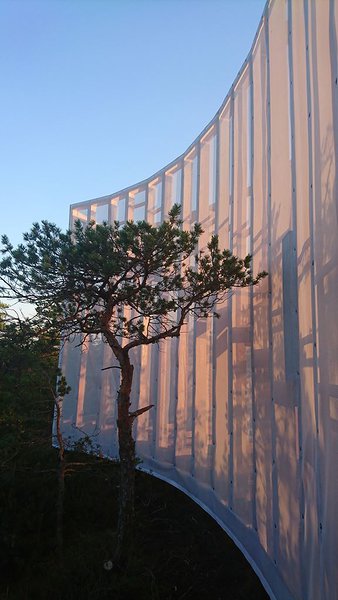
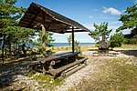
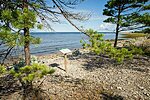

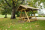
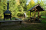
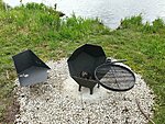
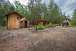
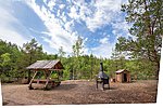
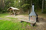


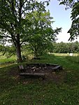

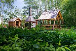


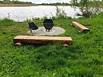


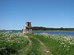
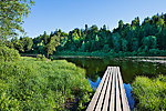
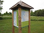


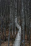
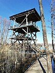


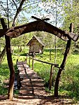



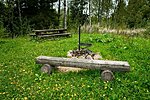
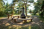
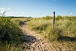

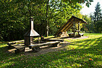


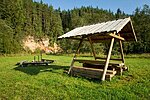
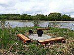


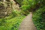
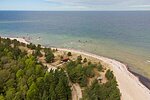
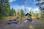
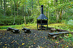
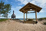


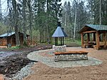
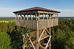
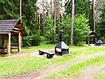
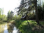

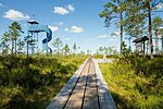
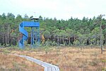

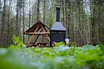
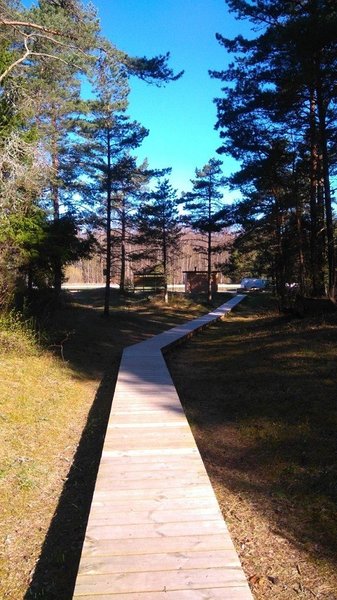
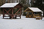
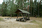
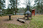
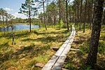
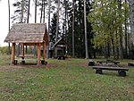


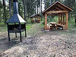


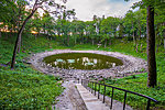
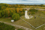


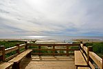



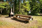
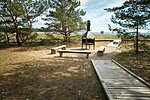
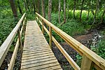
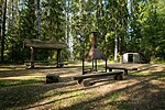


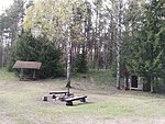
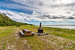

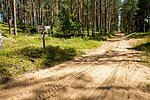

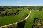
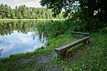
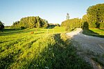






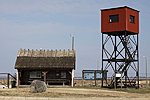


v%C3%A4ike_medium.JPG)




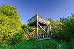

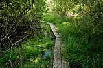
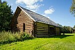

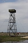
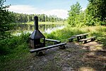
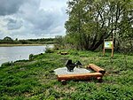
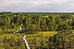
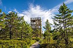

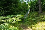


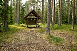
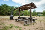

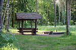
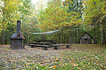


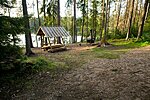
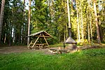


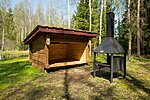
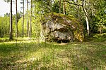

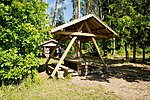
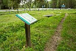

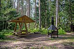
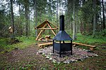


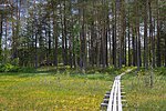


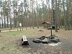
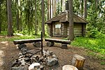

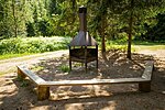
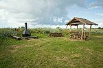
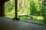




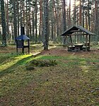
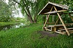

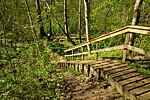
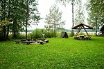
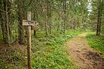
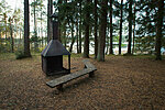


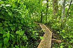


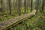

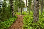


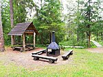
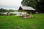
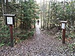


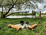
_medium.jpg)
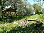

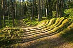
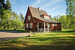

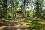
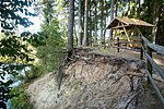
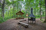
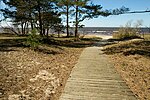


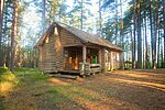




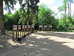

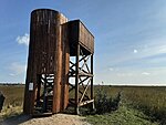


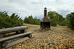
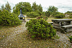


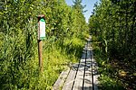
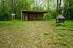
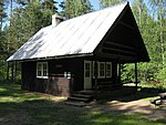


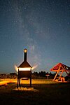
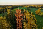

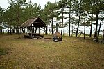
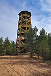

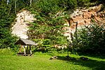

%20Foto%20%C3%9Cllar%20Soonik_medium.JPG)
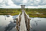
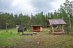

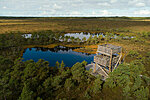

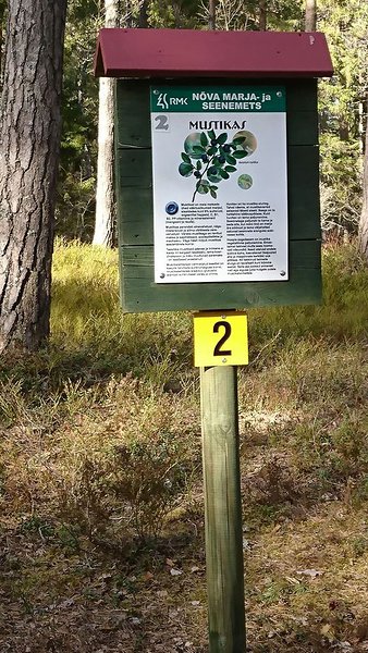


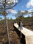
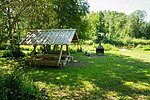
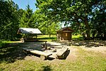
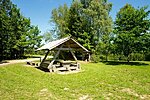
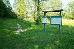
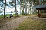

_medium.jpg)

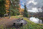
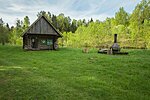
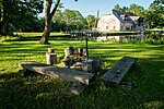


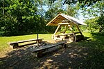


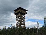
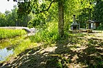
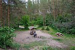


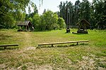
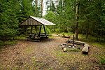

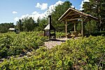
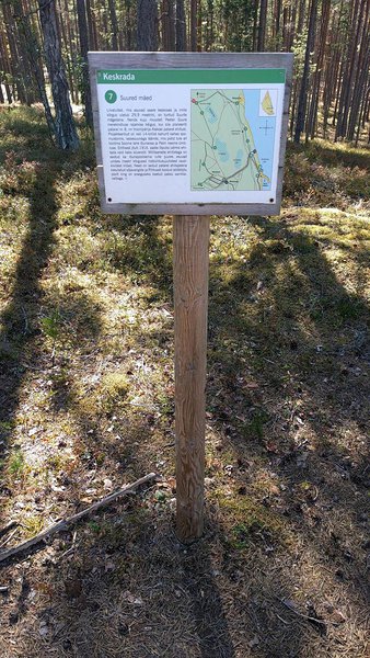
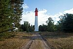
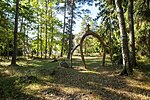
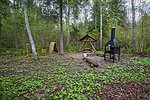

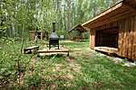

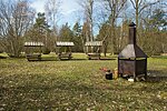
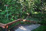
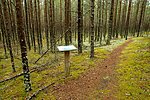


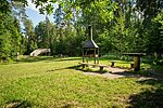


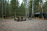
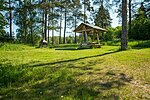

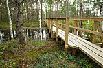

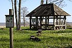


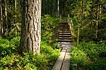


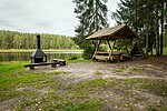
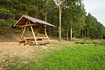
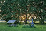


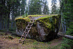


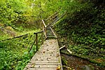
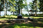
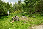

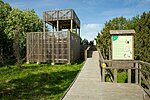
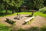

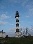
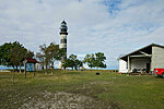
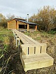
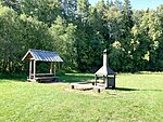

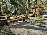
_medium.JPG)


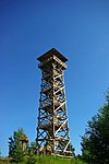
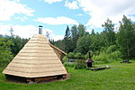
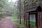

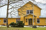


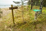


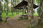
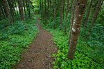
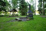
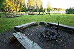


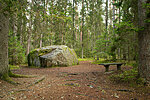

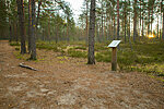
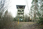
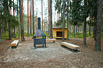
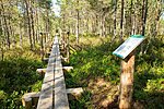


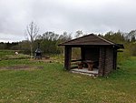
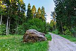
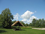
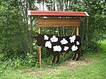
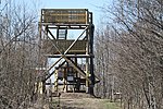


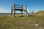
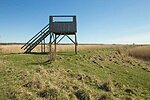
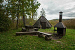


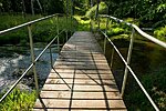
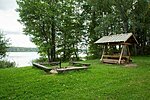
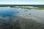


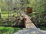

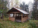
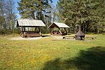

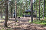

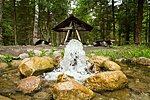


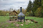

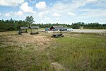
_medium.jpg)
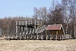
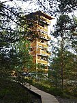


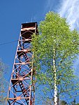


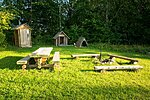

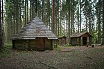

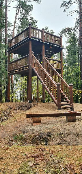
_medium.jpg)


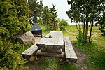
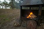
_medium.jpg)
_medium.jpg)


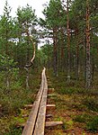
-_medium.jpg)


_medium.jpg)
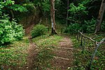






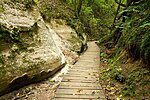


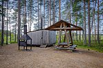
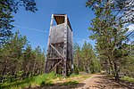
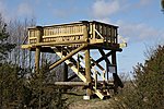
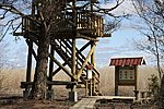






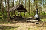

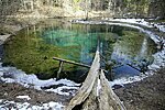
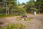
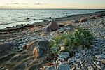
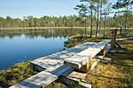
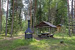
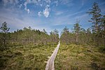
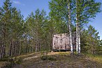


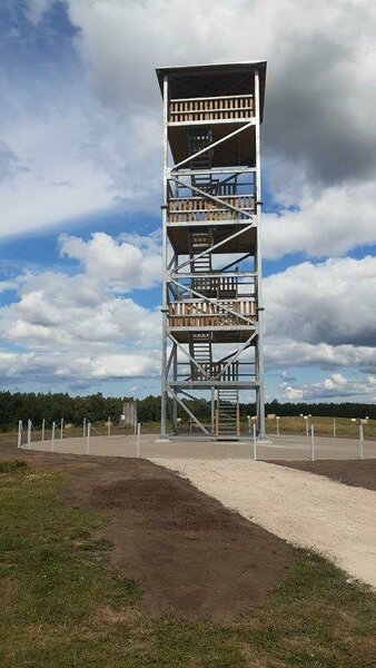
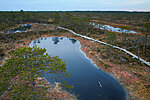




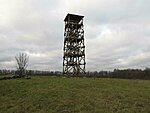


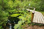


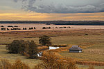

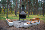
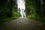

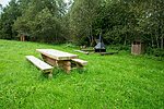
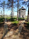


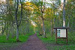
_medium.JPG)
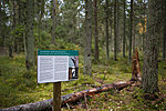

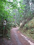

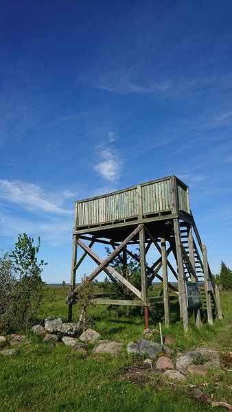
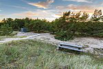

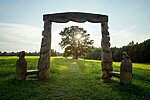


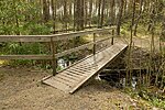
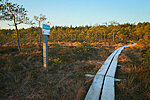

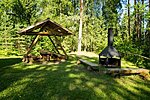
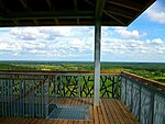
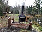


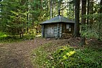
_medium.jpg)
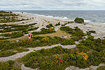
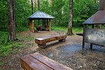
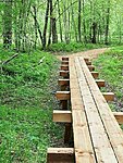


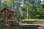

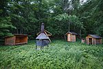
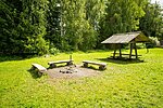
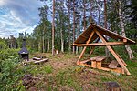
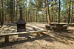


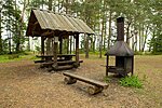


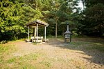
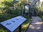

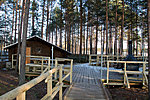
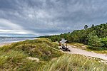
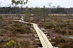

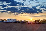


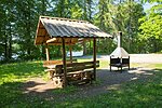


_medium_large.jpg)


